The latest enhancements of ArcGIS Flight are designed to make your drone operations smarter, more flexible, and easier to use. This release introduces highly requested features, improvements, and significant changes to your app’s interface. Here’s what’s new:
Fly Smarter and Safer with Custom Elevation Terrain Following in ArcGIS Flight
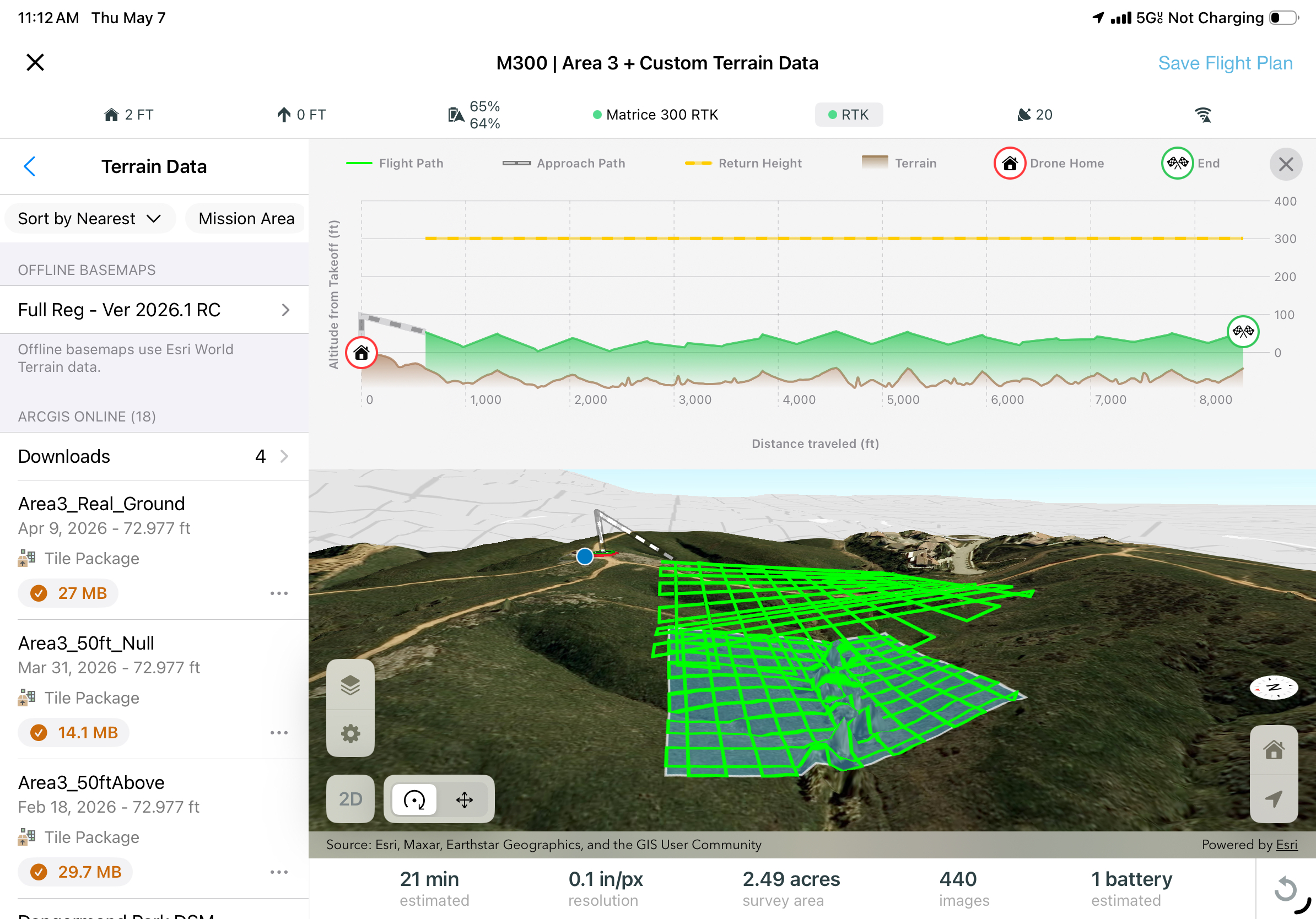
Terrain following is one of the most powerful automated flight capabilities for mapping with drones. By adjusting flight height dynamically based on the shape of the ground, terrain‑following missions help ensure consistent ground clearance, safer operations, and consistent imagery resolution and overlap, especially across uneven or complex landscapes.
Until now, terrain‑following flights in ArcGIS Flight relied on global elevation surfaces. While broadly available, these datasets are sometimes too coarse or outdated for environments that change frequently, such as active construction sites, mines, quarries, landfills, and large earthworks. In these settings, outdated terrain data can introduce risk and reduce the quality and consistency of data capture.
New in this release: Custom Elevation for Terrain Following
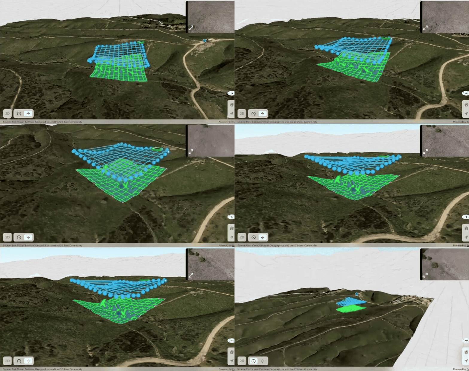
With the latest ArcGIS Flight release, pilots can now plan terrain‑following missions using their own authoritative elevation data. This new capability allows you to define exactly which surface your drone should follow by using custom elevation tile packages, such as high‑resolution surface models derived from previous drone flights.
Instead of relying solely on generalized global terrain, ArcGIS Flight can now use a site‑specific elevation surface that reflects current, real‑world conditions. This is especially valuable in dynamic environments where terrain changes frequently.
Using custom elevation data for terrain following helps organizations:
- Improve flight safety by maintaining consistent, predictable ground clearance over rapidly changing terrain
- Increase data quality by ensuring uniform image overlap and ground sampling distance
- Reduce operational risk when flying close to stockpiles, high walls, or newly modified surfaces
- Plan with confidence using elevation data that reflects the most up‑to‑date conditions on site
By bringing together automated terrain‑following flight planning and user‑provided elevation surfaces, ArcGIS Flight makes it easier to fly safer, capture better data, and operate more effectively in complex, real‑world environments.
To get started implementing custom elevation into your next flight, check out our documentation page for more details on how to set it up.
Bring GIS Context Into the Air: View ArcGIS Layers During Flight
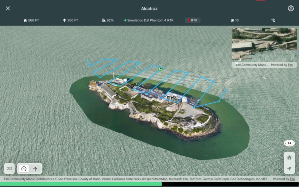
ArcGIS Flight extends access to ArcGIS layers beyond planning and into active flight, allowing pilots to display 2D and 3D GIS layers directly during flight execution. Previously, ArcGIS layers could only be viewed while planning missions; now, the same authoritative maps, operational layers, and 3D content from ArcGIS Online or ArcGIS Enterprise remain visible while the drone is in the air. This added situational awareness helps pilots better understand their surroundings, validate that the mission is progressing as expected, and make informed decisions in real time. Whether viewing boundaries, infrastructure, airspace context, or 3D terrain and assets, in‑flight access to ArcGIS layers ensures pilots stay connected to their GIS throughout the entire operation, not just before takeoff.
Refreshed Map User Interface
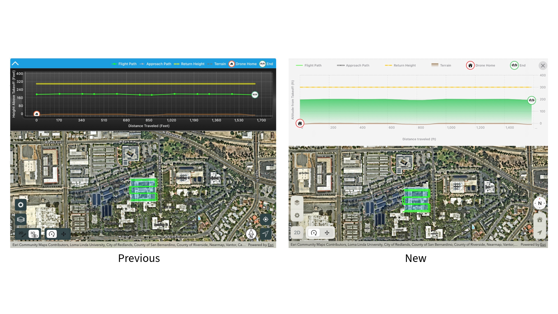
We’ve modernized the map user interface with a fresh new design that makes it easier to plan, monitor, and adjust your missions. View controls are now consistent with other Esri mobile apps, making map interaction intuitive when moving between apps.
Your feedback drives our innovation. We’re excited for you to experience these updates and look forward to hearing how they improve your missions. As always, please share your thoughts and ideas with us to help shape the future of ArcGIS Flight.
For more information on all the enhancements and to share your feedback please visit the ArcGIS Flight Esri Community.

Article Discussion: