displaying
Use # to search tags and @ for authors

By Multiple Authors | ArcGIS |
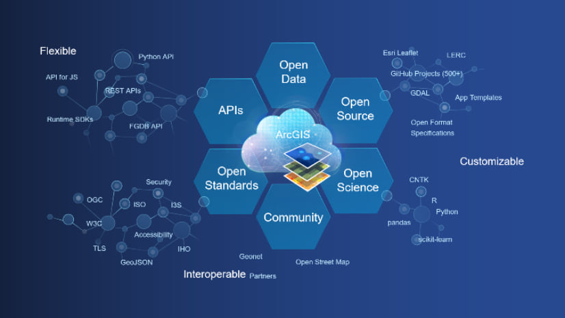
Learn how ArcGIS supports the European Open Data Directive and get practical resources to start today.

By Deane Kensok | ArcGIS Living Atlas |
Learn how you can prepare and share GIS open data for use in editing OpenStreetMap data, which is easily accessible to you in ArcGIS.

By Jill Saligoe-Simmel | ArcGIS Online |
Upgraded support and new tutorials for INSPIRE Metadata in ArcGIS promote open data sharing and reuse using international open standards.

By Multiple Authors | ArcGIS Hub |
If you created an open data site before 2017, it's time for an update.
By Adam Martin | ArcGIS |
This series highlights recent features related to data interoperability, enterprise integrations, and extensibility you might have missed.

By Daniel Fenton | ArcGIS Hub |
Dataset Smart Search is a new beta feature for ArcGIS Hub that makes it easy to explore open data
By john gravois | ArcGIS Hub |
The DC R&D team has been hard at work creating new features in ArcGIS Hub, shipping updates roughly once a week. Now its time for us ...
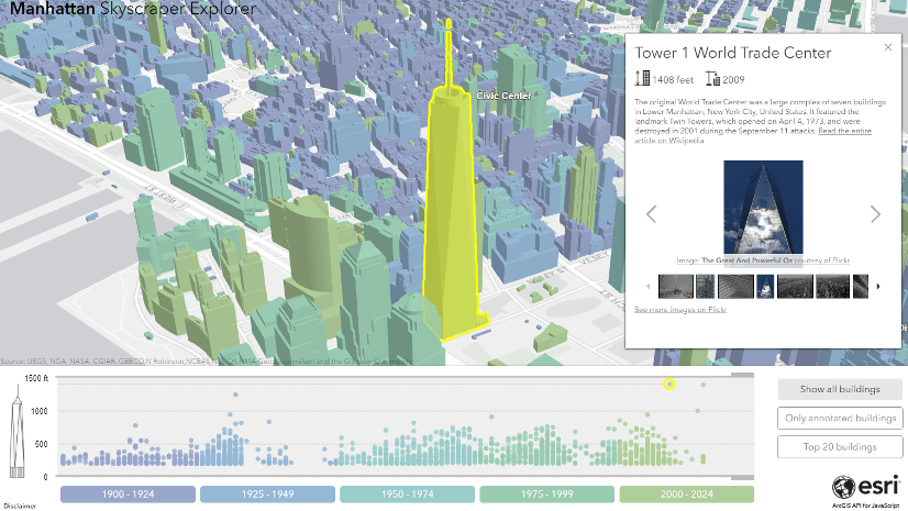
By Raluca Nicola | ArcGIS Maps SDK for JavaScript |
Open data is an awesome thing nowadays. It's amazing how many organizations publish their data to allow citizens to learn more about the ...
By Brenda Wolfe | ArcGIS Hub |
Today ArcGIS Hub becomes available for selected early adopter customers. ArcGIS Hub is a new product that enables governments and commu...
By Courtney Claessens | ArcGIS Hub |
ArcGIS Open Data was renamed to ArcGIS Hub on June 28, 2017. The past month has seen a few releases of ArcGIS Open Data, which most no...