displaying
Use # to search tags and @ for authors
By Multiple Authors | ArcGIS |
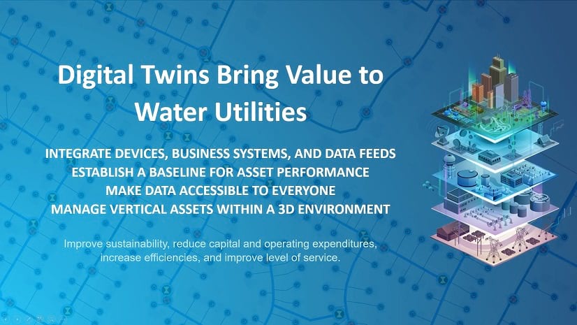
ArcGIS is the foundation for integrating and interconnecting different models to create a modern digital twin that brings value to utilities.
By Multiple Authors |
Managing daily workflows that have changed due to COVID-19. Utilities are using Esri solutions to ensure business continuity.
By Christa Campbell |
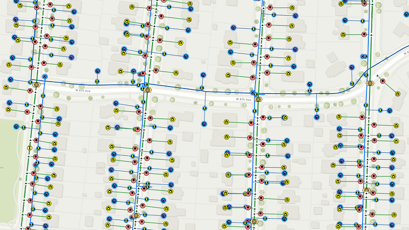
Preparing for the utility network. What you need to know to get started.

By Christa Campbell |
Jack Dangermond keynotes the 2018 Esri Water Conference There wa...

By Derek Lorbiecki | ArcGIS Insights |
Insights for ArcGIS is a new web-based application that helps you integrate spatial intelligence with your organization’s data. Wheth...
By Matt Kennedy | ArcGIS Insights |
Insights for ArcGIS is a new web-based application that helps you integrate spatial intelligence with your organization’s data. Wheth...
By Corey Gens | ArcGIS Drone2Map |
Drones are now everywhere – superbowl halftime shows, delivering packages, racing in the DRL (Drone Racing League), and now can be used...
By Derek Lorbiecki | ArcGIS Insights |
Insights for ArcGIS is a new web-based application that helps you integrate spatial intelligence with your organization’s data. Wheth...
By Howard Crothers |
In March 2017, we made changes to the Local Government Information Model and as a result we’ve received several questions from the wate...

By David Wachal | ArcGIS Online |
ArcGIS connects maps, apps, data, and people so you can make smarter, faster decisions. It gives everyone in your water utility the abili...