Featured Article
Katie Thompson | Apr 23, 2024
ArcGIS Urban will soon be available with ArcGIS Enterprise, providing planners with a new way to leverage their city's GIS data for planning.

Multiple Authors | April 22, 2024
Representing the user experience during Utility Network design, Mohan Punnam details the importance of keeping users at the forefront.
Multiple Authors | April 15, 2024
From emergency management to utilities, journey with Mark Sanders of Entergy, as he shares his passion for GIS.
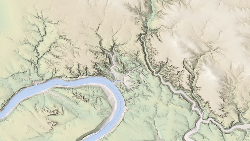
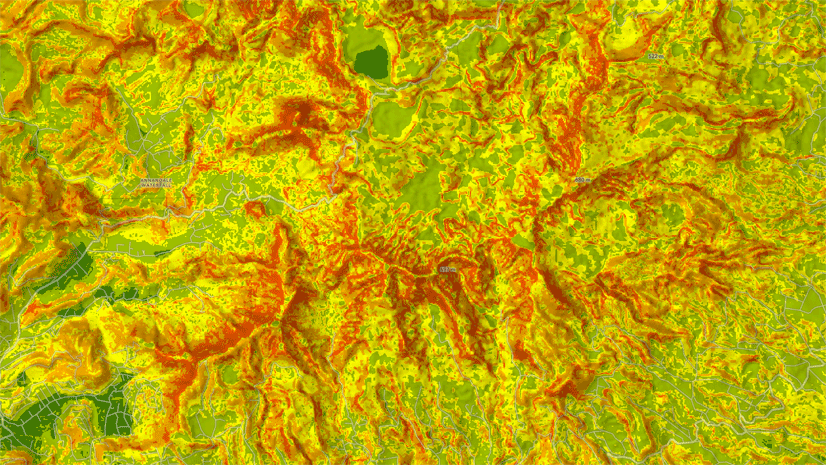
Rajinder Nagi | April 11, 2024
In April 2024, elevation layers have been updated with high-res datasets of Wales, New Zealand & German states of Bavaria, Saxony and Brandenburg
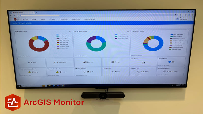
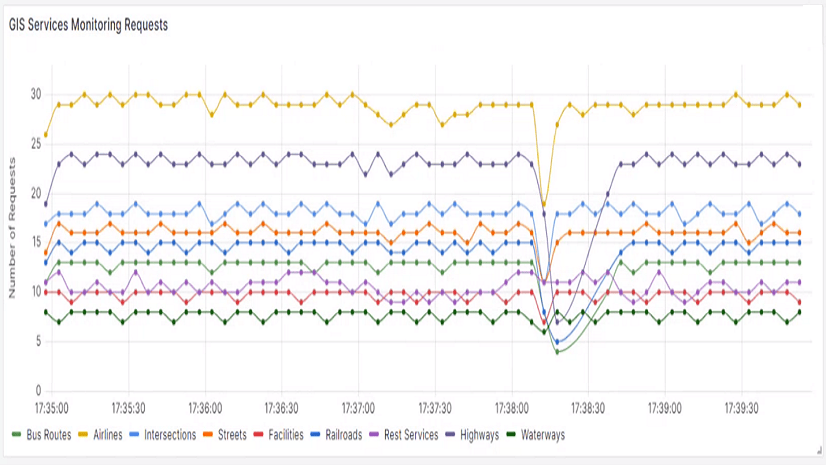
Multiple Authors | April 10, 2024
This blog presents six useful indicators that provide insight on Enterprise portal performance metrics.
Multiple Authors | April 8, 2024
Go behind the scenes with one of Esri's most knowledgeable software development engineers and leaders on the Geodata Management Team.

Bern Szukalski | April 2, 2024
Google Drive offers a way to store, share and manage files. Here's how to use those files in ArcGIS Online maps and content.
Multiple Authors | April 1, 2024
Diana Benedict explores her path to GIS via biology and details how Denver Water is using the technology for a lead line replacement project.

Bern Szukalski | March 30, 2024
Crafting great pop-ups is essential to a great map experience. Use color in pop-ups to clarify or emphasize what your map shows.
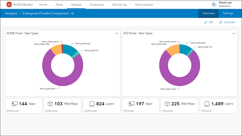
Multiple Authors | March 26, 2024
This blog presents six useful charts and indicators that provide insight on Enterprise portal content metrics.
Multiple Authors | March 25, 2024
Meet Jess Altamira with Esri's GeoExperience Center and find out more about what goes into those impressive stage presentations at conferences.

Bern Szukalski | March 24, 2024
Email can be sent directly from web map pop-ups using several different methods. Here's how...

Diana Muresan | March 21, 2024
A workflow example of two organizations using distributed collaboration to support forest restoration after wildfire damage.

Multiple Authors | March 21, 2024
A highly anticipated event for transportation professionals. Read about Esri's presence at the conference.
Bern Szukalski | March 20, 2024
Take pop-ups to the next level using Arcade to perform calculations, manipulate text, evaluate logical statements, or return a block of content.
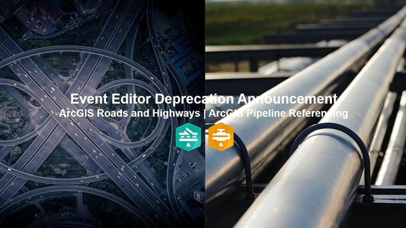
Multiple Authors | March 20, 2024
The Event Editor web application included with ArcGIS Roads and Highways/ArcGIS Pipeline Referencing is being deprecated. Learn more.
Multiple Authors | March 18, 2024
Dive into the programming and development space with Esri's Hussein Nasser and learn more about what he feels is important for success.

Bern Szukalski | March 14, 2024
You've been busy adding items for others in your organization to use. Here's how to prevent accidental deletion of those items.
Multiple Authors | March 13, 2024
ArcGIS Enterprise on Kubernetes has a number of features that can keep production environments reliable, resilient, and operational.

Multiple Authors | March 13, 2024
The ArcGIS Well-Architected Framework and Architecture Center provides guidance for implementing systems with ArcGIS.
Multiple Authors | March 13, 2024
ArcGIS Enterprise can be integrated into your business systems, allowing businesses to leverage spatial data to make decisions in real-time.
Simon Suo | March 11, 2024
With the create task resource in the sharing API of your ArcGIS Enterprise, you can schedule a geoprocessing service based task to run regularly.
Bern Szukalski | March 11, 2024
Tips and techniques to minimize credit consumption when using analysis tools.
Multiple Authors | March 11, 2024
A new R package created by the R-ArcGIS Bridge team enables integration with ArcGIS location services.
Multiple Authors | March 11, 2024
Come along on the geospatial journey of Sarah Alban where she outlines the importance of the human story and experience.

Multiple Authors | March 6, 2024
Learn about events and workshops featuring R at the 2024 Esri Developer Summit.