Project Manager for the ArcGIS Living Atlas of the World Environment Team
Project Manager for the ArcGIS Living Atlas of the World Environment Team
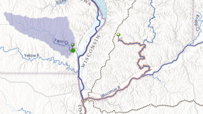
The Watershed and Trace Downstream are FREE to use with an ArcGIS Online for Organizations Account.
On December 31, 2019, 68 layers within the Environment section of the Living Atlas will be taken out of circulation.
The ArcGIS Living Atlas of the World contains vector and raster layers for lands managed or owned by six agencies of the federal governme...
All SSURGO-based Living Atlas items upgraded to the 2017 SSURGO snapshot New map image and 21 image layers with improved performance ...
Portions of the Bighorn Mountains in Northern Wyoming are nearly 3 billi...
The National River Recreation Database (NRRD) is a geodatabase of water trails, Wild & Scenic Rivers, whitewater segments and respect...
The following Land Cover Layers were released last week to the Living Atlas of the World: NEW LAYERS USA NLCD Land Cover 2006 USA NL...
The following Soils Layers were released last week to the Living Atlas of the World: NEW LAYERS USA Soils Albedo USA Soils Bedrock De...
The ArcGIS Online global elevation analysis services were updated last week to include 10 meter resolution elevation data for Norway, Fin...