Jian Lange is a principal product manager with Esri’s Product Management team in Redlands, California. She is responsible for various aspects of ArcGIS Spatial Analysis products, including business planning, road maps, requirements, and management.
Jian Lange is a principal product manager with Esri’s Product Management team in Redlands, California. She is responsible for various aspects of ArcGIS Spatial Analysis products, including business planning, road maps, requirements, and management.
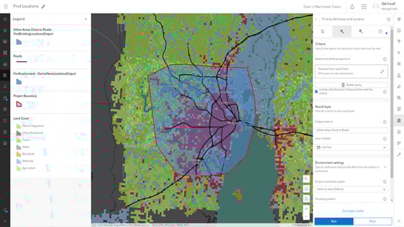
Highlights of Map Viewer analysis in the June 2023 update.
Frequently asked questions about analysis in ArcGIS Online Map Viewer.
Learn about the new analysis experience in Map Viewer including analysis history functionality and more.
This blog post highlight some robust spatial interpolation workflows, and shares a couple of new tools in ArcGIS Geostatistical Analyst.
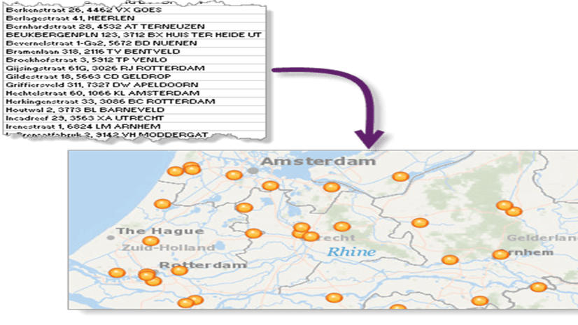
An example of how to leverage the ArcGIS World Geocoding Service in R
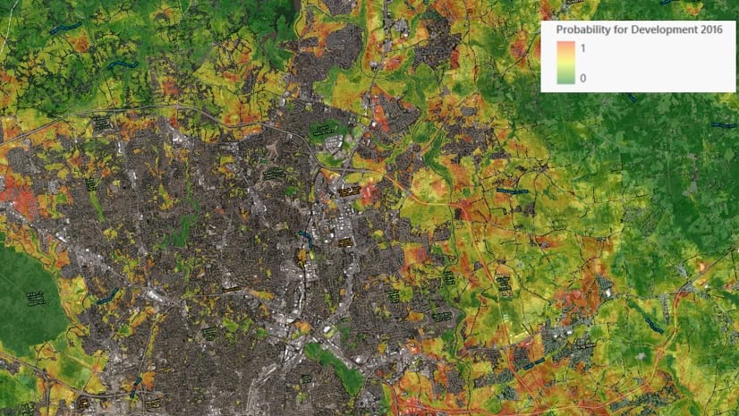
A multi-disciplinary team combines the powerful capabilities of ArcGIS and R to build an urban growth prediction model.
Learn about the best practices of using the Reclassify tool in ArcGIS Pro Spatial Analyst extension, especially when migrating from ArcMap.
ArcGIS Online handles projection for spatial analysis tools although the default coordinate system is Web Mercator.
Some enhancements in the ArcGIS Pro 2.6 release regarding the scheduling geoprocessing workflow.