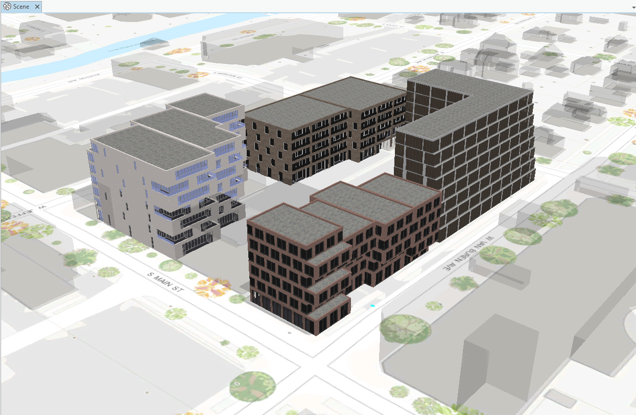
 One great advantage of using ArcGIS Pro is the 3D GIS capabilities built into the app. You can visualize your data and see patterns that you might not notice in 2D. Two dimensional maps are what you think of as traditional maps, seen from a single birds-eye view. With a three dimensional scene, the map area can be visualized from any angle, as if you were a bird flying through the scene rather than only looking down at it. 3D allows you to visualize vertically stacked content, show complex concepts in an easy-to-understand format, and invite imagination and understanding.
For example, if you were a city planner and wanted to create a map to show construction workers where to block off streets for a new project, you might only need a 2D map. However, what if that project also included planning layers of underground electric lines or water mains and above ground features like buildings or fire hydrants? Creating that project in 3D would allow you to visualize that plan in a more meaningful way.
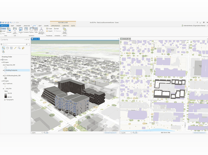
What if you wanted to see both 2D and 3D views at the same time, so you could edit your plan in one view and immediately see its impact on the other view?
With ArcGIS Pro, you can view 2D and 3D representations of your data at the same time by docking a map view and a scene view side-by-side.

For tighter integration, link the navigation of the views by enabling the Link Views option on the View tab.
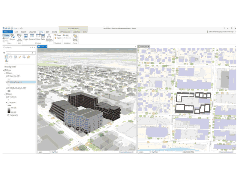
ArcGIS Pro has a few different options of how you can visualize your linked views, which you can read about in the ArcGIS Pro Help. Note that a map and a scene are separate items in your project, even if they reference the same source data. This means that changing the layer visibility in a map or a scene will not impact the layer visibility in another view. Feature edits, on the other hand, update all views of that data.
Here are a couple of good resources to get you started with the why and how of 3D mapping. This video from the 2015 User Conference introduces basic 3D cartographic techniques and will give you an idea of how and when to create 3D scenes in ArcGIS Pro. This free web course on 3D Visualization, will teach you basic 3D concepts, walk you through exercises in creating scenes, and give you even more practice with linking 2D and 3D views.
Article Discussion: