With the 12.1 release of Enterprise, ArcGIS Urban comes with several new and improved features. The highlight of this release is the 3D model upload for projects that allows planners to place and review detailed development proposals in context. Learn more about the new features below.
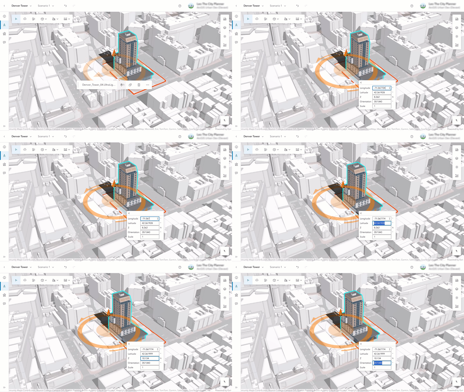
Upload and Precisely Place 3D Building Models
ArcGIS Urban on Enterprise 12.1 now supports uploading 3D building models with or without georeferencing, enabling models to be automatically or manually placed in their correct real‑world location, where they can be reviewed within the broader ArcGIS Urban context.
Streamlined Zoning Review with 3D Envelopes and Regulatory Insights
Projects can now be evaluated directly against the zoning regulations defined in the urban model, supporting a more efficient and transparent review process. Zoning envelopes visualize allowable building volumes in 3D, making it easy to compare proposed designs with what is permitted.
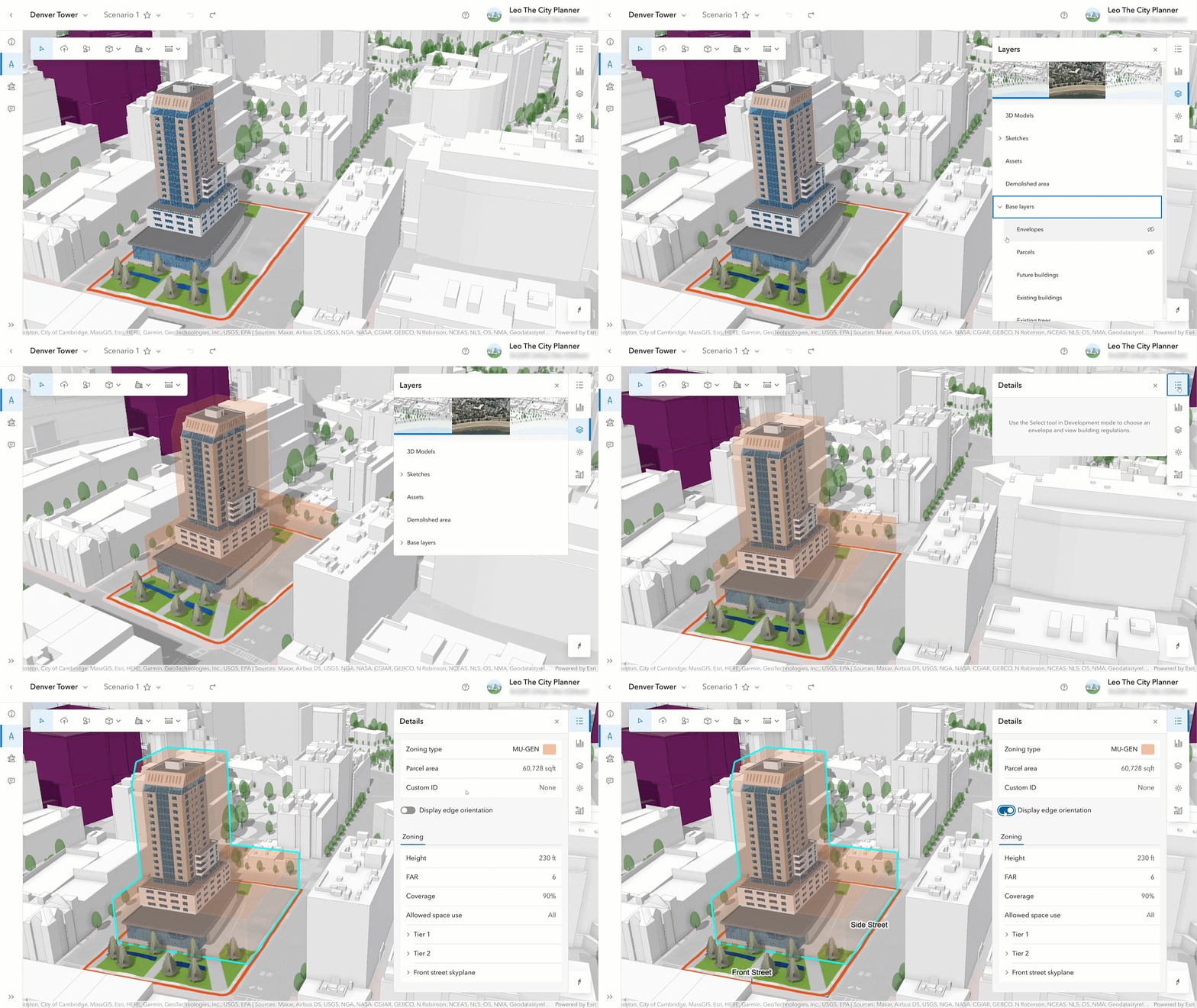
These envelopes can also be exported as part of the project scenario web scene for outreach and stakeholder engagement.
In addition, the project details panel now surfaces comprehensive regulatory information, including coverage, floor‑area ratio, tiers and setbacks, and allowed space‑use types—bringing zoning context directly into the design review workflow.
New Analysis Mode for Evaluating Plan Impacts
A new analysis mode has been added to the plan editing experience, enabling planners to assess plan impacts using tools such as shadow cast, line of sight, viewshed, elevation profile, and suitability.
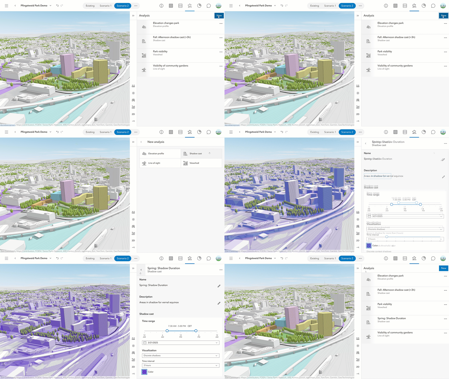
Analysis configurations and results can be saved and revisited in an intuitive list, making it easier to compare scenarios over time without re‑creating analyses from scratch.
Enhanced Suitability Analysis for Data‑Driven Planning Decisions
The suitability analysis tool helps planners score and rank parcels based on criteria such as parcel attributes, zoning, and external GIS layers—producing both a scored map and a ranked list of suitable parcels. Suitability analysis is now fully integrated into the analysis mode alongside other analysis tools, with existing models automatically migrated.
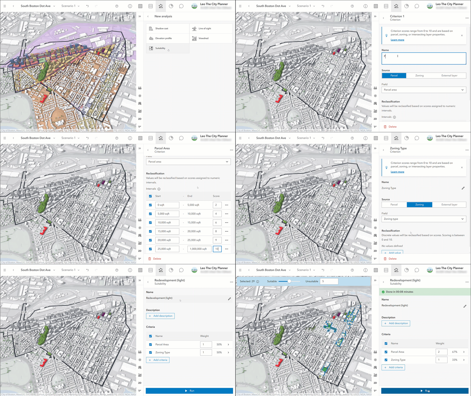
Suitability calculations can now run in the background, allowing users to continue working while processing completes, an important improvement for large or complex plans.
What else is new
Other new features include copy-pasting of metrics between plans and urban models, image upload and georeferencing in projects, parcel parameters in metrics, and the ability to select which project scenario is being visualized in the overview.
Check out all new features in the release notes.


Commenting is not enabled for this article.