Do you have a data set that isn’t quite complete? Maybe a sensor went down, a county has suppressed health data or your sales data is missing a store’s reporting. Depending on the analysis these null values can throw a wrench in your workflow. To help fill in missing values the Fill Missing Values tool was added into the Space Time Pattern Mining toolbox as of ArcGIS Pro 2.0.
Filling Based on Spatial Neighbors
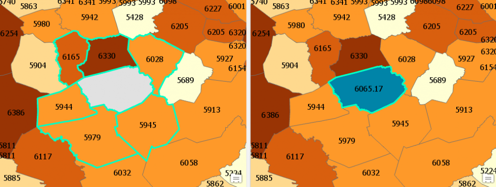
Fill missing values lets you select a ‘fill method’ which includes average, minimum, maximum, median and temporal trend. You also define neighborhoods used to find the values for the fill method calculation. You can use fixed distance, k nearest neighbors, contiguity edges, contiguity edges corners or a spatial weights file. An example below shows the tool using 6 nearest neighbors and the average fill method. The grey polygon on the left has a null value and the light blue highlighted polygons represent its 6 nearest neighbors. After running fill missing values, we can see that the polygon is given the value of 6065.17, the average of its 6 neighbors.

Filling Based on Temporal Trend
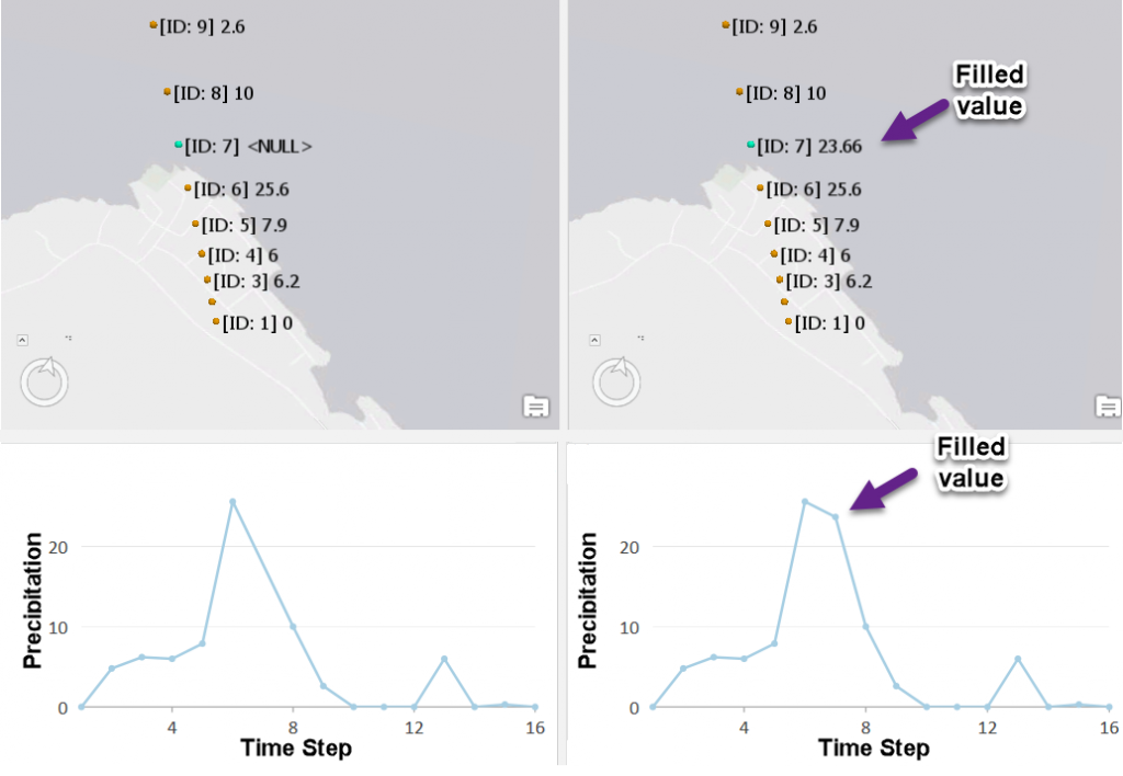
Fill Missing Values also lets you use a temporal trend if you have time series data (if you have station data each location will need to have a unique ID). In the example below [ID: 7] is missing a reading for precipitation from a weather station. Fill missing values will interpolate the trend of the data at that location and return the value at the missing time.

The Fill Missing Values tool can help minimize the impact null values have in your analysis. See How Fill Missing Values Works for tips and best practices.
Article Discussion: