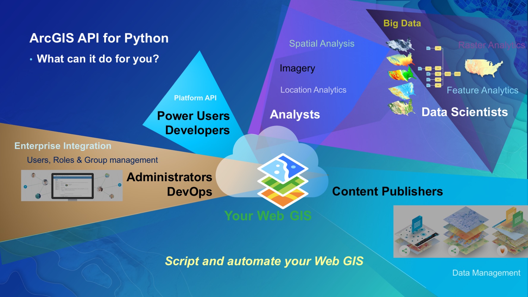
Since its official debut in winter 2016, the ArcGIS API for Python has been a huge hit. The API caters to a wide spectrum of ArcGIS users ranging from GIS administrators, DevOps, content publishers, GIS analysts, data scientists, developers and power users. The API provided these users with a Pythonic representation of their GIS.
Since then, the team has been feverishly developing and expanding the capabilities of the API. We’re very excited to announce the release of v1.2! It packs a number of major features, bug fixes, and enhancements to the API and the accompanying SDK.
Below are some major enhancements in this release:
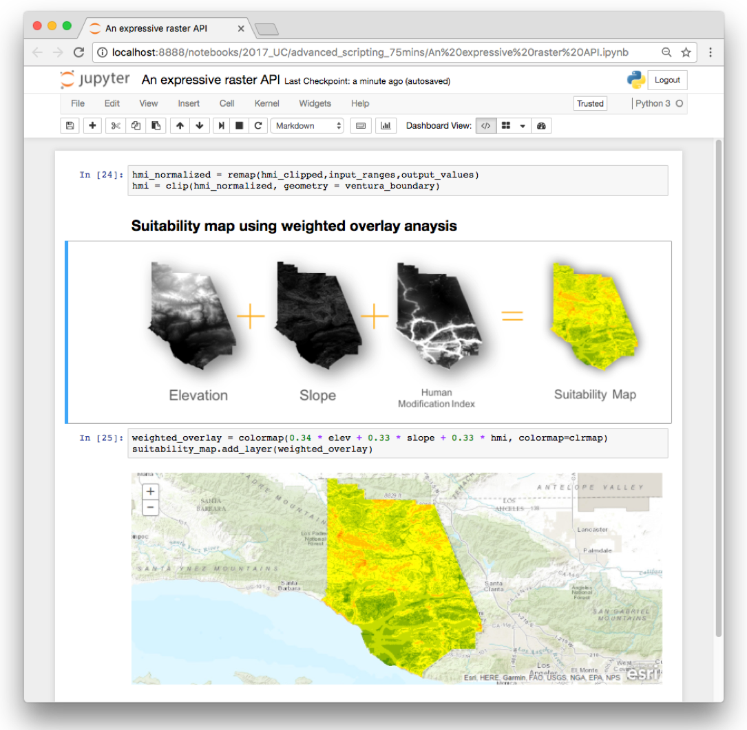
An intuitive and powerful raster API – a new way of working with imagery and raster datasets which we think scientists and analysts will fall in love with. The API exposes the powerful dynamic raster functions as Python functions, allowing users to express their analyses in an elegant and concise manner. This release brings map algebra to the web GIS, and is now as powerful as ever, thanks to distributed raster processing in ArcGIS Image Server.
DataFrames are now SpatialDataFrames – Since day one, the Python API has integrated well with popular data analysis libraries such as Pandas, NumPy and the SciPy stack. In this release, we have extended pandas spatially and created SpatialDataFrames. These DataFrames are spatially aware and let users import and export geospatial data, perform spatial queries & joins, and work with spatial data in a `pandorable` manner.
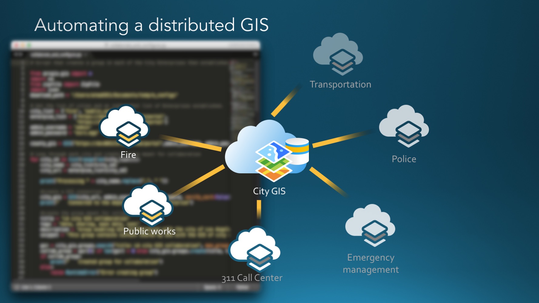
Building a distributed GIS – The automation ability of the Python API is remarkable. While administrators could use the Python API to build and configure their portals, now they can take it even further and establish portal-to-portal collaborations, join existing collaborations and grow their GIS into a distributed system. Collaborations allow data to flow across different organizations.
Powerful GIS administration – a whole new server sub module allows administrators to administer and manage the ArcGIS servers powering their Enterprise. A new admin sub module extends the ability of administrators to script and configure their enterprises or ArcGIS Online organizations, including theming, styling and managing credits.
In addition to these features and capabilities, a number of additional enhancements and bug fixes have been included in this release. At v1.2 this API has become an even more powerful Python library for spatial analysis, mapping and GIS. We appreciate all the users that communicated with us via GeoNet and various other channels, reporting bugs and enhancements. It has been an amazing journey building this release.
Join us at the Esri UC – We’ve lined up a comprehensive set of technical sessions and demo theater presentations at this year’s Esri User Conference (held in Sand Diego, CA, July 10-14, 2017) to cater to every user persona we’ve built this API for. Meet members of the Python team to share your feedback, ask questions or just hang out with us! We will be located in the Developer showcase area. We look forward to seeing you!
– The Python API team
![]()

Article Discussion: