The Esri User Conference (Esri UC), June 27-July 1, 2016, in San Diego, California hosts 16,000 GIS users, managers and developers. 300 moderated sessions. 450 hours of technical training. 300 software vendors. Innovative Startup Zones. Inspirational keynotes. Competitions to test your skills. One-on-one sessions with Esri technical and professional support staff. And more!

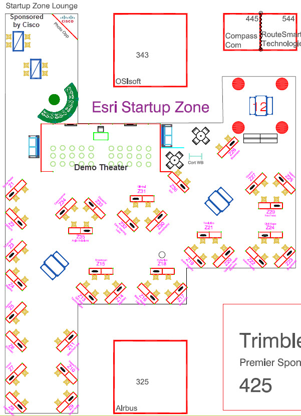
With all of this in one week, we want to make sure you plan some time to visit the Esri Startup Zone (SUZ) in Hall C of the expo floor! This high energy and innovative area is hosted by the Esri Startup Program, featuring the work of 33 up-and-coming businesses who have integrated spatial functionality within their products as well as for
their own organizational understanding and optimization. You can benefit from their knowledge and experience as you interact with CEO’s, Technical Leads, Developers, and a wide range of specialists.Companies will be exhibiting and demoing their innovative solutions leveraging Esri’s software and services across a variety of sectors, relating to emerging technology such as UAS, 3D, location, navigation, GIS positioning, sensors, geospatial intelligence, emergency response and much more. Join this passionate community and learn how they are leveraging GIS for their business and how it can benefit you. Download the SUZ Flier.
Startup Zone Exhibitors:
|
Booth |
Company |
Industry Focus | Company Description |
|
Z19 |
Public Safety/Emergency Management & Health and Human Services | Antris is a multi-communications platform for monitoring work alone safety, real-time workflow management, and analytics reporting using Esri ArcGIS. | |
|
Z35 |
Pipeline & Water/Wastewater/Stormwater | As a frontrunner in GIS Augmented Reality software, Argis™ guides you to unique solutions that bring your organization the most value. | |
|
Z16 |
Defense/Intelligence & Location-based Services | Digital and analog radio real time mapping and communications for situational awareness of vehicles and personnel. | |
|
Z26 |
Defense/Intelligence & Homeland Security | Bluescape is a visual collaborative workspace designed to elevate your work, making it easy for individuals and teams to create and collaborate. | |
|
Z34 |
Health and Human Services | Carevoyance is a provider directory of every physician in the US, linked to millions of provider-level data points – an economic map of US healthcare. | |
|
Z24 |
GIS Services & Public Works | An artificial intelligence company providing LiDAR processing and feature extraction services to the autonomous vehicle and geospatial industries. | |
|
Z8 |
Electric/Gas Utility & Telecommunications | Helping companies engage with their customers using social data mining, analytics, event predictions, notifications, and customizable public maps. | |
|
Z33 |
Electric/Gas Utility & Transportation/Fleet Management | Dispatchr provides the world’s first sophisticated predictive workforce management system to proactively increase the resiliency of the utility grid! | |
|
Z30 |
Location-based Services & GIS Services | DroneDeploy helps businesses capture and analyze drone data. We’re the leading software platform for commercial drones with users in 100 countries. | |
|
Z32 |
Public Safety/Emergency Management & GIS Services | Early Warning Labs (EWL) is an Official Partner of the USGS and America’s Leader in Earthquake Early Warning. EWL provides complete turn-key solutions. | |
|
Z6 |
Defense/Intelligence & Location-based Services | Echosec uses Esri layers and multiple social media data sources to give users in defense, executive protection and public safety the intel they need. | |
|
Z31 |
Location-based Services | Gimbal combines macro and micro-location tools with a suite of tools to build, manage and analyze location-enabled mobile strategies. | |
|
Z13 |
Planning/Economic Development & Real Estate | GIS WebTech specializes in GIS for economic development. Recruit, our cloud app effectively helps economies to grow, small and large. | |
|
Z17 |
GroundVu |
Electric/Gas Utility & Planning/Economic Development | 3D aerial and road data collection and modeling service. |
|
Z22 |
Architecture/Engineering/Construction & Real Estate | Our patented hardware and software platform provides a complete solution for ultrafast, automated, 3D mapping, and visual documentation of buildings. | |
|
Z10 |
Electric/Gas Utility & Natural Resource | InspecTools develops & deploys utility asset risk mitigation systems, using remote sensing, UAVs & manned aircraft, cloud-based & mobile software. | |
|
Z14 |
GIS Services & Planning/Economic Development | Mapillary is a simple, smart street imagery solution for public works, transportation, parks, planning, emergency management, forestry and more. | |
|
Z4 |
Business Services/Mapping Analytics | Analytics for your Web Map! Deliver better services by increasing user engagement! Build a better map with analytics. | |
|
Z11 |
Transportation/Fleet Management/Government & Planning/Economic Development | MetroTech collects real-time traffic data from cameras, applies analytics, & publishes actionable info to municipalities, businesses & commuters. | |
|
Z29 |
Petroleum & GIS Services | NeoTreks develops geospatial solutions for mobile enterprise operations. | |
|
Z18 |
GIS Services, Marketing and Advertising, Digital Display | Pufferfish develop dynamic digital display systems and offer a full range of media services to complement our products. | |
|
Z5 |
Government / Business Services & Demographics/Census/Elections | Quorum enables anyone to influence the legislative process with modern tracking, targeting, and outreach tools. | |
|
Z9 |
Public Safety/Emergency Management & Retail/Commercial | SmartNotify brings Artificial Intelligence to communications. Leverage your GIS data to better interact with your customers and teams. | |
|
Z23 |
Retail/Commercial Business & Defense/Intelligence | Snaptrends® location-based social media monitoring software empowers organizations to visualize & analyze social media conversations. | |
|
Z1 |
Location-based Services | SocialRadar develops cutting edge location technology. | |
|
Z15 |
Public Works & GIS Services | By leveraging modern sensing and GIS technologies, StreetScan provides an end-2-end pavement inspection and management service to the public sector. | |
|
Z21 |
Telecommunication & Location-based Services | We collect billions of data points about human behavior globally, aggregating geo-location and demographics, as well as online and spending behaviors to create insights on human profiles. | |
|
Z3 |
Real Estate & Banking/Credit Unions/Financial Services | TLCengine is SaaS Fintech/Real Estate Search Platform based on TLC: Mortgage Utilities Commute on Monthly basis using Big Data & Predictive Analytics. | |
|
Z20 |
Health and Human Services & Government | Upstream Research™ is an advanced geospatial analytics company designed to identify, forecast and disrupt avoidable chronic disease around the world. | |
|
Z2 |
Public Works & Water/Wastewater/Stormwater | UtiliSync is web app that is replacing clipboards for utility and Public Works field personnel. With you UtiliSync you can complete forms and more. | |
|
Z25 |
Natural Resources/Petroleum/Water Resources | Valarm brings Industrial IoT, sensor telemetry, and remote monitoring to the Esri ArcGIS platform, GeoEvent, Operations Dashboard, ArcGIS Online. | |
|
Z27 |
Natural Resources & Public Works | VizworX is a multifaceted software development company focused on collaborative geospatial information interaction and exploration solutions. | |
|
Z7 |
Defense/Intelligence & GIS Services | Vricon serves the global professional geospatial market with world-leading 3D geodata and 3D visualization solutions. #TiltTheMap | |
|
238 |
Location-based Services/Transportation/Nonprofit/Health | A multi-award winning global addressing system based on 57 trillion 3mx3m squares, each addressed with 3 simple words. w3w.co |
Startup Demo Theater Schedule – Hall C, Startup Zone
Industry Focused Moderated Paper Sessions Featuring Startup Program Partners:
|
Date |
Time |
Company |
Paper Title |
Location |
| Tuesday, June 28 | 8:30 AM – 9:45 AM |
SmartNotify |
Using GIS to Better Communicate with Your Audience: 3 Key Factors |
Room 28B, SDCC |
| Tuesday, June 28 | 3:15 PM – 4:30 PM |
DataCapable |
Room 29A/B, SDCC |
|
| Wednesday, June 29 | 10:15 AM –11:30 AM |
Dispatchr |
Mobile Geospatial Analytics to Increase Grid Resiliency at PG&E |
Room 29A/B, SDCC |
| Wednesday, June 29 | 1:30 PM – 2:45 PM |
Snaptrends |
Room 28C, SDCC |
|
| Wednesday, June 29 | 1:30 PM – 2:45 PM |
what3words |
Room 23B, SDCC |
|
| Wednesday, June 29 | 3:15 PM – 4:30 PM |
Echosec |
Up to Date Social Context Makes You See the World Differently |
Room 24B, SDCC |
| Wednesday, June 29 | 3:15 PM – 4:30 PM |
Valarm |
Esri + Valarm for Real-Time Industrial IoT & Remote Sensor Monitoring |
Room 25A/B, SDCC |
| Thursday, June 30 | 10:15 AM –11:30 AM |
Mapillary |
Street-Level Photos with ArcGIS Integration for Municipal Applications |
Room 29D, SDCC |
Today, startups do more than influence mainstream culture. They fundamentally change the way we operate our organizations. With intense pressure on organizations to innovate and do more with less, Esri startups are delivering powerful solutions with intuitive interfaces that extend the ArcGIS platform. Take some time to see what is trending in the geospatial industry at the Startup Zone!
How can people follow Esri Startup Program?
- Apply or learn more at esri.com/startups
- Follow @EsriStartups on Twitter & Instagram
- Connect with Startups & Developers on GeoNet: geonet.esri.com/groups/esristartups
- Sign Up for our Newsletter developers.arcgis.com/startups/newsletter
- Explore our Developer Community Resources: developers.arcgis.com
- Access hundreds of open source projects on GitHub: esri.github.io
- Questions? Email us: startups@esri.com


Article Discussion: