In 2015, the team at Esri started to roll out 3D capability across the ArcGIS platform. That effort laid the groundwork for an incredible 2016 in which we’re seeing 3D used in all flavors of Esri customer environments and domains. Our 3D support is continuously improving with a fantastic array of releases and updates. With our broad entry into 3D, we’re now starting to see demand increasing for some of the harder domain-specific requirements that we’ll have to tackle into the future.
3D is being adopted rapidly by users in the Esri ecosystem. We can tell this because of the uptake of new apps, the consumption of services in ArcGIS Online, and the shift of many customers to ArcGIS Server 10.3.1 and later to take advantage of 3D capabilities that did not ship in earlier versions. We’re also seeing increasing inquiries from data vendors and developer partners about our open standard for sharing 3D content, Indexed 3D Scene layers (I3S). We first released I3S in 2015 and now customers and partners are realizing that 3D content created in I3S is usable widely across the ArcGIS platform.
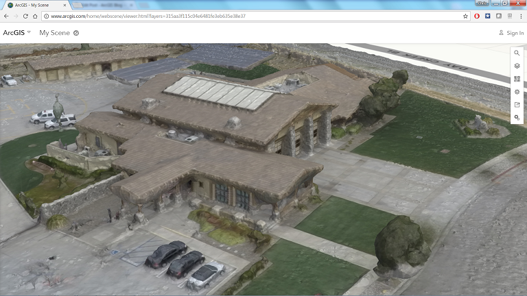
There are many thousands of 3D scene layers and web scenes shared in ArcGIS Online and thousands of users download ArcGIS Earth every month. 3D has become not only a core capability of the ArcGIS platform, but also a core competency within our user community.
3D open standard layers
The development of new layers that use scalable I3S caching has underpinned much of the new 3D development at Esri. I3S layers are usable across many Esri clients and can be mixed-and-matched with other 2D and 3D content. We now have I3S layer types that include:
- 3D Objects that can represent buildings, infrastructure, and analytical shapes
- 3D Points that can represent trees, city furniture, and abstract markers for real world assets such as city or school locations
- Integrated mesh layers for sensor-based data capture of 3D snapshots of the real world
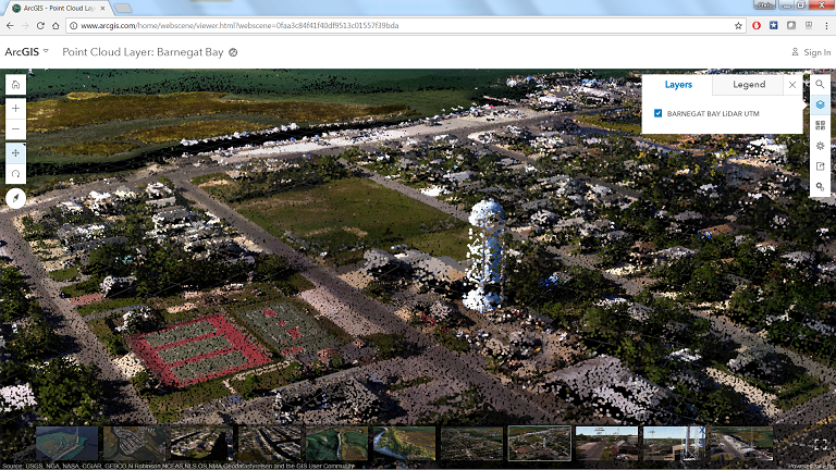
- Point clouds from lidar and other data sources
This year we proposed I3S as an OGC Community Standard and, after positive results in the first part of the process, we now will be working to demonstrate how broadly I3S has been adopted in the community so that our customers can feel that they are supported by standard formats that ensure interoperation and data resiliency.
Although we strive to roll out capability consistently across the platform, it’s impossible to achieve uniformity with so many moving parts. We are constantly working towards consistency and we plan to start enabling more interaction with scene layers including measurement on scene layers and enabling their use in geoprocessing tools. Support for I3S and expansion of the layer types and capabilities of layers will be a key component of our 3D effort into the future.
3D user experience
It’s not possible to overemphasize how much effort has been put into empowering our users through new and improved user experiences to enable data creation, sharing, and viewing unlike customers have been able to before.
Users can now share 3D layers directly to ArcGIS Online and ArcGIS Enterprise. In some cases, we refer to these sharing workflows as ‘one click workflows’ because they have become so streamlined. For issues that are identified by partners and customers, we actively roll fixes into the next release and will be continuing to optimize sharing and publishing because we know that using 3D for communication is one of the key values of 3D adoption.
Users can now host their own 3D elevation services in ArcGIS Online, publishing them directly from ArcGIS Pro 1.3 and later. We have enabled packaging workflows that enable customers to carry large packages of 3D cache as single files on transportable drives. Users can even open massive I3S files locally with ArcGIS Earth and they will be able to do the same with ArcGIS Pro.
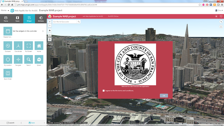
Applications such as ArcGIS Earth, the 3D scene viewer in Online, and story maps put 3D interaction and data visualization capability in the hands of any user who can use a mouse. With the roll out of our new ArcGIS Runtime SDKs that started in November, we’ll be able to start putting mobile 3D in our customers’ hands as well. For users who want to customize mapping web sites easily, Web AppBuilder allows users to quickly tailor new web experiences for stakeholders that can use 2D services along with 3D scene layers.
3D content
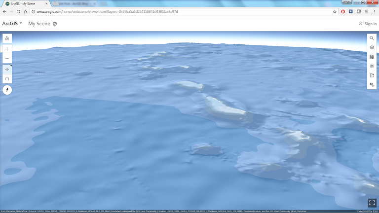
The Living Atlas hosts 2D and 3D public and premium content that can be accessed by our users through our standardized REST APIs and our apps. The Esri World Elevation Service is our most accessed layer. We’ve added new topobathy content to allow users to view the ocean surface. We’ve worked with our science team and outside collaborators to create a new 3D marine ecological units layer. In addition to the 3D layers, 2D Living Atlas content works in 3D as well.

We also are adding new 3D symbols to help users’ layers look great when they are in a scene. We have released new web styles with realistic models that allow customers to use a small set of standard real world objects to represent city furniture, trees, and vehicles. We’re looking forward to hearing user feedback as to what additional content they would like to see in the future.

Products and apps
There has been a tremendous range of product, app, and SDK releases from Esri this year with 3D capability. We are working hard to empower every part of our ecosystem with the ability to consume and derive value from new data types and experiences that we can see are quickly coming to the GIS community through 3D.
Here’s a quick survey of some of the important 3D releases that we had this year.
ArcGIS Enterprise
One of the improvements that greatly supports the 3D story is the repackaging of ArcGIS Server and Portal for ArcGIS under the ArcGIS Enterprise offering. ArcGIS Enterprise describes the minimum offering required for customers to host 3D layers, elevation surfaces, 2D content, web apps, and more on premises. The scene viewer in ArcGIS Enterprise now supports WGS84 content and can stream out large integrated meshes and point cloud scene layers. ArcGIS Pro users have a streamlined experience for publishing 3D content to ArcGIS Enterprise that will be cached as 3D scene layers.
ArcGIS Online
ArcGIS Online has become a critical tool in our 3D toolbox. Any user can explore Esri 3D simply by going to the ArcGIS.com home page and clicking on the Scene link.
User can now host their own 3D layers, 3D raster elevation services, and 3D web apps in ArcGIS Online. The Online viewer recently added fantastic new point cloud scene layer viewing capability and a smart assisted mapping interface for point layers. Developers who want to experiment with custom 3D JavaScript apps can do so using the 4.x version of the ArcGIS JavaScript API that shipped in production this year.
ArcGIS Pro
ArcGIS Pro is our first class desktop tool for authoring, aggregating, and sharing 3D and 2D content. ArcGIS Pro 1.4, due out soon, will add 3D model (multipatch) editing and will continue to improve on the user friendly animation interface that launched in Pro earlier this year. In Pro 1.3, the ability to work natively with KML, including 3D KML, was greatly expanded. With Pro, users have access to Python scripting interfaces, extensive geoprocessing tool libraries, and a .NET API that together allows them to create new processes and automation for working with 3D data.
This year Pro also added new animation authoring capability that is easier to show than to write about:
ArcGIS 3D Analyst
ArcGIS 3D Analyst continued to expand in 2016, adding new capabilities to classify lidar, create 3D objects from procedural rules, and to create interactive elevation profiles. 3D Analyst works in Pro and will be expanded in the future to be able to consume and process scene layers.
ArcGIS Earth
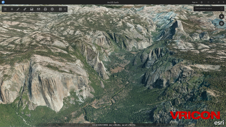
Launching in January, ArcGIS Earth was introduced to help customers transitioning away from Google Enterprise apps. Earth is a native KML client intended to enable analysts, scientists, and students to easily browse geospatial data, sketch simple placemarks, and access proprietary enterprise content inside ArcGIS Online or ArcGIS Enterprise. Earth releases quarterly and we have heard great feedback about our ability to incorporate customer concerns and requirements. One of the most impressive feats of the year for Earth was the addition of the capability to consume massive packages of I3S scene cache content from our data vendor partner, Vricon. The largest dataset I saw in a single file was a 120GB file showing Yosemite Valley… amazing for a <50MB application.
Esri Drone2Map
Drone2Map launched before the 2016 User Conference and immediately became a star with standing-room only seminars and users breaking out drones all over the globe. Because of Drone2Map, I saw monuments in Ireland, archaeological sites in the Nordics, and agricultural surveys in the US. The UAV market is democratizing access to imagery and point cloud data that can be used in 3D across many different geospatial domains and Drone2Map is helping our users take advantage of that data.
Esri CityEngine
CityEngine offered two releases this year that start to show how we are going to turn its direction toward urban planning and city planning customers even more directly. With new reporting capability, the ability to quickly get users modeling with OSM data, and the ability to publish I3S packages that can be used in Online and other apps, CityEngine is even more tightly integrated with the rest of the ArcGIS platform.
ArcGIS Runtime SDKs
A major upgrade to our ArcGIS Runtime SDKs started in November and will continue into next year. The goal of this upgrade is to enable us to provide customizable, efficient SDKs for developers on multiple desktop, server, and mobile platforms. The Runtime 100.0 release exposes 3D capability across all of the Runtime-supported platforms with production support for mobile apps starting in the next major update in mid 2017.
Futures
Broad adoption of 3D at Esri has opened up many areas for deeper requirements from our customers. Some we are able to focus on in the short term and some are going to take a while. BIM-GIS integration has been a frequent topic of conversation in 2016 and we will be looking more closely at how to support our BIM customers in 2017. Subsurface requirements are obvious for 3D. ArcGIS Pro and web scenes with Cartesian coordinate systems provide some tools for viewing underground with Esri, but we need to improve our subsurface navigation capabilities and add more data types that will support subsurface users.
We’re constantly being asked for more types of data layers, import formats, and open standard support. We are working to expand our support for 3D data types and open standards and we will continue to work with partners, such as Safe Software, to support the full range of formats and standards across the industry. In 2017, we will continue through the OGC Community Standard approval process for I3S. As we have embedded I3S across our entire stack of technologies, we hope to see I3S emerge as a commonly available data standard for sharing, distributing, and consuming 3D content across the GIS community both within Esri software and outside of it.
There’s no going back now. If you observe the GIS data vendor market, you quickly see that 3D data collection is becoming a standard expectation of customers in new projects across the globe. The drone industry with the availability of inexpensive access to ubiquitous oblique imagery is becoming a vehicle for 3D content as is the emergence of global-scale 3D content creation derived from historical satellite sensor information. In fact, the future is not 3D, but 4D as continuous imagery collection, point cloud archives, and real time sensor feeds all start to be used together in GIS to provide temporally continuous operational basemaps across multiple scales. Expect to hear more about that in the future.
As we’ve demonstrated in 2016, 3D is no longer an add-on to GIS. GIS is 3D. Now on to 2017.


Article Discussion: