ArcGIS Enterprise configured for Raster Analytics enables large and small organizations to distribute and scale raster processing, storage and sharing to meet requirements for unique projects. This flexibility and elasticity also allows you to pursue projects that were previously out of reach due to hardware, software, personnel, or cost constraints. An overview of Raster Analytics concepts and advantages is described in the article Imagery Superpowers – Raster analytics expands imagery use in GIS.
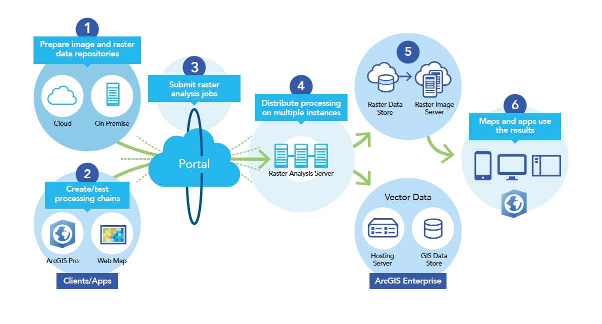
To help you become familiar with the benefits of Raster Analytics, Esri is offering a new Learn Lesson for ArcGIS Enterprise users. The lesson guides you through the process of configuring your Enterprise system for Raster Analytics, shows you how to use raster processing tools and functions to assess potential landslide risk associated with wildfire. The analysis is run on your distributed processing system, and the results are published to your Enterprise portal for ease of sharing across your organization. The lesson is a practical guide for implementing a Raster Analytics deployment, and demonstrating how standard ArcGIS Pro tools and functionality can be used to run distributed processes behind your firewall and in the cloud, and shared with stakeholders across your enterprise. Check out this story map, which gives you a more detailed overview of what the lesson involves.

Ready to try it out? If you want to extend your capabilities with Raster Analytics for increased productivity, test out the lesson and see why users are excited about the opportunity to address demanding projects in a more effective and efficient manner.


Commenting is not enabled for this article.