A broad collection of beautiful and useful geographic items are available to access within your own ArcGIS Enterprise environment, brought to you by ArcGIS Living Atlas of the World. Now, with the new 10.6 release, you can enjoy an even greater collection with a significant increase in content from previous releases. As our world is ever-changing, so is Living Atlas content, and we’ll review some of the highlights in today’s blog.
What is Living Atlas of the World?
Living Atlas is a rich collection of ready-to-use, authoritative content, from maps, layers, and scenes to apps, Story Maps, and more. For example, if you need to find near real-time traffic speeds on an Atlanta freeway one day and a 3D scene of Linz, Austria the next, Living Atlas has you covered.
These items are available for all members of your ArcGIS Enterprise deployment for enrichment, analysis, use in apps, maps and more. You can utilize Living Atlas content as is, or enhance it by incorporating your own data and layers.
Living Atlas content is available in ArcGIS Enterprise by default, and can be configured to bring in content at the subscriber and/or premium levels. You can also choose to download boundary layers from My Esri and host as feature layers in your Enterprise portal (highlighted a little further on in the blog). For more information on default, subscriber and premium levels of Living Atlas content, see Bern’s blog here.
New content in 10.6
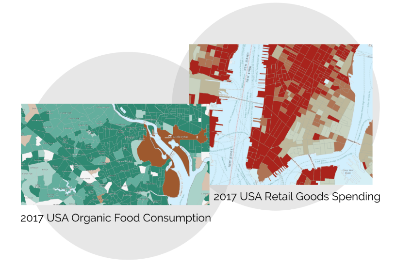
U.S. demographic data
What was the average amount spent on retail goods in New York City in May? How about the market potential for D.C. residents to eat organic food? New 2017 demographic data will help you search for and answer these types of questions. Additional demographic layers include political affiliations, online banking patterns, commute times, pet spending, and more. That’s right – if you need to determine if the amount spent on pet food in Milwaukee is higher or lower than the national average, you can do so using Living Atlas layers. Demographic information is fantastic for a range of analyses at different scales, whether you are interested in trends for a block group or for a whole state. Zoom in and out of your map to see variations in patterns based on different areas.
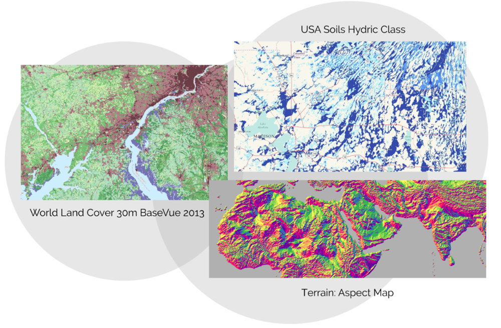
Landscape layers
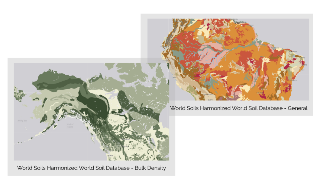
Landscape analysis is a crucial part of civil engineering, land use planning, natural resource management, and ecosystem analysis and monitoring. The ArcGIS Enterprise 10.6 release contains updated versions of SSURGO (Soil Survey Geographic Database) data, which includes layers with attributes on soil hydrology, chemistry, texture, density, and nutrients. These beautiful layers provide all types of information on soil composition around the globe.
Also new in 10.6 are updates to NLCD (National Land Cover Database) imagery layers, including vegetation types, agricultural use, and impervious surfaces. These layers can be used for a wide variety of mapping analyses (and are quite visually stunning!)
Tile layers
Take advantage of vector tile layers and web maps using the improved tiling scheme WGS84 Geographic, Version 2. This includes tile layers such as the World Navigation Map, Hybrid Reference Layer, dark and light gray canvas layers, and street maps. This new tiling scheme is enhanced for precision, and more than 20 items are included in the 10.6 release. Try out vector tile layers today and let us know what you think!
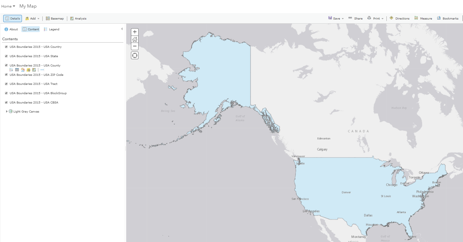
Boundary layers
The 10.6 release brings in updates to boundary layers for a number of countries. Boundary layers are polygons that contain various levels of demographic information about a country, such as population or land area/size. They are also available at different ranges based on the country, from counties to provinces. These layers are great for spatial analysis, such as aggregating data within a certain geographic boundary. They can also be used in scenes, apps and maps (as displayed below within a web map in ArcGIS Enterprise):
There are also approximately 130 boundary layers available in My Esri to download and host as feature layers in ArcGIS Enterprise. If you are interested in these layers, head over to My Esri to take a look at the ones available.
Mature support items in the Living Atlas
Keep in mind that Living Atlas content does have a lifecycle, which means some items may reach a state of mature support, and may ultimately be retired.
Therefore, it is recommended that after you upgrade your Living Atlas content, you do a quick audit of the layers you are using in your maps and apps to determine if any have been tagged as mature support. If they have been tagged as mature support, it is recommended that you visit What’s new in Portal for ArcGIS 10.6 to identify the replacement layer.
—
We hope you are excited about the new Living Atlas offerings in 10.6! To read additional information on Living Atlas in ArcGIS Enterprise, see Julia’s blog, Take advantage of Living Atlas content in your ArcGIS Enterprise. We look forward to hearing more about how you’re using Living Atlas content in your own geospatial maps, apps, and analyses!

Article Discussion: