
Apologies, this blog article has been deprecated and is no longer valid or updated.
It has been replaced by: Use World Imagery Wayback to create a custom basemap.
World Imagery Clarity is a view of Living Atlas of the World imagery that publishes archived imagery that may be more clear and/or accurate than what is presented in the default World Imagery map.
The default World Imagery basemap is designed to present the most recent, high-quality imagery available. Clarity is an alternative view, enabling users to access imagery from the Living Atlas archive that may not be otherwise be available. The imagery in this view may be less current than the default imagery, but can be used to support use cases where the image clarity or accuracy is more important.
*
Clarity examples
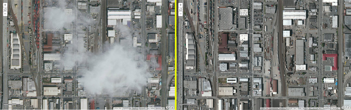
The area shown below is near Seattle, Washington. Clouds and cloud shadows can be seen in the World Imagery on the left. On the right is the same location, but using World Imagery Clarity. The imagery may not be as recent, but is obviously more clear.
The area shown below is near Yosemite National Park, and highlights the fact Clarity is of benefit in non-urban areas as well. The World Imagery on the left is more recent, but has long shadows hiding some of the details. World Imagery Clarity on the right eliminates the shadows, providing more detail.

*
How to use Clarity
To use World Imagery Clarity as your basemap, follow these steps.
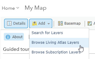
Step 1. Using the Map Viewer, Click Add, then Browse Living Atlas Layers.
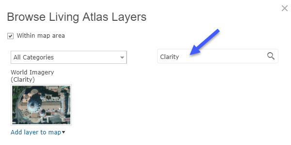
Step 2. Search for Clarity.
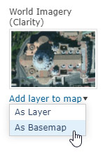
Step 3. Click the arrow, and choose As Basemap.
World Imagery Clarity is now the basemap, and will be saved with your map.
You can use World Imagery Clarity anytime you want; experiment to see which imagery view you prefer in your particular map area. An Administrator can also add it to your organization’s basemap gallery. See Configure map.
*
For more information
For more information see World Imagery (Clarity).


Article Discussion: