Last week we attended the Dynamic Mapping of Secondary Cities Symposium at Harvard University to discuss mapping activities and solutions for emergency preparedness, resiliency planning, and urban sustainability in Secondary Cities. Secondary Cities are rapidly growing urban areas that are regional hubs for commerce, services, and governance that often do not have adequate planning mechanisms for future development and growth. Using a variety of technologies and tools we can equip citizens in these cities with the abilities to conduct surveys and build up robust datasets, and then to analyze the datasets and share insights, knowledge, and stories. These resulting insights have incredible potential for improving resiliency, human security, and emergency preparedness.
The Secondary Cities program is an initiative of the Office of the Geographer and is currently working with six cities. We highlighted the work done in Kharkiv, Ukraine, and their use of Survey 123 to conduct data collection surrounding the theme of emergency preparedness as it relates to vulnerable populations, mobility, and accessibility. Going further, we proposed a few techniques to put this data to work through data dissemination using ArcGIS Open Data and knowledge sharing with ArcGIS Online and Story Maps.
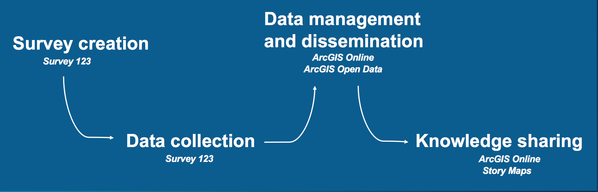
Collecting data
The Secondary Cities team met with stakeholders in Kharkiv to define the themes, features, and attributes needed for their data collection surveys, and used Survey 123 to ultimately create three smart surveys for mobility features, public safety, and community resources.
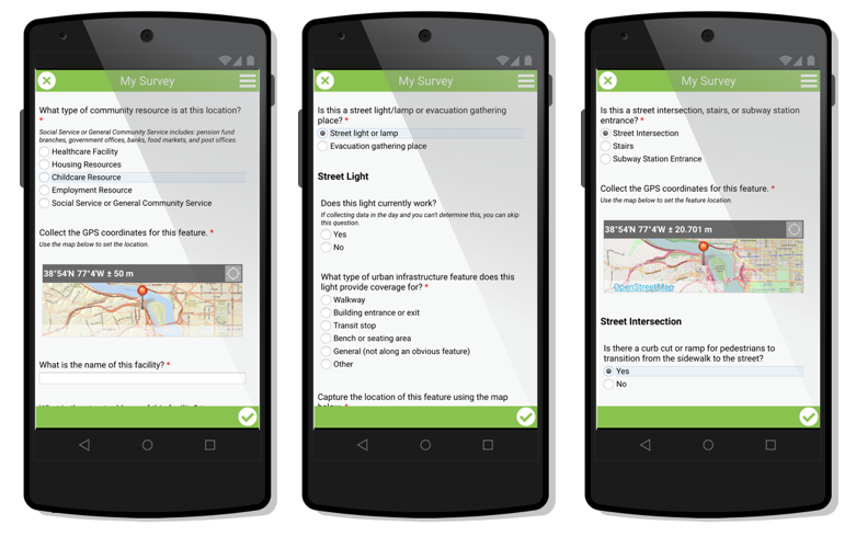
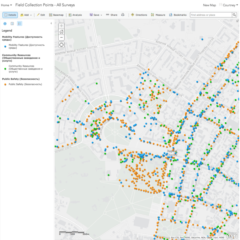
These surveys were shared with 34 data collection team members who took their smartphones to the streets and ended up collecting over 13,000 features in three weeks! These three surveys culminated in three feature services hosted in ArcGIS Online which can then be shared with wider audiences and used to create analyses and garner new insights. The teams in Kharkiv are currently undergoing quality assurance and quality control procedures to make sure that the data is robust and accurate.
Disseminating data
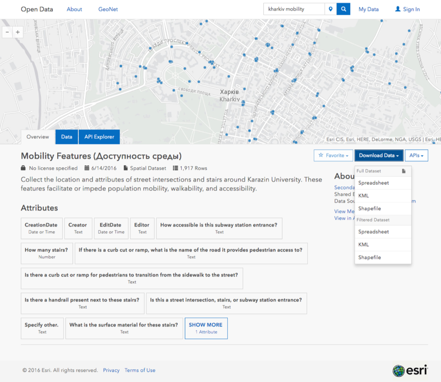
For demonstration purposes we showed a workflow of taking a resulting feature service and sharing it with ArcGIS Open Data. This expands the reaches of the dataset by making it accessible to the general public without disconnecting it from the source. From here, anyone can search for the dataset, explore and filter the features and spatial distributions, and download the data in multiple formats or access it through open APIs. In this case, we’ve accessed the resulting dataset from the Mobility Features survey and filtered it to only show where there is no curb cut or ramp for pedestrians to transition from the sidewalk to the street. We can use this filtered dataset to highlight areas which need increased accessibility.
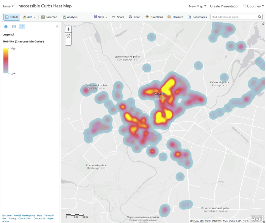
Knowledge Sharing
Once we have accessed and explored the dataset from ArcGIS Open Data, we can open it in ArcGIS Online to perform more analysis and cartography. Below we have a simple heat map of the filtered dataset, showing areas where there is a high number of inaccessible curbs. From this dataset we can also perform a hot spot analysis of the points to determine statistically significant dense locations of inaccessible curbs. The two maps can be used in a Story Map to share the data and insights in an accessible way for broad audiences. These types of information products and new insights can be used to aid decision making and help increase emergency preparedness, mobility, and accessibility.
Connecting local knowledge with domain expertise
The Secondary Cities program is creating rich datasets full of invaluable local knowledge. By taking the survey’s datasets and sharing them with ArcGIS Open Data, we can open access to analysts, researchers, citizens, and students around the world who can apply their domain knowledge to the region’s specific problems. It’s exciting to see the Secondary Cities progress and witness how data collection and knowledge sharing can have a lasting effect on cities’ resiliency, human security, and emergency preparedness around the world.
Consider how you can apply this workflow to your data collection and knowledge sharing work, and get in touch if you have any questions!
Commenting is not enabled for this article.