Governments and organizations have been hard at work creating Open Data sites to make their authoritative data accessible, discoverable, explorable, and collaborative. There are over 25,000 datasets in the Open Data catalog and over 100 sites in the ArcGIS Open Data site gallery for you to explore! The Site of the Week is a series that profiles one ArcGIS Open Data site each week.
—
Site of the Week, Data Quality Edition: Nebraska Game and Parks Commission
Globally, there are currently 1,542 organizations making their data open with the ArcGIS Platform, and this number continues to grow. Within these organizations we see a range of types: all levels of government, non-profits, educational institutions, events, and more. While some governments have created federated sites across the internal departments and commissions, others have individual sites for individual overseeing bodies— today we’ll look at Nebraska Game & Parks Commission Open Data.
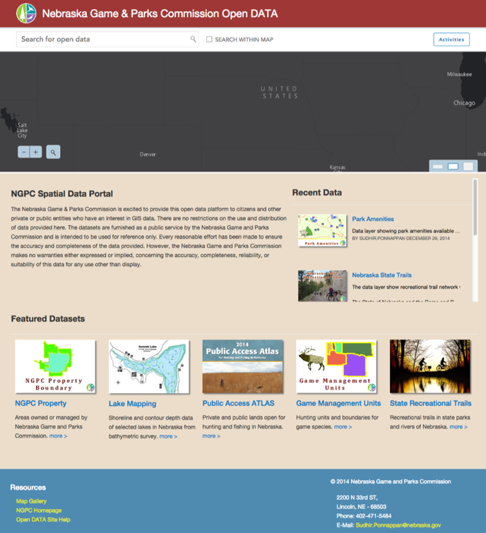
There are over 50 high quality datasets ready for Nebraskans to discover and use to answer their questions about the state’s fish, wildlife, park, and outdoor recreation areas. All these spatial and non-spatial datasets are carefully crafted to be authoritative, informative, and user friendly.
The NGPC deserves an award for exemplary data quality. Let’s pick apart one of these datasets and see what makes them so great:
Title
This seems rather elementary, but a clean title sets the tone for the dataset. Most data on ArcGIS Open Data sites comes from geodatabases and map services, and their titles are meant for the administrators and GIS software. Editing the titles to be end-user friendly allows NGPC site visitors to easily discover and understand the data.

Description
NGPC’s descriptions are comprehensive and provide context to the data, the attributes, method of collection, and more. As a user, I can feel confident that this dataset will provide the information I’m after, and sometimes am even directed to more information elsewhere.
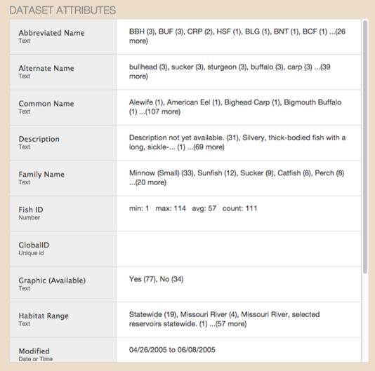
Attribute names
Similar to titles, attributes often need to be edited to better serve the end-user—the standard GIS attribute fields are not the most useful for people unfamiliar with the data. NGPC has provided attribute aliases that clearly state what the field is and what it means.
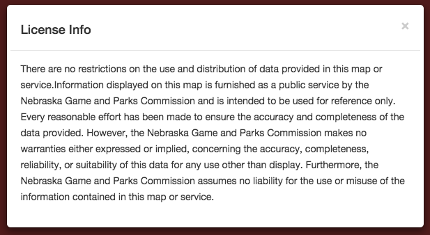
License
It’s important to note that even though NGPC’s license dictates no restrictions on the use of the data, it is still included on the homepage and each individual dataset. Users are clearly informed of the lack of restriction and can be confident when using the data for other applications.
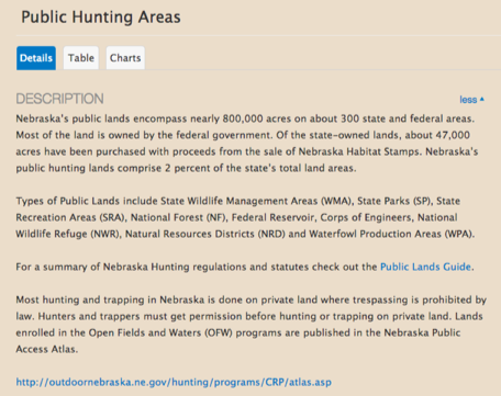
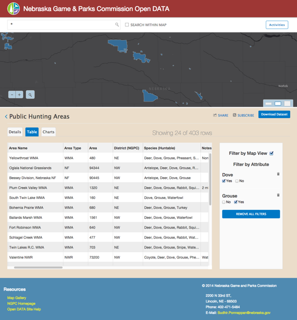
With the Commission’s Open Data site, Nebraskans have an interactive way to find information that is truly augmented with the NGPC’s data quality. Nebraskan hunters can discover the Public Hunting Areas dataset, filter out the areas they want, and discover their areas of interest.
The NGPC site is a great example of a resource for people to both find answers to common questions, or access data to use in mashups and application development. If you’re in the process of preparing data for your own Open Data site, NGPC is a great example to look at.
—
Stay tuned for next week’s Site of the Week. In the meantime, check out the interactive Explore Open Data map to view more awesome sites, and get started with making your own Open Data site here.

Article Discussion: