As a data provider, you understand the importance of making your data Findable, Accessible, Interoperable, and Reusable (FAIR) by wide audiences. One step in achieving this is by sharing your trusted, curated content using standards-based catalogs like ArcGIS Hub.
Hub is a comprehensive data discovery, coordination, and engagement platform designed to help organizations share trusted data, maps, and applications. By providing a geo-enabled destination for your community, Hub enables organizations to work better together.
ArcGIS Hub now supports DCAT-US 3 (beta)!
Thousands of organizations already use ArcGIS Hub catalogs to share data and federate their content with open data portals like data.gov and data.europa.eu . With DCAT3 support, these organizations—such as national, state, and local government agencies—can share open data more effectively, making it easier for users to find, access, and utilize valuable information.
Esri is excited to announce support for DCAT-US 3.0 (beta), the DCAT application profile for the United States. ArcGIS Hub with DCAT-US 3 supports federal agencies implementing the Foundations for Evidence‑Based Policymaking Act of 2018 (the OPEN Government Data Act). This enhancement further increases the discoverability of data shared using ArcGIS Hub catalogs.
Continue reading to learn more about how Hub catalog feeds enhance data sharing and discoverability.
Federating your data: enhancing discoverability
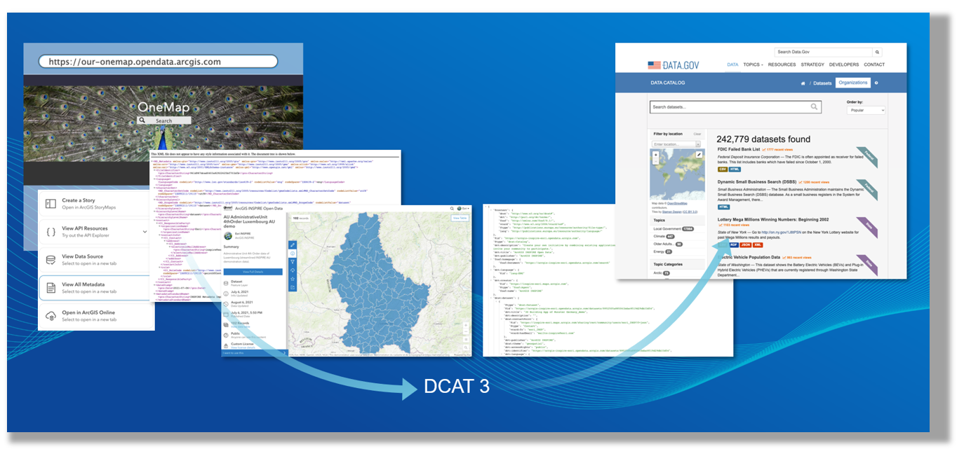
Federating your data means making your datasets discoverable on distributed data portals without having to physically move or duplicate the data. Instead, these platforms regularly harvest your metadata using catalog feeds, providing dynamic access to your organization’s shared data. This approach enables you to maintain control over your data while still making it visible and accessible to additional audiences.
For example, data.gov and data.europa.eu are two prominent open data portals that can register data from content providers using catalog feeds. These platforms play crucial roles in promoting open data and transparency in their respective regions, enabling users to discover, access, and utilize valuable datasets for various purposes. This is where interoperability standards come into play.
How catalog feeds work in ArcGIS Hub
The process is straightforward. When you share content in ArcGIS Hub and enrich it with detailed metadata, you make it more discoverable and reusable. The Hub catalog automatically transforms the metadata and generates the catalog feeds, ensuring that your data is accessible.
ArcGIS Hub supports multiple open standards-based catalog feed formats, including GeoRSS, DCAT, and OGC API – Records, providing flexibility and broad interoperability.
What is DCAT and why is it important?
DCAT is a standardized data catalog vocabulary designed to facilitate interoperability between data catalogs published on the Web.
ArcGIS Hub has a long history of supporting DCAT for catalog federation, including DCAT-US 1.1, DCAT-AP 2.1.1, DCAT-AP 3.0.0, and now DCAT-US 3.0 (beta), enabling organizations to easily federate their open data to others. As the amount of data continues to grow, helping people and AI find the right information at the right time is more important than ever.
Understand how metadata is mapped to DCAT-US 3.0 (beta)
Curious how metadata is represented in a DCAT-US 3.0 (beta) feed? Review the crosswalk to see how ArcGIS metadata elements, along with mappings of other metadata standards, populate DCAT-US 3.0 (beta) feed.
During the beta period, we welcome your feedback. Please share your thoughts through the DCAT-US 3.0 (beta) survey.
Try it out
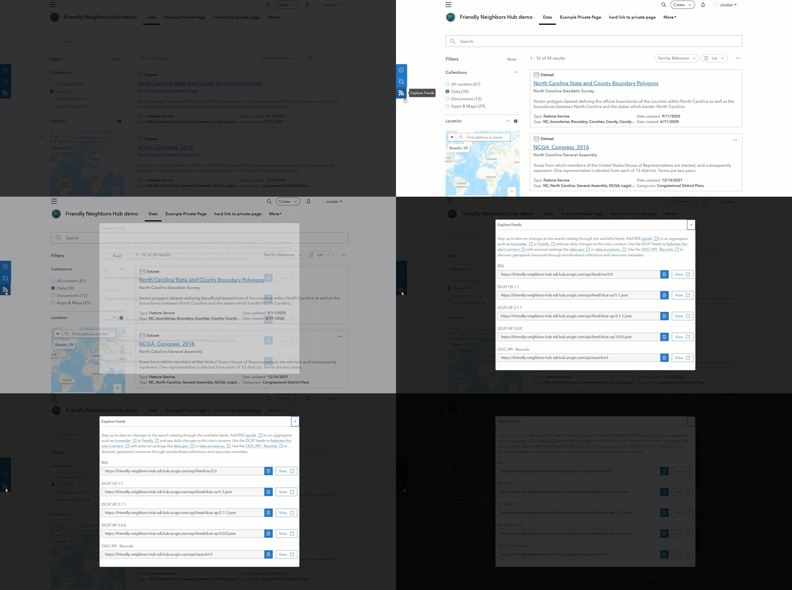
Explore a site’s catalog feed by appending a feed API, such as /api/feed/dcat-us/3.0, to your Hub site URL. You can then register the feed with the appropriate open data portal.
| Catalog feed standard | Description | Explore feed |
| GeoRSS | A format for syndicating geographic content | <siteURL>/api/feed/rss/2.0 |
| DCAT-AP 3.0.0 | Data Catalog Vocabulary for interoperability in Europe (required by data.europa.eu) | <siteURL>/api/feed/dcat-ap/3.0.0.json |
| DCAT-US 3.0 (beta) | Data Catalog Vocabulary for interoperability in the United States (required by data.gov) | <siteURL>/api/feed/dcat-us/3.0 |
| OGC API – Records | ArcGIS Hub’s native catalog API for discovering and accessing records | <siteURL>/api/search/v1 |
Learn how to federate data and manage your catalog feeds in the ArcGIS Hub documentation.
What’s next?
Esri is committed to continuing its support for evolving open standards. As metadata and catalog standards evolve, ArcGIS will continue to evolve with them. By supporting DCAT3, ArcGIS Hub reinforces its position as a powerful platform for trusted content discovery and collaboration.
This article was originally published October 28, 2025. It has been updated to communicate current status of DCAT-US 3.
More ArcGIS Hub resources
- Find out what’s new and learn best practices on the ArcGIS Blog
- Visit the ArcGIS Hub Esri Community
- Attend Hub webinars
- View presentations, demos, and how-to videos on our ArcGIS Hub playlists
- Get inspired by examples in the ArcGIS Hub gallery
- Sign up for the ArcGIS Hub e-newsletter





Commenting is not enabled for this article.