The ArcGIS Online global elevation analysis services were updated last week to include 10 meter resolution elevation data for Norway, Finland, Denmark, Austria, and Spain. The updated services include Viewshed, Profile, and Summarize Elevation. Previously, elevation data for these areas were only available at lower resolution. With the update, these five countries now join the continental US as areas using 10 meter data. Nearly all other parts of the world use 30 meter resolution SRTM data as their finest resolution in the global elevation analysis services.
There are many ways to access these services across the ArcGIS platform.
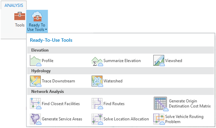
In ArcGIS Pro, Elevation services are found in the Analysis tab under Ready-to-Use Tools.
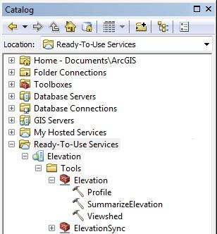
In ArcMap, sign in to your ArcGIS Online account and the services can be found at the bottom of the Catalog window under Ready-To-Use Services.
In ArcGIS Online you can use these services to perform interactive visibility analysis anywhere in the world. To do this, click the Analysis button and find Create Viewshed under the Find Locations section.

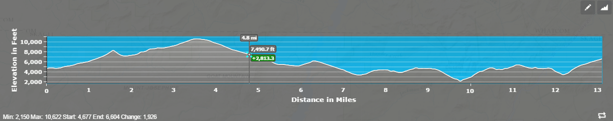
If you want to create your own custom app with an interactive elevation profile graph widget, the quickest way to do that is with the Profile App Template.
Using Web AppBuilder for ArcGIS you can create your own custom hosted analysis applications. The Create Viewshed dialog shown above from ArcGIS Online is also available as a standard analysis widget in Web AppBuilder.
And if you want to add an elevation profile graph into your Web AppBuilder project, there is a free custom profile widget available.
For developers more interested in hacking a bit of code, these services are also available in the REST API.
Most of the elevation analysis services consume credits (1 credit per 1,000 input features) and therefore your account needs to have certain permissions set by your site administrator in order to take advantage of these services. The synchronous elevation profile service used in the app template and Web AppBuilder widget does not consume credits.


Article Discussion: