“Hack”, “how-to”, whatever the handle, to me it means putting some maybe-unexpected pieces together in a somewhat-unexpected way to create something with interest. You know, ideally.
Luminance Hack
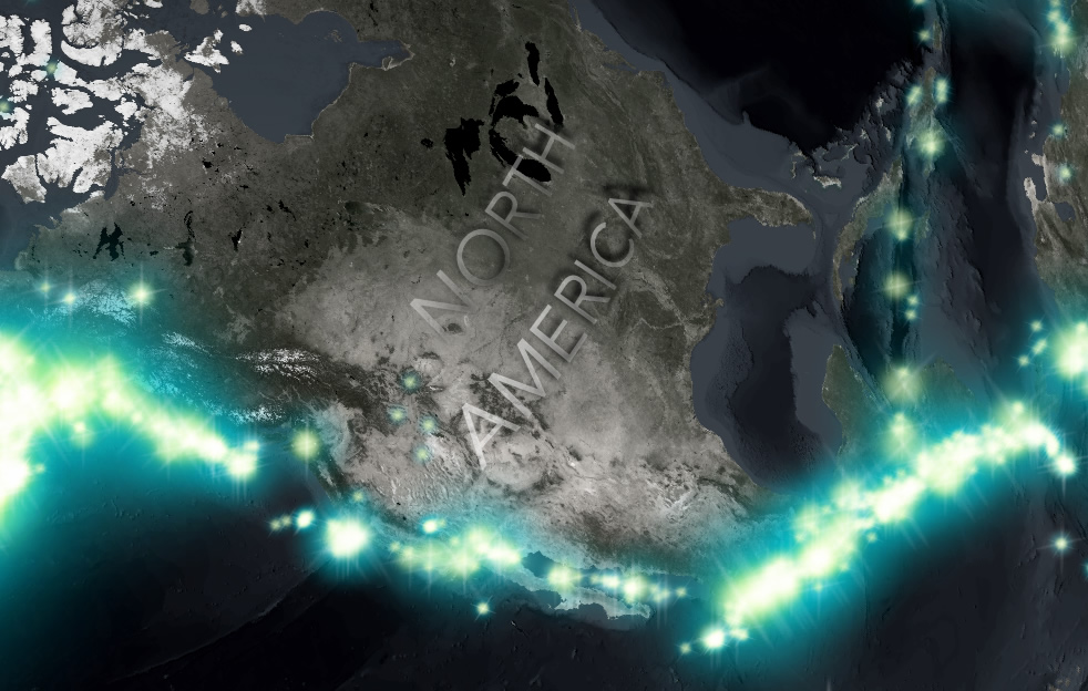
Ah, it’s so simple. So simple. Just use symbol layers in Pro to stack up a host of really faint glow images, apply them to hundreds of thousands of historic earthquakes, and bang! You’ve walked backwards into a map of Earth’s tectonic plate boundaries bursting with violent energy.
Hacking a DEM Sunrise
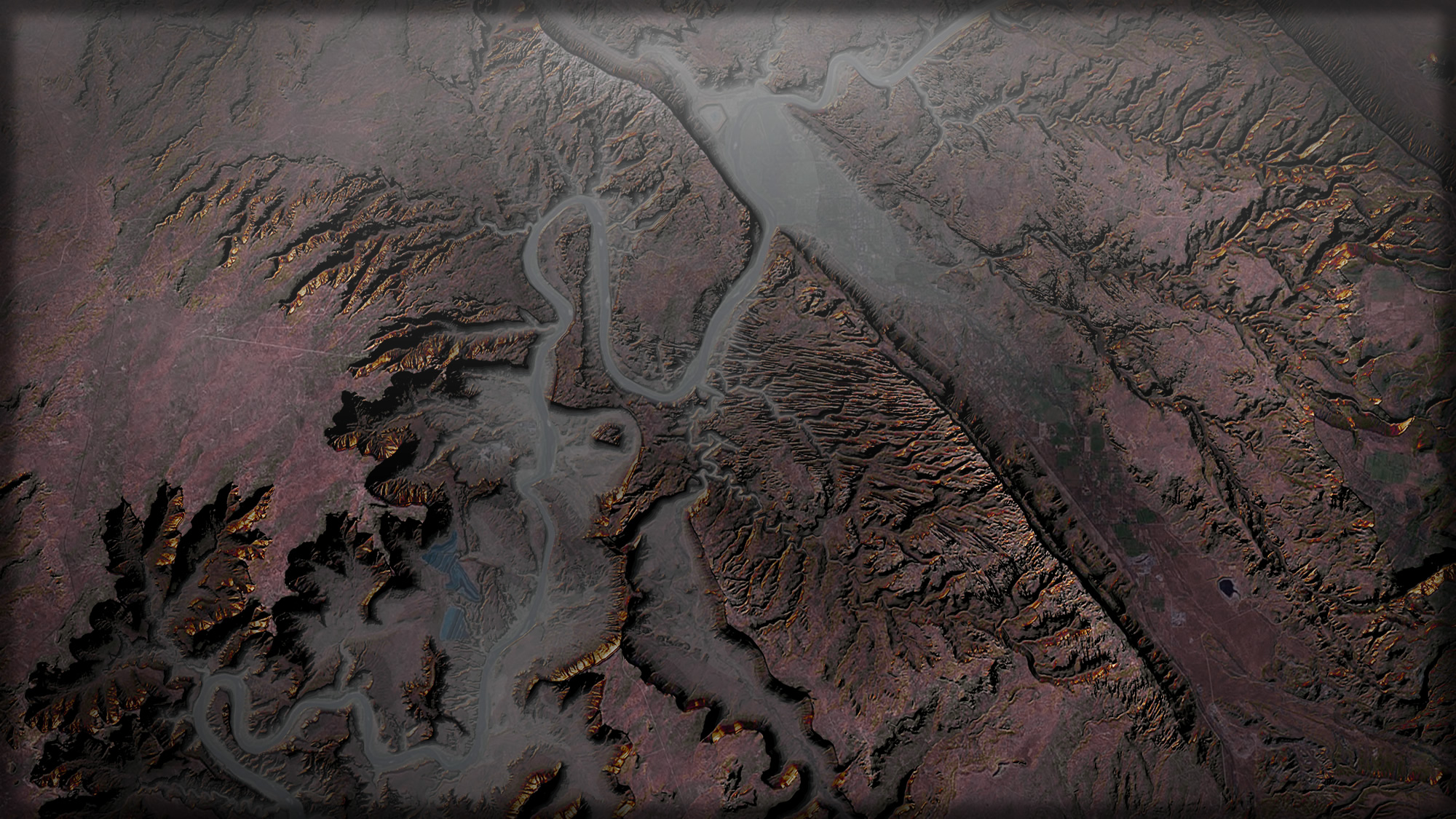
Could this have been my very favorite hack? Quite possibly. It is definitely the hackiest of these hacks. How can you, with a Digital Elevation Model, make a map that looks like you are flying overhead at 5:30 am looking down as the morning sun bathes peaks and mist with its amber hue? Here’s how! This effect was one of several bizarre unnatural things I did to DEMs.
Mega-Easy Coastal Stipple Effect
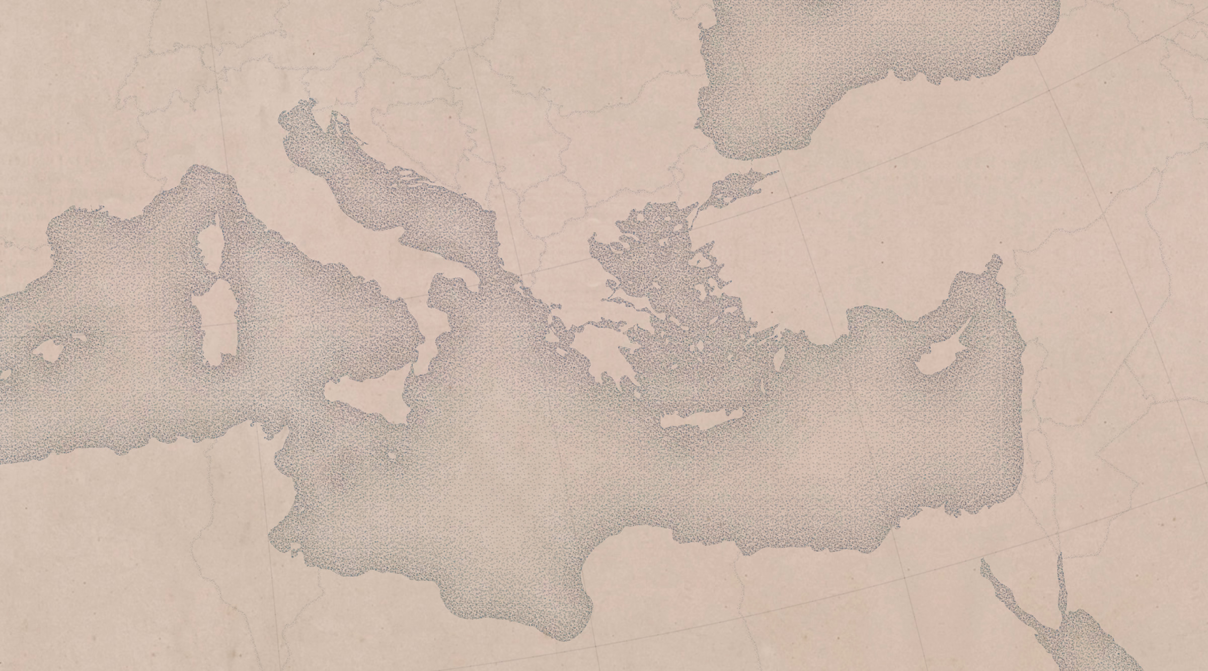
I look at old maps a lot and marvel at the craft of those cartographers. Like awesome coastal stippling or the sweet vintage water lines. Then, I can’t help but try to get a similar effect in today’s tools! Because why not? I feel the same about fantasy maps made for books.
Absurd Paper Maps in Pro
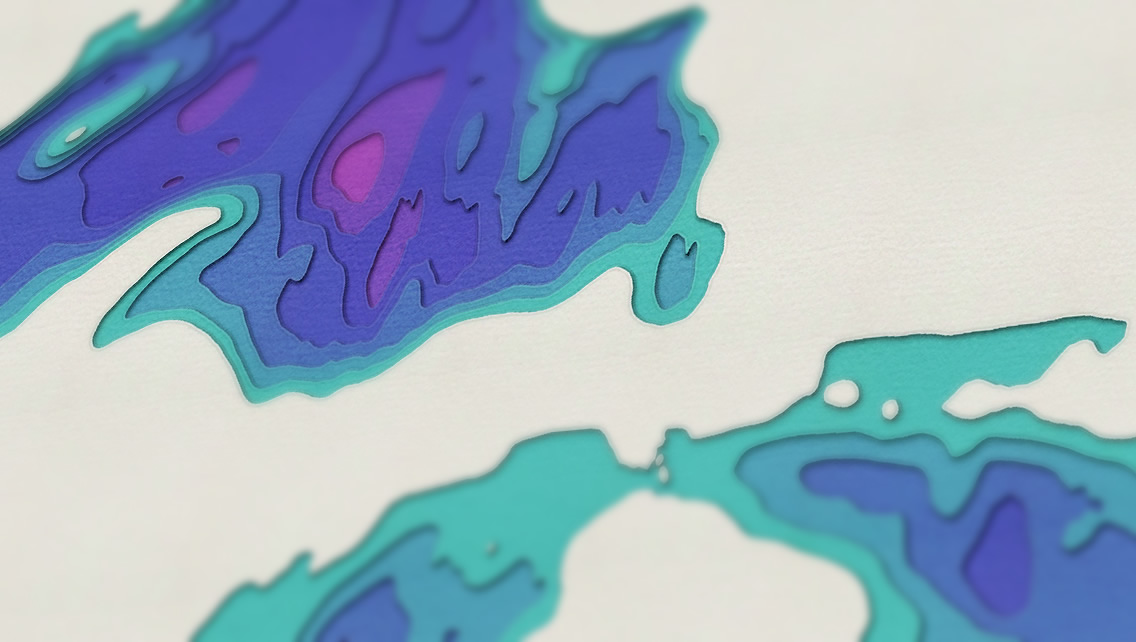
Speaking of hand-made looking maps, this hack is so specific that I think it does a reasonable job if faking out most of the people who look at it. This stacked cardboard bathymetry map is absolutely digital -made easily in ArcGIS Pro.
Firefly Basemap Starter Pack for ArcGIS Pro
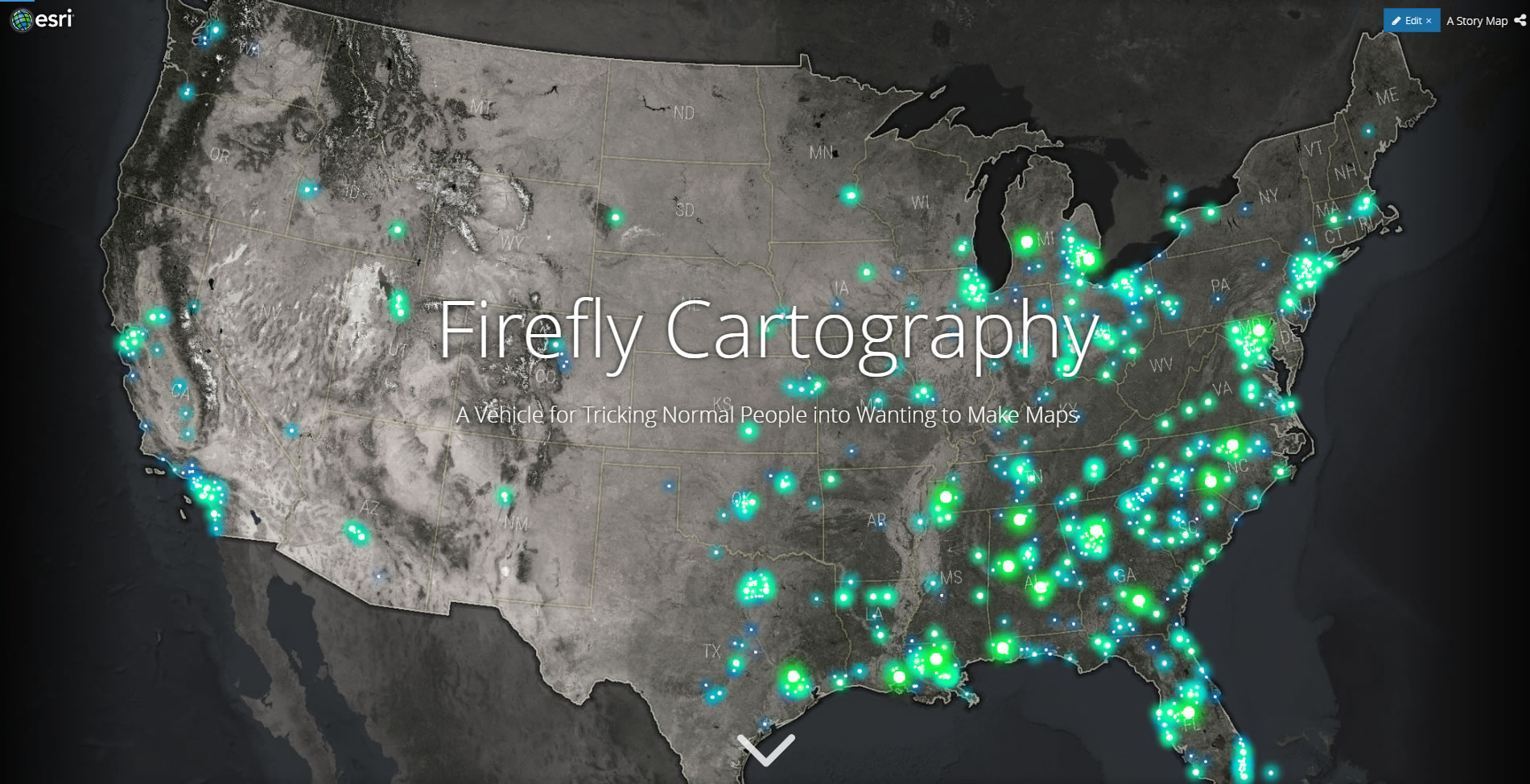
This blog post represented the bloggy introduction of Firefly cartography. Hack? Yes, Firefly is a brain hack! Should you click on this link? No! Why? Because this basemap is pre-crunched and now available to you as a tiled map service! And the glowing firefly symbols are now baked into ArcGIS Online!
Check out the Living Atlas for some Firefly resources and examples. Get ready to live.
How to Make the Map on the ArcGIS Book
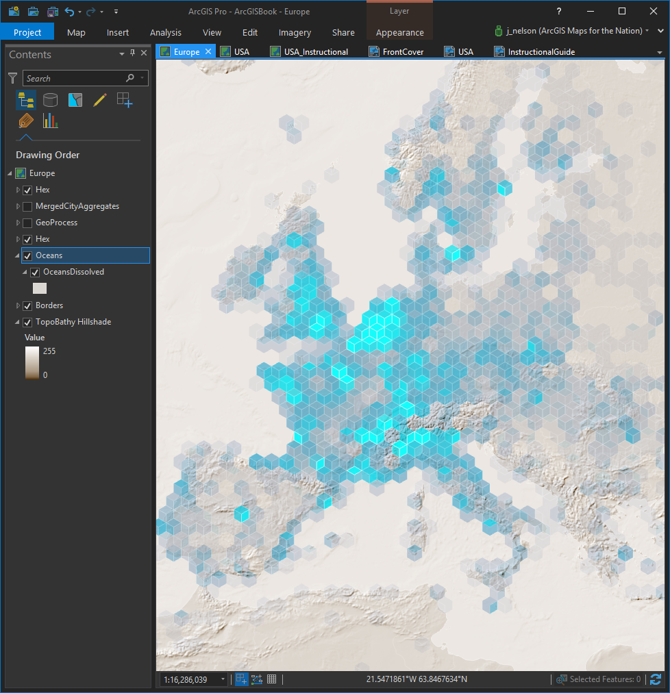
Often my initial reaction when I see a map that I admire is to be somewhat intimidated by it, and the cartographer. That’s natural, but I’ve learned that seemingly-complex maps are usually a pretty knowable/doable series of steps. There’s no magic other than in the invention. So when the map above was on the cover of the Arc GIS Book, it seemed like the ultimate opportunity to peel back the mappy veil and show, step by step, how it was made. And it’s pretty straightforward.
Thanks for a hacky maptastic 2017!
Well, thanks for making it down this far. And for supporting the awesome tools and hacks that generate exciting ideas and push towards inviting cartography! I look forward to continuing the conversation into 2018. See you around the bend!
Happy Mapping, John


Article Discussion: