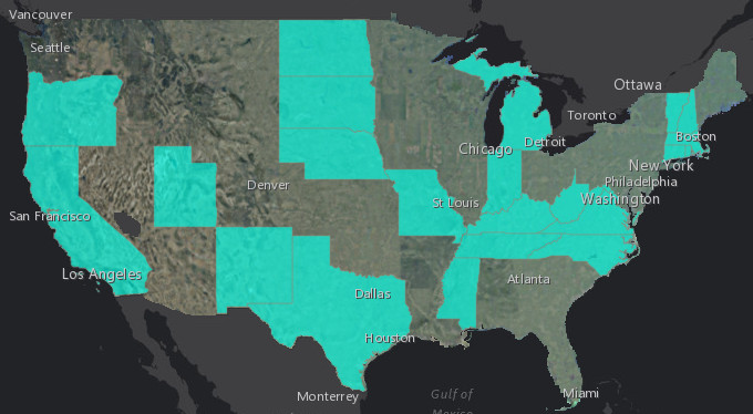
Did you know that Esri hosts a set of image layers with recent 1m (or better) resolution, multispectral imagery for the continental United States? The Living Atlas includes a set of NAIP image layers hosted by Esri and these layers now include the NAIP 2016 1m and 60cm imagery. Over the last few months, we have been busy assembling, processing, and publishing this imagery to make it available to you. Last week, we released our final set of NAIP 2016 imagery and the image layers and maps now include the latest imagery for 24 states (shown below). You can discover and access these layers through the Living Atlas (in various apps) as well as through the ArcGIS Online NAIP Imagery group.
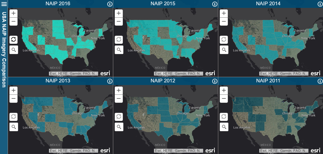
The imagery is made available by the USDA Farm Service Agency. The National Agriculture Imagery Program (NAIP) acquires aerial imagery during the agricultural growing seasons in the continental United States. The image layers published by Esri include all NAIP imagery since 2010 and provide access to imagery for each state in 4-bands (RGB and Near Infrared) with the option to display the imagery as false color or to display the NDVI showing relative biomass of an area. Using the image layers, you can access the different vintages of imagery over time to better understand how conditions have changed (click on image below).
The NAIP image layers are available to users with an ArcGIS Organizational subscription at no additional cost. To access the NAIP imagery maps and layers, you’ll need to sign in with an account that is a member of an organizational subscription.
The NAIP imagery is also being added to our World Imagery map, which already includes much of the NAIP 2016 imagery. The final set of NAIP 2016 imagery will be added to the World Imagery map in the next couple weeks.
Thank you again to the USDA Farm Services Agency for making this useful imagery publicly available!

Article Discussion: