The Ocean Basemap Team is happy to announce the release of the Arctic Ocean Basemap as a production basemap! We previously blogged about the development of this service. The Arctic Ocean Basemap uses the Alaska Polar Stereographic projection (WKID 5936) and is cached from ~1:451million to ~1:881k. It covers the northern latitudes of the globe from 90 to 50 degrees north. Like the Web Mercator version of the World Ocean Basemap, the Arctic Ocean Basemap consists of two map services. In this web map, the base and reference services are combined to create a “map sandwich”. You can also use the base or reference services individually.
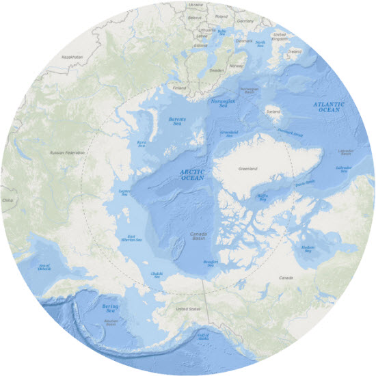
Additionally, we released the production version of the Arctic Imagery map. This basemap is in the same coordinate system as the Arctic Ocean Basemap, but it is cached to larger scales, from ~1:451million to ~1:110k. It provides 15 meter TerraColor imagery for the same northern polar region (90 to 50 degrees north latitude), though the projection will support display of data to lower latitudes. Both Arctic Ocean and Arctic Imagery maps are designed to be used as basemaps for overlaying other data for the arctic region.
As a reminder, this ends the beta release version of all the Polar Arctic services and web maps. Because of this, the URLs have changed. Now is the time to update any web maps or apps that utilize the beta services. The beta services and web maps for the Arctic Ocean and Arctic Imagery will be removed from ArcGIS.com at the end of September 2015. The new production service and web map paths are:
- Arctic Imagery web map:
http://www.arcgis.com/home/item.html?id=7ec08e5438304dbfa1e26181503e6fa8 - Arctic Ocean Basemap web map (“map sandwich” of base and reference services):
http://www.arcgis.com/home/item.html?id=c7381cb155a043a2bba2b84566677262 - Arctic Ocean Base service (bathymetry relief and tints, land base and roads):
http://services.arcgisonline.com/arcgis/rest/services/Polar/Arctic_Ocean_Base/MapServer - Arctic Ocean Reference service (water body labels, undersea feature labels, bathymetric depth values, administrative boundaries and names and populated place names):
http://services.arcgisonline.com/arcgis/rest/services/Polar/Arctic_Ocean_Reference/MapServer
Commenting is not enabled for this article.