ArcGIS Living Atlas of the World provides foundation elevation layers and tools to support analysis and visualization across the ArcGIS platform. These layers get updated quarterly with high resolution elevation data from open sources and community maps program. In this release, world elevation layers are updated with many high-resolution elevation datasets as described below.
These layers are updated with topographic lidar derived bare earth elevation:
- Updates to USGS 3DEP 1 meter DTM’s covering partial areas of the conterminous United States
- Lidar derived 0.25 meter DTM covering Canton of Basel-Landschaft, Switzerland
- Lidar derived 0.5 meter DTM covering Canton of Solothurn, Switzerland
- Lidar derived 0.5 meter DTM covering Canton of Aargau, Switzerland
TopoBathy layer is updated with the following bathymetry datasets:
- NOAA’s NCEI 1/9 arc sec (~ 3 meters) DTM’s covering partial areas along the east coast of United States
- NOAA’s NCEI 1/3 arc sec (~ 10 meters) DTM’s covering partial areas along the east coast of United States
- NOAA’s NCEI 1 arc sec (~ 31 meters) DTM’s covering partial areas along northeast coast of United States
- NOAA’s NCEI 3 arc sec (~ 93 meters) DTM’s covering partial areas along northeast coast of United States
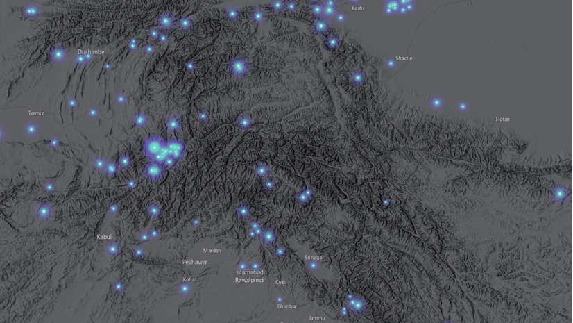
In this release, USGS 3DEP 1 meter got a significant update, increasing the 1m coverage area to almost double. The graphic below shows the coverage of newly added (magenta) 3DEP 1m data along with previously available (yellowish green) coverage.

Here are a few examples highlighting the improvements with before and after images.
Highland, CA, USA – fine details depicted with USGS 3DEP lidar derived 1 meter in suburban landscape in comparison to old NED 10 meters

Oberdorf, Basel-Landschaft Canton, Switzerland – depicting the fine details with lidar derived 0.25 meter data in comparison to WorldDEM4Ortho 24 meters

Langendorf, Solothurn Canton, Switzerland – depicting the fine details in urban landscape with lidar derived 0.5 meter data in comparison to WorldDEM4Ortho 24 meters

Baden, Aargau Canton, Switzerland – depicting the fine details in the hilly landscape with lidar derived 0.5 meter data in comparison to WorldDEM4Ortho 24 meters

These data updates will also be rolled out to other world elevation derivative products – Elevation 3D (Terrain3D and TopoBathy3D) and World Hillshade in the next quarter (Q3).
For more information about the various data sources available in World Elevation services, check out the Elevation coverage map. Esri will keep improving World Elevation Services, Tools and derivative products by including high resolution data from open source and the Esri Community Maps program. Additionally, to contribute high-resolution elevation data to Living Atlas of the World, check out the Esri Community Maps for Elevation program.


Commenting is not enabled for this article.