ArcGIS Pro users enjoy ready-to-use data at their fingertips!
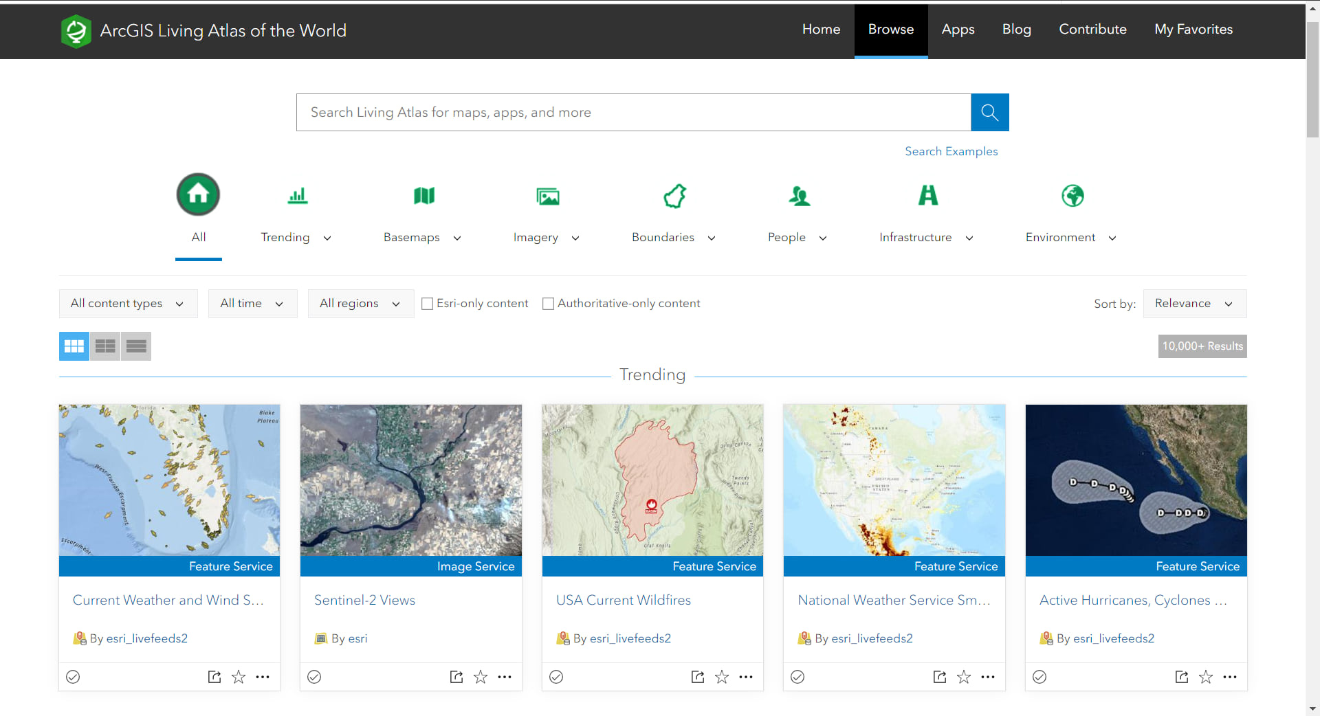
ArcGIS Living Atlas of the World is an evolving digital repository assembled from the collective work of the global GIS community. It includes maps, apps, and data layers to support your work. People share their spatial content to Living Atlas to connect millions of GIS users to their spatial layers, maps, and more. Explore the multitude of layers and maps and combine them with your own work to enhance your project.
In ArcGIS Pro, you can find and add Living Atlas data using several workflows such as the Catalog pane, Catalog view, or the Add Data dialog box.
Let’s go through the three ways to add Living Atlas data to your project. My project contains school locations and I would like to learn about the families who live in the surrounding areas to gauge how many children may attend these schools.
Catalog Pane
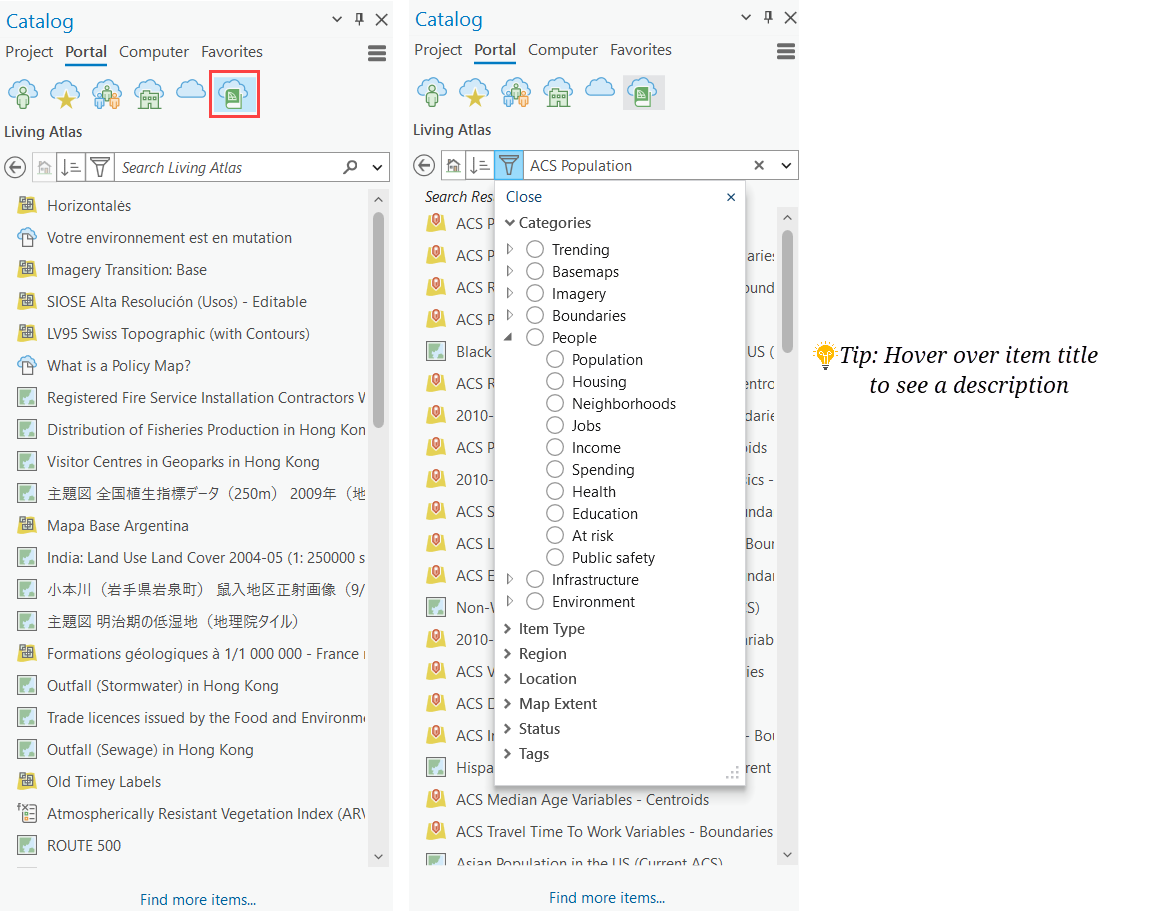
- Open the Catalog pane and click Portal.
- You’ll see six different icons. The far right icon of a book and cloud is for Living Atlas.
- Browse through the Living Atlas categories using the drop-down or search ‘ACS Population’.
- Drag and drop the ACS Population Variables layer into the map. Alternatively, right-click on the layer > Add to current map.
- Now you are ready to start exploring the new data in your project. Simply click on the map for additional pop-up information.
Project View
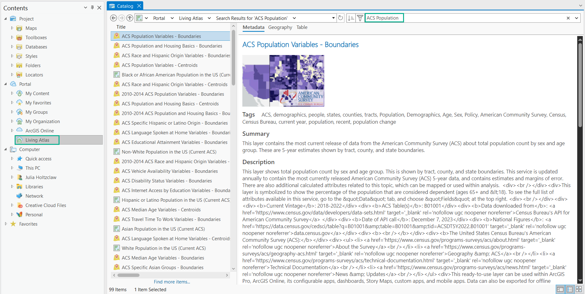
- Open the Catalog View window by clicking the View menu > Catalog > Catalog view
- Select Living Atlas under Portal
- Use the Search bar to find an item or use the Categories drop down to filter based on content subject (Imagery, Basemaps, People, etc)
- Click an item to view the metadata
- Right-click the item to Add To Map
Add Data
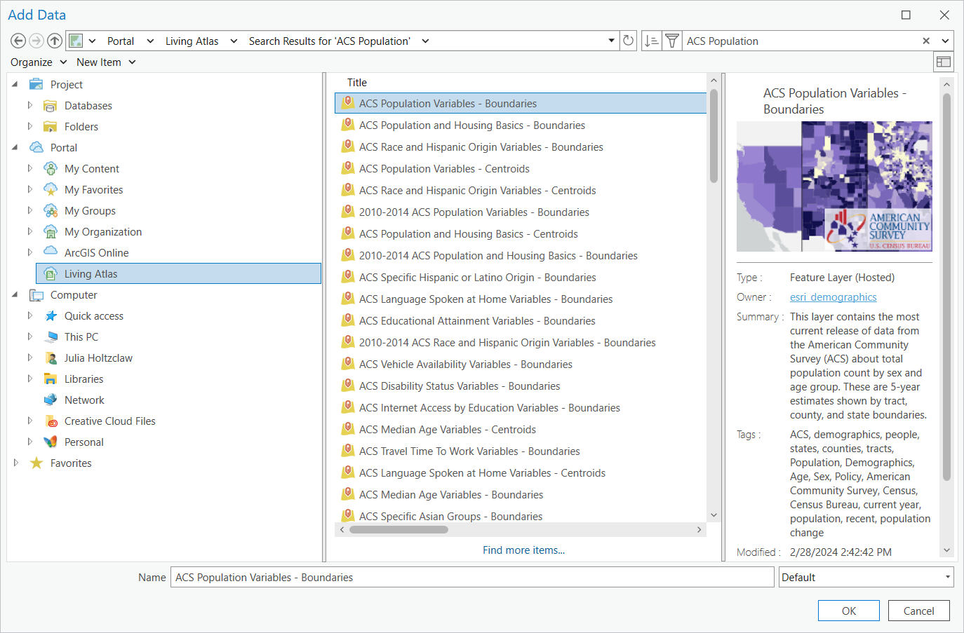
- Click Add Data on the Map ribbon
- Click Living Atlas under Portal
- Use Categories to filter or Search in the bar
- Select the layer > OK to add to the map
These are the three easy ways to browse and access Living Atlas data in your ArcGIS Pro projects. With Add Data, you can add layers directly to the map. The Catalog View and Pane also allow for adding ready-to-use maps. If you would like to learn more or contribute to ArcGIS Living Atlas of the World, visit this blog or this Learn path.

Commenting is not enabled for this article.