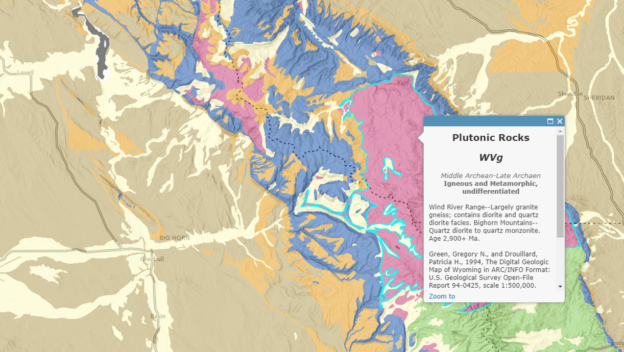
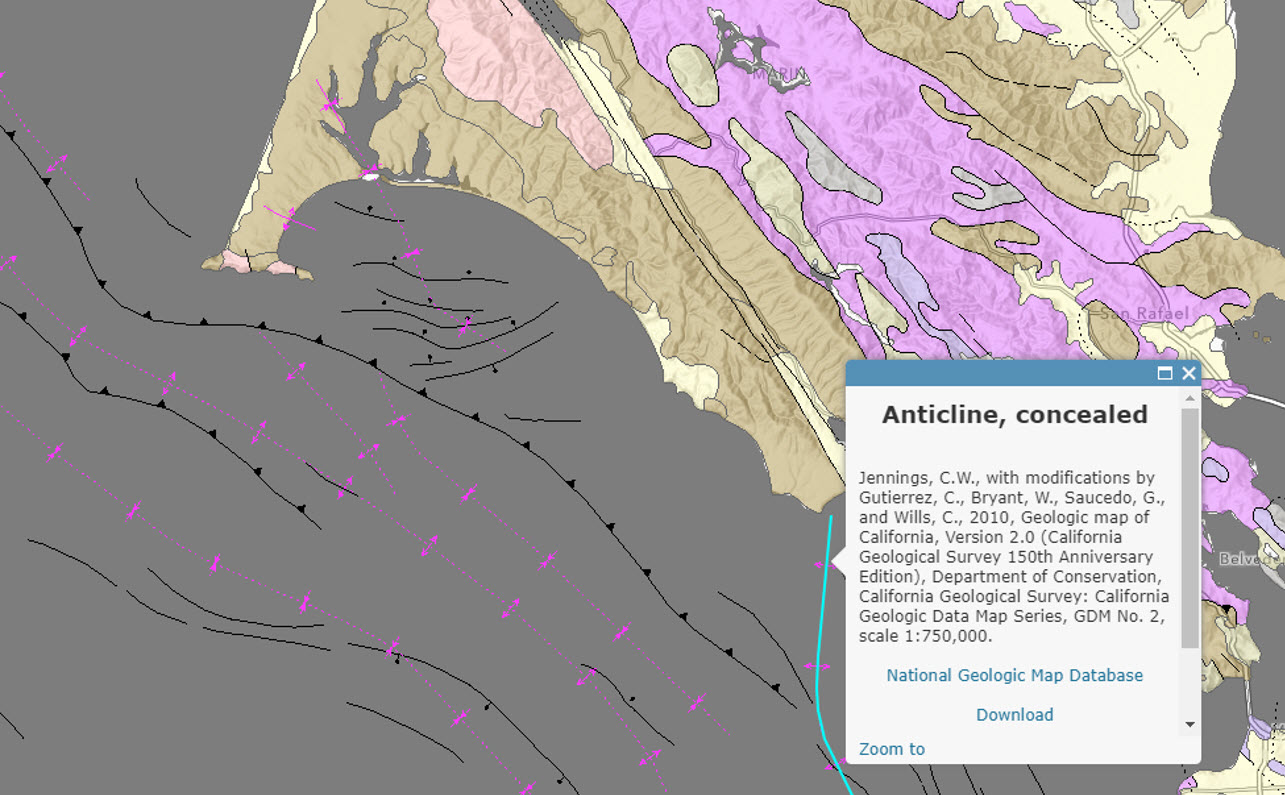
The US Geologic Survey’s (USGS) State Geologic Map Compilation is now available as a ready-to-use webmap and a set of three feature layers in the Living Atlas. These map and layers can be used as part of your GIS project in ArcGIS Online and in ArcGIS Pro.
The State Geologic Map Compilation provides a seamless spatial data set that combines state geologic maps for the 48 conterminous United States. The layer’s attributes have been standardized among states to facilitate analyses of lithology, age, and stratigraphy at a national scale.
Esri built these maps using feature services hosted by the USGS through the ScienceBase catalog which include more than 2,500 ArcGIS map layers. The ScienceBase catalog provides open access to a wide array of data produced for publications by USGS and partnering agencies engaged in scientific endeavors. It covers topics from sea otter tracking in California, to fish populations in headwater streams of the Adirondack Mountains, to this beautiful geology map compilation.


Commenting is not enabled for this article.