- Map packages updated to the 2017 version of SSURGO
- New application
- Map packages now on Amazon s3, resulting in much faster downloads
The SSURGO downloader provides fast access to 2,200 ready-to-use map packages with the same suite of attributes contained in the map image layer for a hydrologic subbasin. This allows you to start working on your project in minutes by providing a simple way to navigate to a location, select a watershed, and download the map package for that area.
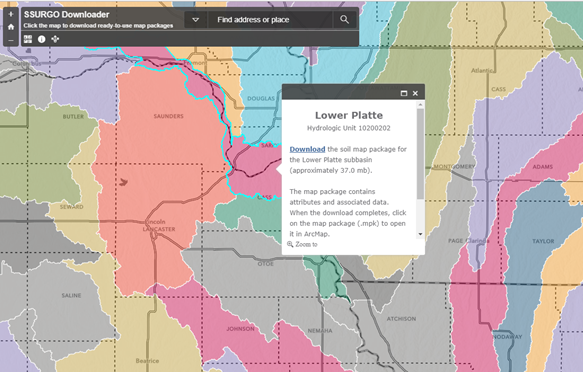 Double clicking the map package opens it in ArcMap. You can also add the map to an ArcGIS Pro project by selecting the Insert tab and then selecting Import Map in the Project section. Browse to the map package and select it to open it as a new map in your Pro project.
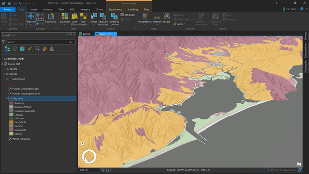
The 3d map in the screen shot below of the Tillamook Bay region in Oregon was made by downloading a map package, importing the map to ArcGIS Pro and adding the human geography overlays and the World Hillshade layer as a base map. A couple of quick clicks convert the 2d map into a 3d map. The entire process took less than 5 minutes and provides a complete set of attributes.


Article Discussion: