For years Esri has been providing federal information in the Living Atlas of the World. The great news is that now many federal agencies are developing layers and apps of their own. This is true for US Fish and Wildlife Service, whose Critical Habitat Designated Under the U.S. Endangered Species Act layer now joins the Living Atlas of the World, produced by the Federal User Community.
Esri Critical Habitat Raster Layers Enter Mature Support
Until now, Living Atlas of the World has maintained 17 raster layers representing critical habitat including 15 individual species of concern. Updated annually, these raster layers do not exactly match the Critical Habitat Designated Under the U.S. Endangered Species Act layer which is updated throughout the year.
The decision was made that these individual raster layers will no longer be maintained annually by the Living Atlas team and will enter mature support.
Creating a raster from the new critical habitat layer
So how do you create your own critical habitat raster if there is no raster layer for your species of concern, or if the critical habitat raster layer you have been using is going into mature support?
The following are the steps to make your own raster of a species of concern. Before you begin, you must have a spatial analyst license to use some of the tools to create the rasters.
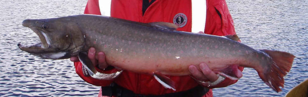
As an example, let’s use the critical habitat for bull trout, a fish found in Northwestern USA streams and lakes, to create one of these rasters. We will create a 30 meter cellsize 1-bit raster for bull trout critical habitat like the ones in the Living Atlas. In these rasters, a value of 1 in a pixel means bull trout critical habitat is present, and a value of 0 means bull trout critical habitat is not present.
The Living Atlas layer for bull trout is among the least straightforward to create since it’s made by rasterizing lines and polygons and bringing them together into a single 1-bit raster.
In ArcGIS Pro, search for the layer “Critical Habitat Designated Under the U.S. Endangered Species Act” in the Living Atlas and add it to a map. This is the authoritative feature layer from US Fish and Wildlife Service, produced by Federal User Community.
You will notice “FWS HQ ES Critical Habitat” becomes two layers of line features and two of polygon features in your map’s table of contents. The USFWS layers separate final and proposed critical habitat. You will find bull trout on the final list of species in both the lines and polygons.
Now let’s isolate the critical habitat for bull trout from all the critical habitat. To do this, apply a definition query to the final lines and polygons. Choose the dialogue options to complete a query that says: comname is equal to Bull Trout. Do the same thing with the polygon features for bull trout.

The raster layers in the Living Atlas were all produced using the same projection, cellsize, and snap raster. Let’s establish a layer we can use as a source to create our new rasters against. The layer USA NLCD Tree Canopy Cover 2016 uses the North America Albers Equal Area Conic, an equal area projection, and a 30 meter cellsize. Add this layer to your map from Living Atlas.
Rasterize the polygons by using the feature to raster geoprocessing tool. In the environments tab, set the output coordinate system, cellsize, and snap raster to the USA NLCD tree canopy cover layer. Set the processing extent to the current display extent. In the parameters tab, for input features, choose “FWS HQ ES Critical Habitat\Critical Habitat – Polygon Features – Final”. For the field, use OBJECTID. For the output raster, type “polygons_raster” as the name.
Next, rasterize the linear features layer “FWS HQ ES Critical Habitat\Critical Habitat – Linear Features – Final” the same way, using the same values in the environment tab. Use “lines_raster” as the output raster name.

The two rasters that result, lines_raster and polygons_raster will contain cells with only one value (the value of the OBJECTID) and areas of no data. If you try to mosaic these two rasters to a new raster now, the output would consist of a raster with nodata except in those places where data in the two rasters overlap. We need to find a way to fill the no data areas with a value of zero.
Using the create constant raster geoprocessing tool, create a constant raster using the same projection, cellsize, and snap raster as the others, with a constant value of 0. Let’s call it zero_raster.

Now we can use the mosaic to new raster geoprocessing tool. In that tool add the three rasters, lines_raster, polygons_raster and zero_raster. Where it says pixel type, choose one bit. This bit depth will cause all values greater than zero to become a 1. Where it says mosaic operator, choose maximum. This will output the maximum value found in each pixel from the three rasters. Under the environments tab, where it says extent, use zero_raster. Where it says no data, choose none.
What results is an image where cells equal to 1 represent areas from both polygon and line vectors for bull trout critical habitat, while cells equal to 0 represent areas where bull trout critical habitat is not present.

This image can be used for decision support, such as in suitability modeler, now built inside ArcGIS Pro. The image may also be served as an image layer to a server federated with ArcGIS enterprise.
Layers Entering Mature Support
As stated above, the 17 image services go into mature support and one hosted feature layer also goes into mature support. Please discontinue use of the Esri layers, and instead use the Critical Habitat Designated Under the U.S. Endangered Species Act layer which is now in ArcGIS Living Atlas.
For your reference, here is the list of layers going into mature support on January 27, 2021:
USA Critical Habitat American Crocodile
USA Critical Habitat Atlantic Salmon
USA Critical Habitat Bull Trout
USA Critical Habitat California Condor
USA Critical Habitat Chinook Salmon
USA Critical Habitat Chum Salmon
USA Critical Habitat Coho Salmon
USA Critical Habitat Delta Smelt
USA Critical Habitat Desert Tortoise
USA Critical Habitat Marbled Murrelet
USA Critical Habitat Mexican Spotted Owl
USA Critical Habitat Northern Spotted Owl
USA Critical Habitat Peninsular Bighorn Sheep
USA Critical Habitat Sockeye Salmon
USA Critical Habitat West Indian Manatee
USA Critical Habitat Final
USA Critical Habitat Proposed
USA Critical Habitat Feature Layer


Article Discussion: