Data is a critical element in any decision making. Whether it is improving the operation of utility networks, developing public safety response plans, or performing site selection analysis, access to accurate and up-to-date data is key to better insights.
ArcGIS Online includes a collection of global map layers and data that you can combine with your data and analyze on a map.
Here is how you access the map layers and data in ArcGIS Online:
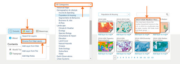
- Sign in to ArcGIS Online and go to the Map tab.
- Click Add in the top left area.
- Select Browse Esri Map Layers from the drop-down list.
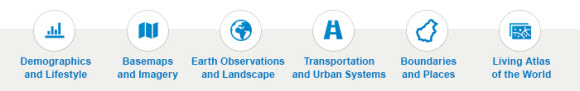
- Click All Categories to choose the type of map layers you want to add to your map or search for them.
- Hover over the thumbnail of a data layer to get more information about it.
- Click Add layer to map and start using the data.
Connect and discuss with other ArcGIS Online users. Join the ArcGIS Online community on GeoNet.
Check out more ArcGIS Online tips and tricks.

Article Discussion: