The 2017 Esri User Conference has come and gone, leaving us buzzing with ideas and excitement on how to bring back the latest in GIS to our respective organizations. Hopefully, you found time to stop by the 3D GIS Showcase, attend a technical session on 3D, or watch the 3D Demo theater to get professional guidance from one of our staff members. To refresh your memory on the sessions, we pulled together a list of the proceedings and their corresponding materials, along with some other 3D-centric resources.
Getting Started
3D is a core component of the ArcGIS Platform. It’s the future of GIS – and already a key part of GIS workflows around the world. ArcGIS brings 3D to everyone, with tailored experiences for different types of users. If you’re trying to get started in 3D, we had two technical sessions that were tailored for those looking to jump in or boost their current skills. Chris Andrews, Esri’s 3D Product Manager, gave an excellent presentation on 3D Across the ArcGIS Platform, reviewing how 3D fits into the ArcGIS Platform along with your current workflows. Another presentation from cartographic experts Nathan Shephard and Kenneth Field, 3D Cartographic Techniques: An Introduction, shows how you can take your 3D data to the next level and tell your story in the most compelling way possible.
ArcGIS Pro
Working with 2D and 3D data in the same environment has never been easier, thanks to ArcGIS Pro. The desktop application gives you the power to visualize, edit, and analyze your geographic data in 2D and 3D – all while giving you many options to share out your work quickly. We had quite a few sessions regarding the 3D side of ArcGIS Pro. Whether you’re just getting started with 3D in ArcGIS Pro, learning to edit in 3D, Authoring 3D Scenes in ArcGIS Pro, or exploring what’s new in LiDAR and ArcGIS Pro, you can find what you need to advance your knowledge of 3D in Esri’s powerful desktop application.
CityEngine
July was an exciting month for CityEngine. Early in the month, CityEngine 2017.0 was released with many new and exciting features. If you’re just getting started with CityEngine, check out the two sessions hosted at the UC focused on introducing the audience to the software: A Quick Introduction to CityEngine along with CityEngine: An Introduction are both great resources presented by CityEngine experts. You may also want to check out the session ArcGIS Pro and CityEngine: Advanced Topic which gives an overview of when to use ArcGIS Pro and when to use CityEngine, describing the differences between the two.
We also had the opportunity to go LIVE on Facebook with two power users of CityEngine – Devin Lavigne of Houseal Lavigne and Matthias Buehler of vrbn. They discussed how they use CityEngine in their daily work: Devin utilizes CityEngine for master planning and Matthias creates city backdrops for blockbuster films with the program.
Virtual Reality (VR) and Augmented Reality (AR)
In addition to the latest CityEngine release, a new version of ArcGIS 360 VR was also released in early July. Utilizing AR and VR is a fantastic way to take your 3D data to the next level. For more information on how Esri is integrating VR into the ArcGIS Platform, check out the Hands on with VR and AR technical session or VR with ArcGIS.
To jump into AR and GIS, Esri Labs released a new mobile augmented reality app, AuGeo. This initiative explores consuming ArcGIS data in an augmented reality environment – and is available for ArcGIS users for free here. We encourage you to try it for yourself, bringing data from your existing ArcGIS point feature layers directly into the app!
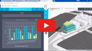
3D Web GIS
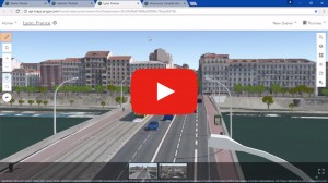
A huge component of utilizing 3D in the ArcGIS Platform is the ability to share the content after its been created. The best way to do this is via the web – which is why the session ArcGIS Online: 3D Web Scenes was so popular! 3D web scenes utilize the Indexed 3D Scene (I3S) layer specification: the session I3S an Open 3D Standard reviews the spec and describes its relationship to the rest of the ArcGIS Platform. For example – I3S provides Point Clouds and 3D Mesh the opportunity for to be hosted on the web, or “baked” as a scene layer.
Plenary Highlights
If you didn’t make it to San Diego, no sweat. Catch up on highlights from the plenary session on YouTube. Thomas Emge showed Scene Viewer and its support for vector tiles in 3D. Did you know you can zoom to a point layer with tourist attractions and view callouts and labels? You can also view massive point clouds in a Web browser, such as a view made up of 40 billion points.
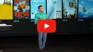
CityEngine also had some awesome coverage at the plenary! Brandon Jarratt (General Technical Director at Walt Disney Animation Studios) took to the stage to talk about how CityEngine was used in the Disney film Zootopia – relive his presentation here.
Lastly, discover how Smart Dubai is applying GIS across the City of Dubai to create smart governance that will move them forward as a world leader in digital transformation and create the smartest and happiest city on earth.
3D was huge at the 2017 Esri UC. We hope you learned something new about 3D while you were there, and could take an idea back to your organization to get started. After all, we live in a three-dimensional space – why shouldn’t your GIS data as well?
PS – Other 2017 Esri User Conference paper sessions and technical workshop material can be found here.

Article Discussion: