Another exciting release is upon us! We’ve added measuring areas in scenes, introduced edge rendering for 3D Object scene layers, and now offer mobile support!
Mobile Support
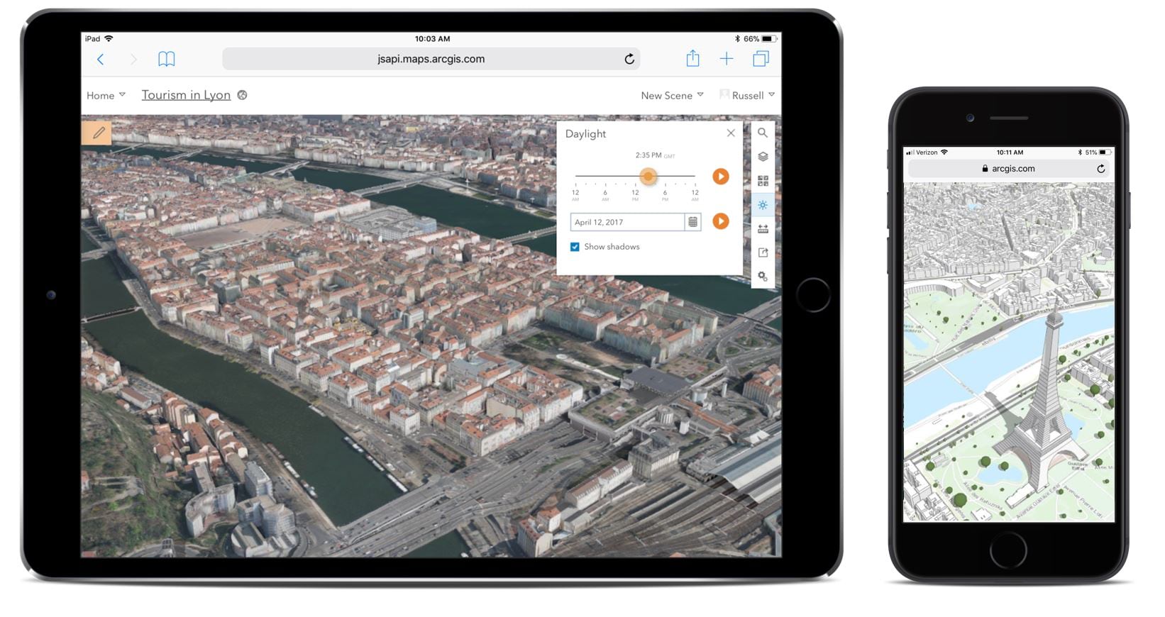
Scene Viewer has been widely used on desktop browsers since its initial release. With this release, now you can now check out your scenes on your modern phone or tablet. We’ve optimized the responsive UI of Scene Viewer for a light viewing experience on phones. On tablets, you can create and update scenes or use tools such as Daylight or Measure. Scenes support touch gestures for easy navigation such as zoom, pan, rotate, and tilt and they load and render fast (read more below in the performance section). Access these web scenes on the new and improved ArcGIS Online mobile site or through a shared URL.
Edge Rendering
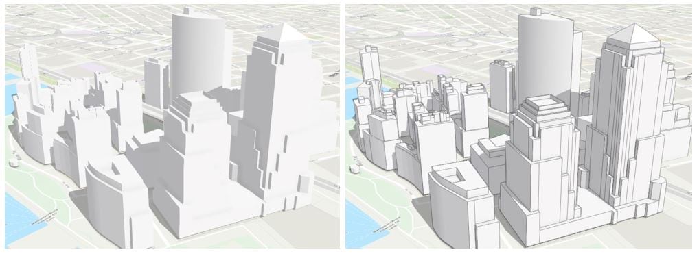
Use Edge rendering to make your scenes look stunning! This new enhancement allows you to style your building (3D Object) scene layers, with or without textures, by adding outlines (edges) to the building shapes. The edges will improve depth perception and help you clearly see the details of the features within the scene layer. To enable edges, simply switch on the Edges toggle in the configure layer panel and the layer will update automatically.
Measure Area
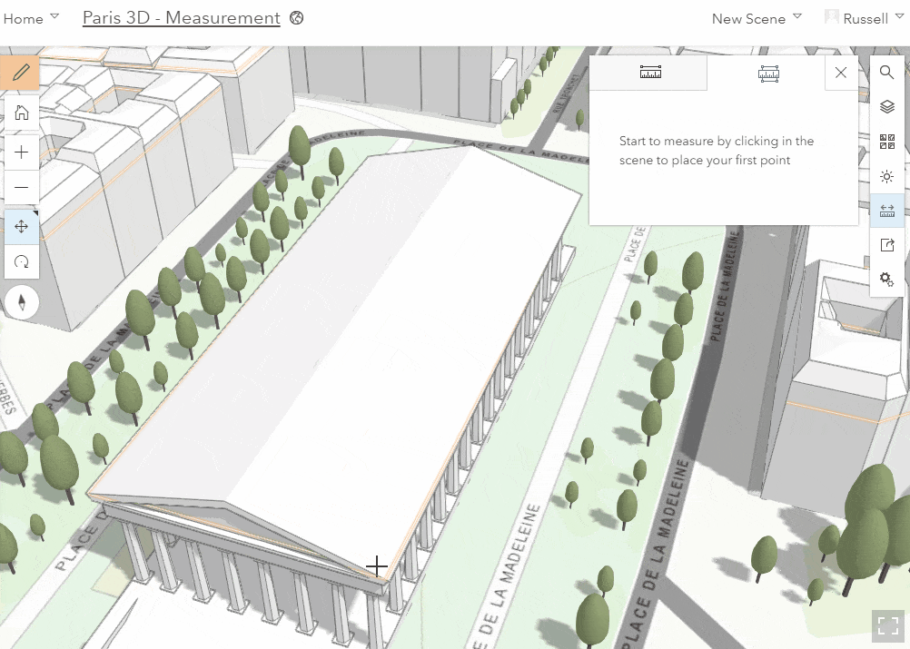
In the last release of Scene Viewer, we added point to point measurement which helped you calculate distances and heights interactively. In this release we have extended the measure tool to support area measurements. Use this tool to calculate ground area and perimeter, as well as, vertical walls and roofs by clicking on just a few points in the scene. Adjust your measurements by simply clicking or tapping any point in the measurement and dragging to a new position. The calculated area and perimeter will update automatically.
Performance
Scene performance continues to improve. This release we focused on the optimizations critical for mobile device stability and loading speed. Also, Scene Viewer now proactively monitors memory use per layer and adjusts the level of detail of the data displayed to keep memory under control. This behavior can be fine-tuned with the Performance-Quality settings in Scene Viewer. Finally, scene layers now use significantly less memory and the loading logic has been moved to web workers so that data loads continuously, even while you move around the scene.
Miscellaneous
Refresh Interval: Some of the layers you use in a web scene are dynamic and updated on a regular interval. A refresh interval can help your layers in your web scene stay in sync with any changes taking place to the underlying data. The refresh interval is set on the layer either in the item details page or in Map Viewer and saved back to the layer. You can add these layers into your web scene and they will automatically refresh at the set interval rate. For example, you can use the tall cylinder 3D symbol for water gauges to display water levels and use the refresh interval to update the attribute driving the height of the cylinder.
Scene best practices: If you have questions about why your web scene is not performing well, then check out the new Best Practice for Scene Performance guide. It outlines the most common issues with web scene configuration that negatively affect performance and provides some helpful hints you can make to your scene content, symbology, and slides to make your scenes outstanding.

Commenting is not enabled for this article.