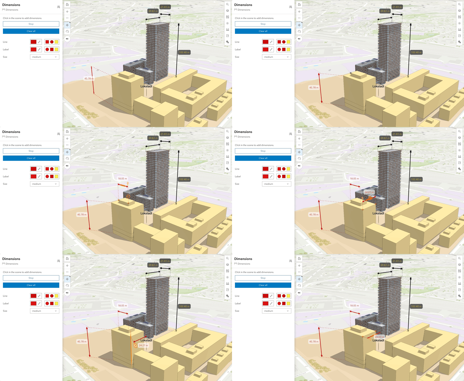
In this release, Scene Viewer team is very excited to bring a new tool to help with the storytelling in 3D context. This unveils new possibilities combining performant 3D content on the web, and the powerful interactive analysis tools.
Add Dimensions to your scene
Each dimensions layer allows you to create multiple dimensions with labels that display either the horizontal, vertical, or diagonal distance between the points. You can group the dimensions into themes, with different colors and sizes for the lines and labels for each layer, allowing you to customize the visualization. The dimensions are saved in the scene and can be used in slides to share with stakeholders, such as for existing and proposed developments.

As an engineer working in Architecture, Engineering, and Construction, using Dimensions tool will be extremely helpful when illustrating your project. You can add dimensions for the length of a pipeline, the distance between two tunnels, or the height of a bridge. In Scene Viewer, you could use 3D measurement to interactively analyze the object, and then use Dimensions to keep it as an annotation. Saving dimensions as a scene layer for each object and then keeping the results within slides for presentation which enables a much easier storytelling by bringing your audience with your analysis process.
Use Dimensions and Line of Sight to facilitate storytelling
In the June release, we introduced a new feature to help add Line of Sight as a layer, and save it in slides. It was used by architects and urban planners to better understand a significant redevelopment plan in Zurich.
The city of Winterthur transforms a former industrial area for train manufacturing into an urban living space for people who care about sustainability. “Rocket & Tigerli “ building with 100 metres height marks a milestone in the construction of timber buildings. It is an historically innovative construction system that examines wood as a natural replacement for concrete and will be expected to be completed and ready for residents to move in to by 2026. Thanks to our partners from city of Winterthur, we can now explore both tools in this web scene to see how it works.
New Development - Winterthur Lokstadt
How to use Dimensions
- Click a point or line that you would like to snap to
- Click another place as the end point
- A dimension length is added with default black arrowed line
- Drag or Rotate the dimension length for better visualization
- You can adjust the line or label color to match your theme
- Snapping also works on Dimension to provide an option for more control and precision when adding dimensions. Click here to learn more about how to edit a dimension layer.
Besides dimension, you can now use your keyboard to browse through all the UI elements in Scene Viewer. Do give it a try and let the team know your feedback!

Article Discussion: