The team has been working over the last few months to enhance the ArcGIS for Emergency Management solutions and to improve the solution deployment process. We’d like to highlight the following solutions:
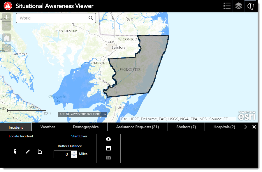
Situational Awareness, Operations Response, and Logistics Planning
Each of the solutions above have been re-designed to support a more streamlined workflow for the end-users. Highlights from the re-design:
- Each of the configured tabs can reflect a count
- Incident locations can now persist both Points and lines
- The incident location can now be defined through the pop up
- The download options have been improved to support consolidated information from each tab and includes the analyzed summary information for all the tabs.
- A new capability, snapshot, was added to enable the user to capture, and persist the incident information at a point in time.
Learn more:
My Hazard Information
My Hazard Information sample configuration enables constituents to easily obtain information about evacuation routes, potential hazards, and information regarding public safety resources in their community. To learn more, or to get instructions on how to configure My Hazard Information for your organization, visit the Solutions site.
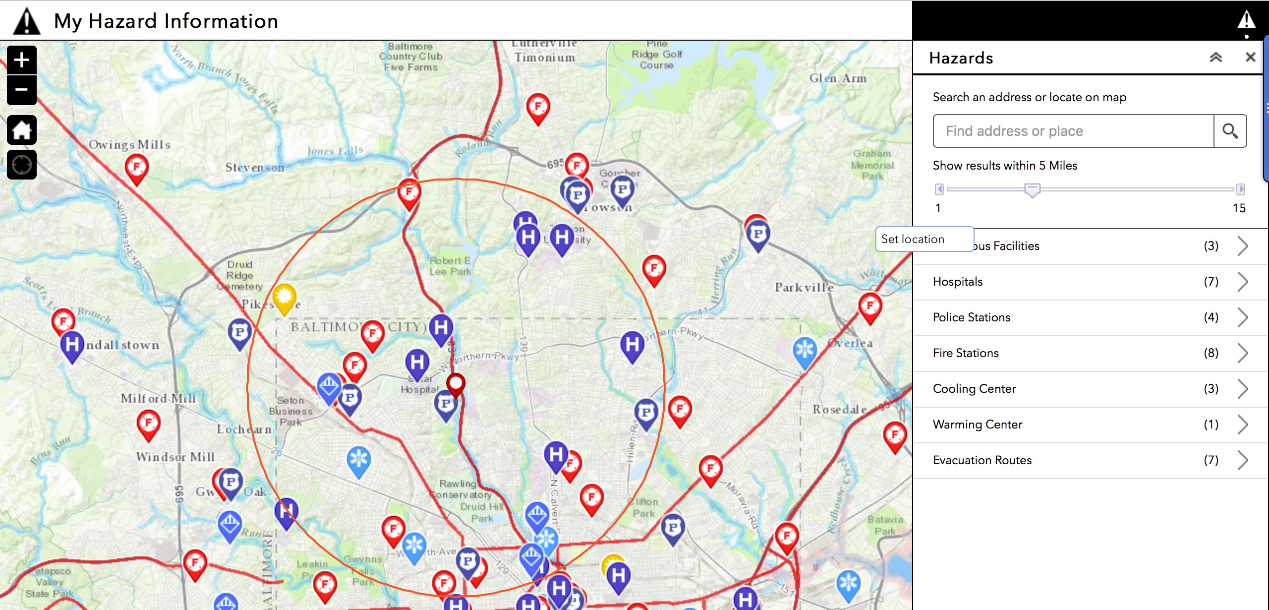
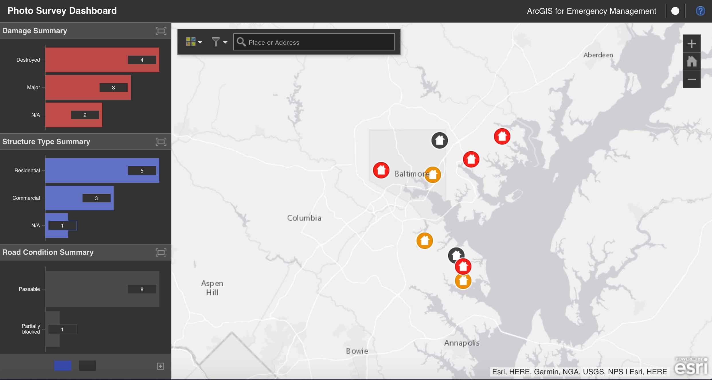
Photo Survey – Damage Asssement
The Photo Survey solution utilizes CAP imagery to make quick, visual assessments of an area post-disaster. We’ve added an Operations Dashboard configuration to the solution to enable staff to monitor the assessments made using the Photo Survey application and empower them to make operational decisions based on the early assessments made.
To learn more about the Photo Survey solution, please visit the Solutions site.
Community Addresses
Community Addresses helps state and local organizations aggregate address information from authoritative sources into a consolidated address database.
The solution provides a collection of tools that enables organizations to do field mapping, populate information, and load data. The Community Addresses solution also supports persistence of the field mapping and other settings to support the update of address information on a regular basis.
To learn more, and to get started with Community addresses, please visit the Solutions site.
ArcGIS Solutions Deployment Tool
You can now quickly deploy ArcGIS for Emergency Management solutions with the ArcGIS Solutions Deployment Tool. With this tool, GIS staff and emergency management personnel can quickly and easily deploy Emergency Management solutions. During deployment, the tool will create all the items required to support the configuration, including groups, feature layers, maps and applications that make up the selected Emergency Management Solution.
To learn more, and to get started with the ArcGIS Solutions Deployment Tool, please visit the Solutions site.
To see a comprehensive list of what we’ve been working on to include both new solutions and enhancements to existing solutions, visit our site.

Article Discussion: