ArcGIS Online has just been updated with the following new features and enhancements. This release includes new capabilities for organization administration, and also includes enhancements and updates to the Living Atlas and other areas as detailed below.
For additional information see the What’s new help topic or ArcGIS blog posts specific to this release.
*
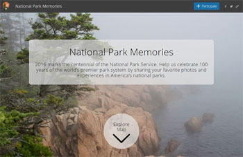
Redesigned Living Atlas website
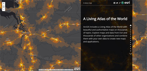
The Living Atlas of the World is a vast collection of curated, authoritative content from Esri and the global GIS user community, containing maps, data layers, tools, services, and apps for geographic analysis. Just released, the redesigned Living Atlas website makes it easier to both discover, and contribute to, Living Atlas content.
The redesign includes new search tools that make it easy to find and browse content you are interested in. You can filter based on content type (e.g., maps, layers, scenes, apps, tools) and by date of contribution. You can also filter based on themes, and refine your theme search.
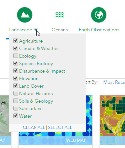
Other improvements include My Contributions, an easy way to contribute and manage your contributions, and My Favorites, enabling you to identify interesting content for quick access. For more information, and to browse the Atlas, visit the Living Atlas website.
*
ArcGIS Content
The content found in the Living Atlas of the World includes useful and authoritative maps, basemaps, and layers covering thousands of topics. These can be accessed directly from the map viewer so you can combine them with your own data to create new maps and applications.
For this release, the following have been updated:
- The World Imagery basemap has been updated with additional sets of DigitalGlobe imagery for several countries, including detailed imagery for many metropolitan areas, as well as NAIP aerial imagery for several states in the United States.
- Esri vector basemaps have been updated with newer and more detailed data for several communities around the world. Administrators can configure a custom basemap gallery to include one or more Esri vector basemaps.
- Demographic maps have been updated with the latest Michael Bauer Research (MBR) data for more than 35 countries including Brazil, Austria, Greece, Ireland, Portugal, and Turkey.
- United States traffic count data has been updated.
*
Map Viewer
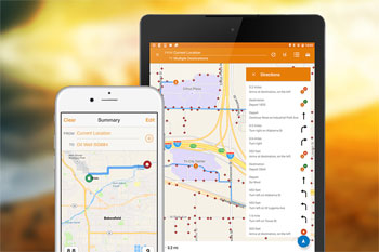
Map viewer is a built-in app that enables you to view and author maps, navigate, see map details, edit, perform analysis, and more (depending on your privileges). New for this release: When generating directions, you can now add barriers.
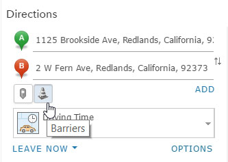
Barriers are added interactively, and can be used to represent temporary route restrictions, such as street closures during an events like parades, marches, and marathons. Future releases will include the ability to add barriers from other layers, edit barriers, and more.
*
Scene Viewer
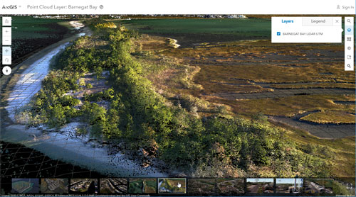
The scene viewer is a built-in app that enables you to author and explore 3D scenes. The scene viewer now supports point cloud scene layers published using ArcGIS Pro 1.4. Point cloud scene layers provide fast display of large volumes of symbolized and filtered point cloud data. For more information see Point cloud scene layer in ArcGIS Pro.
Additional enhancements and improvements include the following:
- Use the new tall cylinder, tall cone, and tall cube 3D object symbols to thematically style your point layers.
- Touch navigation is now supported with touch screen devices.
- OGC Web Map Tile Service (WMTS) layers can now be added to scenes.
- You can choose US standard or metric units when entering a size for 3D objects in a point layer.
*
Hosted Web Layers
You can publish your maps and data as hosted layers to ArcGIS Online. When you do this, ArcGIS Online takes care of hosting your layers and the data that populates them. Tile layers published to and hosted on ArcGIS Online support fast visualization of large datasets using a collection of predrawn map images or tiles. See About hosted layers for more information.
Hosted web layer enhancements
- You can now publish hosted vector tile layers from ArcGIS Pro 1.4.
- After creating a hosted feature layer view, you can now specify a view definition to set the fields or features that are available in the view, enabling you to hide certain data.
*
Account Switcher
If you use multiple accounts for ArcGIS Online, you can now link accounts so you can switch easily between them. You can also connect your Esri websites, such as customer information for My Esri, e-Learning, GeoNet, and more.

The option to switch accounts is currently available from your ArcGIS organization website, the ArcGIS Online website (for public accounts), and Esri websites. For more information, see Switch Accounts.
*
Organization Administration
Administrators can now configure a Shared Theme with a logo and color palette to match the organization’s branding, making it easier to ensure a consistent look and feel. Shared theme settings will be automatically applied to newly configured Open Data sites and configurable apps, including Story Maps. Shared theme settings can be found in the General tab of My Organization.
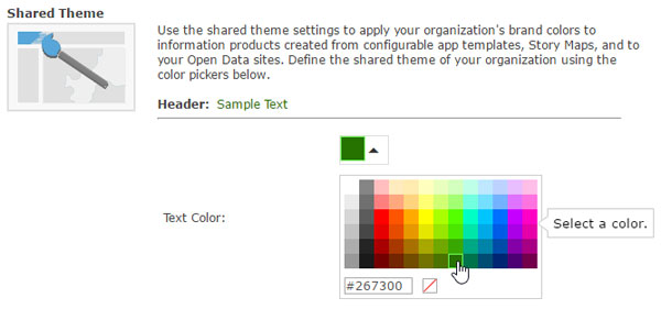
Note that currently most, but not all, configurable apps and Story Maps support shared theme settings. Those not supporting shared themes will be updated in subsequent releases.
Four new privileges are available for custom roles. Members can now be assigned the privilege to create and own groups that allow members to update all items in the group (previously reserved for administrators). Privileges to view organization members, view content shared with the organization, and view groups shared with the organization have also been added.
Administrators can now assign groups and credit limits to members during the invitation process.
Organizations that use enterprise logins can now automatically synchronize member profiles with the latest account information from the identity provider.
*
Configurable Apps
Configurable apps provide an easy and fast way to go from a web map to an application, with no coding required. Most of the configurable apps now support the new Shared Theme organizational setting (see section above). This setting allows administrators to configure a logo and color palette for consistent branding of configurable apps created by organization members.
Time Aware
Time Aware is a configurable app template that enables you to visualize time enabled layers in a web map using a time slider.
Time Aware now supports future dates, so can be used for animating forecast data, such as weather.
Crowdsource Reporter
Crowdsource Reporter provides the ability to collect a variety of crowdsourced issues or observations in a single application. You can now reorder the details, attachments, and location sections of the submission form and load the app on mobile devices with a map view of existing reports instead of a list view. In addition, the help panel can now be loaded as a splash screen after signing in to the app.
Crowdsource Manager
Crowdsource Manager allows users within an organization to review and triage data collected using a variety of applications including Crowdsource Reporter, GeoForm, Survey123, and Collector for ArcGIS. Now you can choose to automatically display the pop-up content, media, or related records associated with a selected report.
*
Story Maps
Story Maps let you combine authoritative maps with narrative text, images, and multimedia content, making it easy to harness the power of maps and geography to tell your story.
Shared theme support
Several story maps now support the new shared theme organizational setting (see section above). This setting allows administrators to configure a logo and color palette for consistent branding of apps created by organization members. Shared theme colors are applied to Story Map Journal and Story Map Series. The shared theme logo is applied to Story Map Journal, Story Map Series, Story Map Cascade, and Story Map Shortlist.
Search
Authors using Story Map Journal, Story Map Series, and Story Map Shortlist (beta) can now enable readers to search for features in map layers or search for places using your organization’s settings.
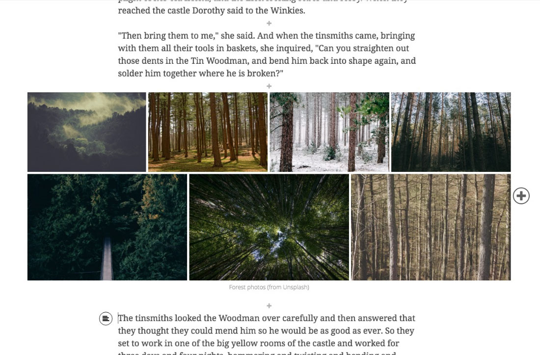
Story Map Cascade
Story Map Cascade is no longer in beta, and is now available in all supported languages. In addition, image galleries and 3D performance have been enhanced.
Story Map Shortlist
Story Map Shortlist (beta) lets you organize points of interest into tabs that make it fun for users to explore what’s in an area.
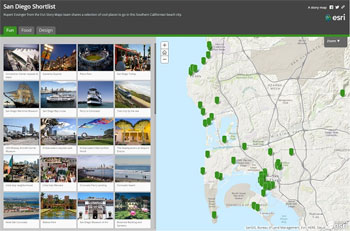
You can now drag local images from your computer directly into your Story Map Shortlist. Images are optimized for fast display, and stored in your Shortlist. When you create a Shortlist from places defined in a web map, you now have the option to automatically reflect updates to those places as they are updated in the web map. Shortlist is now available in all supported languages.
Story Map Crowdsource
Story Map Crowdsource (beta) enables you to publish and manage a crowdsourced story to which anyone can contribute photos with captions. Use it to engage a specific or general audience on the subject of your choice.
Crowdsource is now available in all supported languages.
For more information, see the Story Maps website.
*
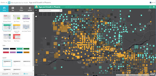
Web AppBuilder for ArcGIS
Web AppBuilder offers a way for you to easily create HTML/JavaScript apps that run on any device, using a gallery of ready-use-widgets. You can customize the look of your apps with configurable themes, and can host your apps online or on your own server.
New for this release:
- A new Legend widget is available for viewing legends in 3D apps.
- Two new tools are available in the Analysis widget: Join Features and Find Outliers.
- Plan Routes, Connect Origins To Destinations, and Find Nearest tools in the Analysis widget now have the option to include Route Layer as a result layer.
- The Layer List widget now supports showing or hiding labels for a layer.
- You can now configure the labels for the Tasks and Results tabs in the Query widget.
- Unsupported basemaps with different tiling schemas from the current basemap are now excluded from the Basemap Gallery widget.
- Layer List (3D) now supports displaying layer hierarchy and terrain layers.
- Related records now use the pop-up title defined in the map viewer as the default display name instead of the display name defined in the service. You can change the title to a different field name at run time.
- Label configurations in a layer are now honored in the app.
- Feature sets—for example, a query result, a GP result, or a selection set—can now be saved to My Content.
View the Live Sites Showcase to see applications from the Web AppBuilder community. For more information, see What’s New in Web AppBuilder.
*
Apps for the field
ArcGIS apps for the field help you use the power of location to improve coordination and achieve operational efficiencies in field workforce activities. Apps for the field have had numerous enhancements since the previous ArcGIS Online update. These including the following:
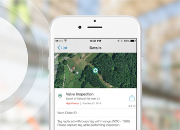
Collector for ArcGIS
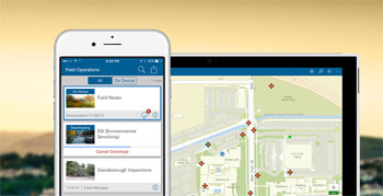
Collector for ArcGIS enables the use of your smartphone or tablet to collect and update information in the field, whether connected or disconnected. For this release Collector features improved integration with Navigator for ArcGIS and Workforce for ArcGIS when using Android devices. See What’s new in Collector for ArcGIS for more information.
Operations Dashboard for ArcGIS
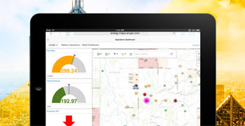
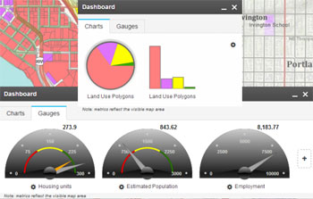
Operations Dashboard for ArcGIS enables you to stay on top of your operations by monitoring activities, tracking assets, and viewing real-time data feeds.
The browser version of Operations Dashboard for ArcGIS has been updated. A new item type named dashboard has been added to ArcGIS Online. The new item provides support for browser-based authoring, including smart mapping, labeling, and more, as well as a chart library with advanced configuration and display capabilities. For more information, see Operations Dashboard for ArcGIS.
Navigator for ArcGIS
Navigator for ArcGIS provides the ability to search your assets, route on your own road network, and view your layers. Navigator for ArcGIS is now better integrated with Collector for ArcGIS on Android. For more information, see What’s new in Navigator for ArcGIS.
Survey123 for ArcGIS

Survey123 for ArcGIS is a simple and intuitive form-centric data gathering solution that makes creating, sharing, and analyzing surveys possible in three easy steps. Survey123 for ArcGIS includes the following updates for this release:
- When creating surveys with Survey123 Connect, you can now build surveys on top of your existing hosted feature layers.
- You can use social logins, including your Facebook or Google account, to log in to the Survey123 app.
- Your survey results can now be shared with stakeholders through the Survey123 website.
Survey123 for ArcGIS 2.0 Beta is available through the Early Adopter Community. For more information, see What’s new in Survey123 for ArcGIS.
Workforce for ArcGIS
Workforce for ArcGIS is a mobile solution that uses location to improve the efficiency and coordination of your field workforce. New in this release:
- Workforce is now available for mobile workers using Android devices.
- Dispatchers can disable clustering, enabling easy identification of individual workers, and determining which is closest to a particular assignment.
- Project owners can identify workers from other organizations that have not accepted invitations to a project.
For more information, see What’s new in Workforce for ArcGIS.
*
Apps for the office
ArcGIS Apps for the Office enable operations managers and analysts to visualize data in a geographic context to gain location-based insights and make decisions that save money and time. Apps for the office have made numerous enhancements since the previous ArcGIS Online update including the following:
ArcGIS Maps for Office
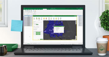
ArcGIS Maps for Office delivers the ability to ask location-related questions of your data, get new insights, and make smarter decisions, all within familiar Office products; Excel and PowerPoint. Maps for Office also enables Office product users to directly benefit by being an integral part of your ArcGIS organization.
For this release, Maps for Office delivers improved speed and better usability. Also added is support for vector basemaps and layers. You can select items on a map and export the corresponding rows of data to a new Excel workbook or worksheet, and you can choose the spatial reference system to use when exporting the data.
For more information, see What’s new in ArcGIS Maps for Office.
ArcGIS Earth

ArcGIS Earth is an interactive globe that lets you explore the world and display 2D and 3D map data. ArcGIS Earth has a redesigned drawing workflow that allows for continuous drawing, adding custom icons for points, customizing labels, and setting the altitude mode. You can also search the table of contents and open pop-up information in a browser window. For more information, see What’s new in ArcGIS Earth.
Esri Business Analyst
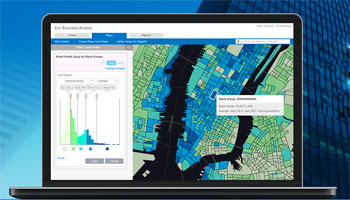
Esri Business Analyst provides location-based insight for market planning, site selection, and customer segmentation, and is available for both web and mobile apps.
Web app enhancements include more powerful suitability analysis with competitive layers and better support for site attributes, improved infographics with support for adding location pictures, attributes, and using your own data, and updates for 32 countries in Western and Eastern Europe. For more information, see What’s new in Esri Business Analyst Web App.
GeoPlanner for ArcGIS
GeoPlanner for ArcGIS helps you plan and evaluate land use, natural resource, and landscape architecture scenarios using collaborative dashboarding and sketch tools, helping you make informed, evidence-based decisions about development and conservation.
GeoPlanner for ArcGIS now supports visualizing your data in 3D so you can better evaluate your scenarios. In GeoPlanner 3D mode, you can extrude features, model shadows, view perspectives by date and time, and evaluate a scenario’s impact by viewing Key Performance Indicators. For more information, see What’s new in GeoPlanner for ArcGIS.
*
For more information about the March 2017 release
For more information about the March 2017 release, see the What’s new help topic or view other ArcGIS blog posts specific to this release.

Commenting is not enabled for this article.