ArcGIS Image for ArcGIS Online has many advantages for your organization including powerful imagery hosting and raster analysis in SaaS. One of the first questions that I get asked at conferences is simply, ‘what are the advantages using ArcGIS Image for ArcGIS Online for my organization?’ To fully articulate the value, the answer to this question often starts a discussion about workflows. However, regardless the workflow or organizational goals, there are some common advantages that are always discussed. Here are a few of these advantages.
ArcGIS Image is a SaaS product
With an ArcGIS Online organization and the ArcGIS Image user type extension, you are ready to go. There is no additional setup from your end to install. Imagery layers can be created and analyzed within ArcGIS Online in many ways that will be familiar for desktop GIS users. As the administrator of your ArcGIS Online organization, you can control who within your organization can create the imagery layers and use raster analysis. Once the layers are created, anyone in the organization can view them or the analysis output derived from them. They will be accessible like any other ArcGIS Online layer. Since ArcGIS Image is a part of ArcGIS Online, you can view the imagery layers, analyze them, and share the results from any modern internet browser for a comprehensive web user experience in the native application.
ArcGIS Image has powerful imagery hosting capabilities
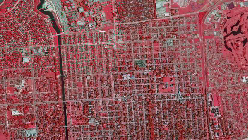
Large imagery layers can be used across the organization and across the world. Sharing large images within your organization does not have to include accessing a networked drive or downloading the data. Stream the imagery layers to the users with ArcGIS Image for ArcGIS Online. There is no need to download the images to use them. Once hosted, the imagery layers retain the pixel values and raster bands. You can create custom visualizations, investigate the pixel values, and perform analysis on the imagery layer in ArcGIS Online and ArcGIS Pro. Also due to the compression used in ArcGIS Image, the file size of the input images can be reduced allowing for faster performance. ArcGIS Imagery layers can be created from ArcGIS Online, ArcGIS Pro, and through ArcGIS Python Notebook. The hosted imagery layers are capable of maintaining custom visualizations that can be set in the map, set when creating the imagery layer, or through processing templates.

ArcGIS Image has robust raster analysis
Take advantage of ArcGIS Online’s scalable raster processing. The imagery layers created in ArcGIS Image are ready for analysis, interpretation, and visualization. Both tiled and dynamic imagery layers retain the pixel values and all the raster bands. The pixel values and raster bands are available for raster functions and geoprocessing tools. There are over 150 raster functions and several geoprocessing tools to use in ArcGIS Online for raster analysis. There are familiar tools for you to create derived imagery layers just like you did in ArcGIS Pro. Once you have refined the analysis you want to perform, then you can also create raster function templates just like you did in ArcGIS Pro to use later or share within your organization. The processing power of ArcGIS Online can be used to process larger imagery datasets and for advanced analysis like deep learning inferencing. Imagery layers can be analyzed by creating custom visualizations with different raster bands and the pixel values can be identified for interpretation.

Regardless of the workflow your organization is interested in, these three advantages are central to many of the conversations I’ve had with customers. ArcGIS Image for ArcGIS Online can benefit your organization in many ways by providing a common operating picture based on the latest imagery your organization has acquired. These imagery layers are not just for context, they can also be used for analysis within ArcGIS Pro and within ArcGIS Online.
Overall, ArcGIS Image for ArcGIS Online provides the means to creating foundational content, using the latest imagery you’ve acquired. It makes this content accessible so that users across the organization can enrich their workflows with up-to-date information.
If you’re interested in discussing the advantages to your specific workflows, the imagery team would love to help. To start the discussion, connect with your Account Manager. If you don’t have one, or if you’re not sure who your Account Manager is, please complete form on the other side of this link. We’re here to help.


Article Discussion: