For several years, the ArcGIS Living Atlas of the World has provided a collection of “live feeds” layers featuring frequently updated data from authoritative data providers around the world. The collection of Live Feeds supports maps and applications on many topics, including a rich collection of earth observation maps.
Esri’s Community Maps Program now supports select live feeds submissions. If your organization is managing Road Closure and Stream Gauge service items, you can share these items through your Community Maps account by adding them to your ‘Registered Layer’ list.
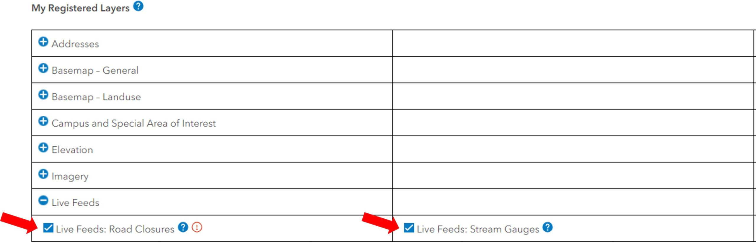
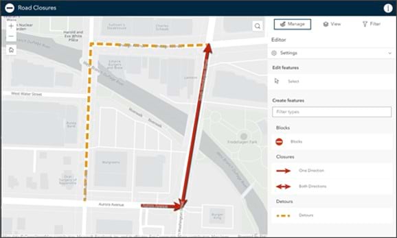
Live Feeds: Road Closures
Community Maps will accept road closures and detours curated using the Road Closures solution. Road closure information will be aggregated and shared with Community Maps partners, so residents and visitors in your community have access to this information on the devices, and in the consumer mapping applications, they typically use.
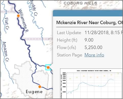
Live Feeds: Stream Gauges
Community Maps will accept Stream Gauge data from Feature Services, API endpoints, and Online repositories that are frequently updated (e.g. ftp site or online files). The gauge data must provide near real-time depth and/or flow rate observation in a standard format such as XML, JSON, or tab-delimited text or through consistent API calls. In addition, it should be possible to query the gauge’s time series record and create graphs using web services.
Learn more about data formats and requirements related to Road Closure and Stream Gauge service items and how your organization can participate by clicking the Community Live Feeds story below.
How to connect:
For details related to road closure criteria and requirements, please email CommunityNotifyRoadClosures@esri.com .
For details related to stream gauge criteria and requirements, please email CommunityNotifyHydrology@esri.com .
Organizations that wish to share road closure and live stream gauges information can register for the Community Maps Program by clicking here . If you have questions about the Community Maps Program, and how to register your organization’s road closure and stream gauges information, please email communitymaps@esri.com.

Article Discussion: