This spring, releases of ArcGIS include upgraded support for the latest version of the INSPIRE Metadata v2 style. INSPIRE is the infrastructure for spatial information in the European community. It provides an interoperable framework for sharing spatial data to help address cross-border and pan-European issues. Metadata, data, and services are key components of the directive that help promote open data sharing and reuse.
Making metadata easier
Creating INSPIRE Metadata hasn’t always been easy. ArcGIS lightens that burden with tools tailored to the INSPIRE Metadata v2 style. Importantly, your metadata provide input to the INSPIRE Monitoring process that takes place each year.
New tutorials for ArcGIS Online, ArcGIS Enterprise, ArcGIS Pro, and Esri Geoportal Server provide straightforward step-by-step guidance to create metadata that ‘pass’ the INSPIRE Reference Validator. The following tutorials are now available:
- Create INSPIRE Metadata v2 with ArcGIS Online and ArcGIS Enterprise Portal
- Create INSPIRE Metadata v2 with ArcGIS Pro
- Create INSPIRE Metadata v2 with ArcGIS for INSPIRE 10.8.1 and Geoportal Server
Metadata flow with your data
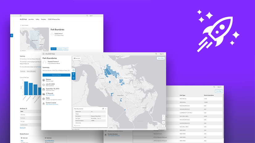
In ArcGIS, your metadata live close to your data, flowing through the system as you publish and share open data. For example, metadata managed in ArcGIS Online is automatically available when items are shared to your ArcGIS Hub open data catalog.
What’s next? This summer, the PSI-2/Open Data Directive implementation takes effect. Beyond INSPIRE, we’re working to make it easier for you to meet your obligations under the Open Data Directive. ArcGIS Hub provides a robust system of engagement and delivery for your open data catalog. ArcGIS Hub already supports data catalog federation with DCAT. Soon, your metadata can continue its flow through to regional open data portals using the European DCAT-AP data catalog vocabulary specification.
Stay tuned!
Subscribe to the INSPIRE Esri Community space to follow upcoming news about ArcGIS INSPIRE solutions.
UPDATE: This article was updated on 23 August-2024 adding a link to instructions using the new ArcGIS metadata editor.
Cover photo by Pineapple Supply Co. on Unsplash


Commenting is not enabled for this article.