 2016 United States Demographic maps and services are now available on ArcGIS Online. Esri Demographic maps are featured in the Living Atlas of the World, the foremost collection of authoritative, ready-to-use global geographic information ever assembled.
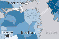
New Maps
More than fifty new web maps cover a wide range of topics like income, diversity, education, health insurance, and much more. This release features ready to use traffic count map and app available for the first time on ArcGIS online. If there is a map you would like to see added to Esri demographic content please let us know.
- New versions of more than fifty USA demographic web maps are now available. Each web map is supported by a similarly named map image.
- 2016 Traffic Counts in the United States – This new map features traffic count data from Kalibrate. Traffic counts are a requirement for most new franchise locations, and a major factor in highway funding calculations.
- All crime maps updated with 2016 data.
New Services
To access demographic ArcGIS Online services use the ArcGIS REST API.
Most USA services now feature a country level layer with data for the United States, except for the Crime, Shopping Center and Traffic Count services. See attribute lists for each individual data set in the Esri USA Demographics help documentation for detailed information.
- USA_Demographics_and_Boundaries_2016 – This service now includes the Infogroup Business Summary attributes. It no longer includes the Age by Gender attributes which are now available in a new separate service.
- USA_Age_by_Gender_by_Race_2016 – This service includes age related attributes. In 2015, these attributes were part of the USA_Demographics_and_Boundaries_2015 service.
- USA_Consumer_Expenditures_2016
- USA_MPI_1_2016 and USA_MPI_2_2016
- USA_Retail_Marketplace_2016
- USA_ACS_1014 – This ACS service provides data from block group to country.
- USA_ACS_Tract_1014 – This new service provides additional 2010-2014 data from the American Community Survey from tract level up to country.
- USA_Traffic_Counts – This new service presents nationwide traffic count data.
- USA_Crime – Updated with 2016 data.
- USA_Shopping_Center – This new service presents key data about the largest shopping centers in the nation.
Access to Esri demographic maps and services requires an organizational or a developer account and consumes credits.
If you have any questions regarding 2016 USA Demographic maps and services please contact Nuno Ricardo, Product Engineer on the ArcGIS Content Team.

Article Discussion: