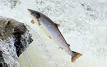
 Atlantic salmon (Salmo salar) populations are in decline. Although there are many contributing factors, one of the most important is habitat connectivity. Dams and other man-made structures can block the migration of Atlantic salmon from the ocean to preferred spawning habitat. New dams are built with fishways—artificial waterways that fish use to access areas that are otherwise unreachable. However, many older dams are not outfitted with fishways, rendering huge stretches of suitable spawning habitat inaccessible to migratory fish. Fortunately, fishways can be retrofitted to existing dams to restore habitat connectivity.
In the new Connect Streams to Salmon Migration lesson on the Learn ArcGIS website, you’ll evaluate dams in the Mersey River of Nova Scotia, Canada, to determine the location best suited for the construction of a new fishway. After deciding on a dam, you’ll estimate the total amount of salmon breeding habitat made available by the fishway construction.
Written by Ian Manning, Esri intern, ArcGIS Learn team.

Article Discussion: