ArcGIS Online has just been updated with the following new features and enhancements. This is a minor release, but includes updates, beta releases, and new capabilities for administering organizations, open standards, configurable apps, story maps, and more. For additional details see the What’s new help topic.
Apps button
Click the apps button

for easy access to Esri web apps and related sites enabled through your organization. These can now be launched directly by clicking the button which appears in the site header.
Map viewer
Map viewer is a built-in app that enables you to view and author maps, navigate, see map details, edit, perform analysis, and more (depending on your privileges). Updates for this release:
- When creating filters on a layer, you now have additional choices for time-based features.
- Color and size options for styling a layer have been updated, including a new color ramp for rendering single-band imagery layers.
- You can now set a visible range for labels in a layer, allowing you to specify whether labels are displayed at different zoom levels.
Configurable apps
Configurable apps provide an easy and fast way to go from a web map to an application, no coding required.
Geo Tour (beta)
Geo Tour is a new configurable app that lets you guide the viewer on a tour of locations. Tour stops are driven by an ordered list that can be based on any attribute. Stops can represent a “top 10” hierarchy or any other order.
Styler (beta)
Styler is a new configurable app template providing the ability to easily style your application by configuring the color, theme, layout, panels and position of UI components. In this beta release, Styler is intended for use with 3D web scenes.
Other updates
- Crowdsource Manager now supports adding related records and videos.
- Crowdsource Reporter and Crowdsource Polling now limit the number of times a viewer can vote. The limit is once per browser session.
See the Web Application Templates group for more information about these, and other, app templates.
Story Maps
Story Maps let you combine authoritative maps with narrative text, images, and multimedia content, making it easy to harness the power of maps and geography to tell your story.
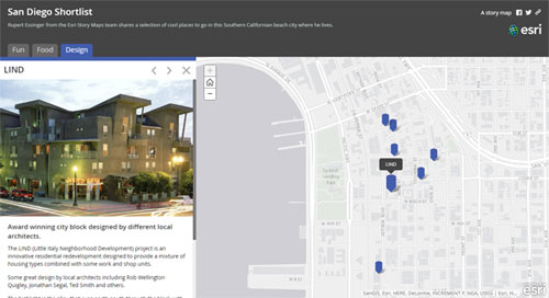
Story Map Shortlist (beta)
Story Map Shortlist is a popular story map app, allowing you to present places of interest organized into a set of easy-to-use tabs. Shortlist was previously only available as a source code download that required self-hosting, but is now hosted in ArcGIS and features an interactive builder for authoring.
Other Story Map updates
- Story Map Journal now supports printing, linking between sections, and has a new white theme for the Floating Panel layout.
- Story Map Cascade (beta) now has autoplay. Authors can now upload multiple images at once and change the color of text.
- Story Map Crowdsource (beta) lets contributors more easily specify a location by clicking the map or using a geotagged photo. Exploring Crowdsource content is now easier and more engaging for your audience.
- The Story Map Cascade, Crowdsource, and Shortlist apps are now supported in the My Stories section of the Story Maps website. Login to manage your stories, check for issues, and more.
For more information visit the Story Maps website.
Web AppBuilder for ArcGIS
Web AppBuilder offers a way for you to easily create HTML/JavaScript apps that run on any device, using a gallery of ready-use-widgets. You can customize the look of your apps with configurable themes, and can host your apps online or on your own server.
The following new options are available in existing widgets:
- Edit—Edit related records.
- Search—Adds the ability to use local search.
- Filter and Group Filter—Turn off filters set on the map.
- Near Me—Remove layers with zero results from the results list.
- 3DFx—Add area extrude effect.
- WebApp Builder and Templates now support integrated mesh scene layers.
For more information see the Web AppBuilder for ArcGIS help.
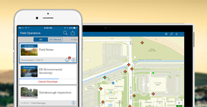
Apps for the Field
ArcGIS apps for the field help you use the power of location to improve coordination and achieve operational efficiencies in field workforce activities. Field apps have had numerous enhancements since the previous ArcGIS Online update (June 2016). These enhancements include the following:
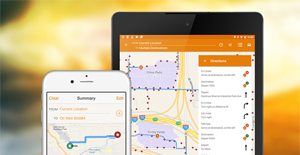
Collector for ArcGIS
Collector for ArcGIS enables the use of your smartphone or tablet to collect and update information in the field, whether connected or disconnected.
Collector 10.4 adds support for high-accuracy GPS receivers. You can collect and update data using a location provider, transform coordinates between coordinate systems, and attach spatial accuracy to the GIS features you collect.
The 10.4 release also includes integration with Workforce for ArcGIS, released on iOS in July, Windows in August, and with Android coming soon. For more information, see the Collector for ArcGIS help.
Navigator for ArcGIS
Navigator for ArcGIS 2.0 provides the ability to search your assets, route on your own road network, and view your layers. With this release, support was added for creating optimized routes and better integration with other apps—including our apps and yours.
Navigator was released on iOS in July, and the Android version is in beta. For more information, see the Navigator for ArcGIS help.
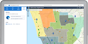
Operations Dashboard for ArcGIS
Operations Dashboard for ArcGIS enables you to stay on top of your operations by monitoring activities, tracking assets, and viewing real-time data feeds. Dashboard 10.3.3 brings new languages and bug fixes to the Windows app. For more information, see the Operations Dashboard for ArcGIS help.
Survey123 for ArcGIS
Survey123 for ArcGIS is a simple and intuitive form-centric data gathering solution that makes creating, sharing, and analyzing surveys possible in just three easy steps. Survey123 1.7 introduces a streamlined user experience for authoring smart forms from your web browser. The Survey123 mobile app now preserves EXIF metadata in photos captured from your device.

The app also includes over 20 new mathematical functions for user input validation, and supports preloading data from CSV files. The reporting and analytical capabilities in the Survey123 Hub now include options to print summary results as PDFs and include enhanced drill-down views. For more information, see the Survey123 for ArcGIS help
Workforce for ArcGIS
Workforce for ArcGIS is a mobile solution that uses the power of location to improve the efficiency and coordination of your field workforce. Workforce 1.0 was released in July, and integrates with Collector, Navigator, and Survey123 to provide a streamlined, workflow-driven solution for completing assigned work. For more information, see the Workforce for ArcGIS help.
GeoPlanner for ArcGIS
GeoPlanner for ArcGIS helps you plan and evaluate land use, natural resource, and landscape architecture scenarios using collaborative dashboarding and sketch tools, helping you make informed, evidence-based decisions about development and conservation.
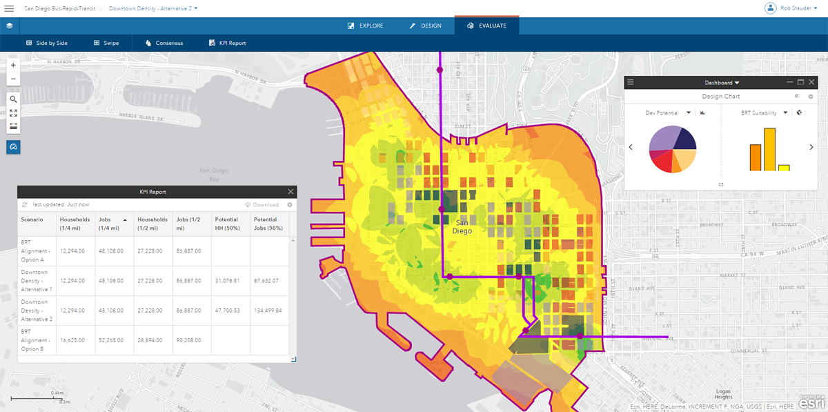
Shortly after this release, the hosted version of GeoPlanner will be updated to include the following new features and capabilities:
- A Split tool allows you to subdivide existing polygon and line scenario features.
- The Add Performance Indicator tool now has an equation builder that makes it easier for you to create a KPI equation by allowing you to select fields, mathematical operators and Area and Permiter measurements from a UI.
- A new Basic Template that you can use for simple sketching projects. This template includes a dashboard with several pre-created generic performance indicators.
- Ability to create new design layers from existing datasets. This allows you to quickly and easily start a plan or sketch from an existing dataset. All symbols, fields and default values defined in the existing dataset are applied to the new design layer.
- Ability to export suitability models as TIFF files so can use your models in ArcGIS Pro and Desktop.
- Support for all languages available in ArcGIS, so you can plan and design in your native language.
Organization administration
Administrators can now manage licenses for Esri Business Analyst web, Esri Community Analyst, and GeoPlanner for ArcGIS. An account enabled for Esri access now has unlimited access to self-paced, E-Learning resources on the Esri Training website.
Feature layer template gallery
The gallery for creating new hosted feature layers has been redesigned to make it easier to choose the template you want to use, and you can now filter based on the purpose of the template. In addition, many new templates have been added for utilities management.
ArcGIS content
Beta versions of Esri vector basemaps have been updated for several areas and have addressed several known limitations.
World Imagery has been updated with the initial set of DigitalGlobe imagery for several countries. More imagery will be deployed over the coming months. Detailed boundary layers for several dozen countries have been added to the Living Atlas and made available for display and analysis in the map viewer and other ArcGIS apps. Cyprus is now available as a region.
Open standards
ArcGIS Online continues to improve its commitment to standards and interoperability with enhanced support for Open Geospatial Consortium (OGC) services. Additional OGC options are now available within the map viewer for appending custom parameters to WMS, WMTS, and WFS requests. For example, if the service requires an access key, the key can be included as a custom parameter for all requests made to the service. When adding WMS data to your map in the map viewer, you can now choose specific layers to add instead of adding the entire WMS service.
For more information
For more information about this release, see the Whats New help topic or ArcGIS Blog posts specific to this release.

Article Discussion: