The final release of ArcGIS Online for 2016 features tons of new functionality and updates. Specifically in configurable apps, we have updates to the configuration pages, new functionality for existing apps, improvements to current beta apps, and bug fixes to address many reported issues across the board. Our Story Maps were also updated with many new enhancements. To explore everything new with Story Maps, check out our What’s New in Story Maps (December 2016) blog. Here are a few highlights of what is new with configurable apps for the December 2016 update.
Configuration Pages
The configuration pages of many of the configurable apps have been enhanced with a new look and experience for customizing the app’s settings and options. Space is utilized better with a new horiziontal row of tabs which contain all settings. The right hand side (and majority) of the page will now display the app in a preview style look. When the “Save” button is clicked, the preview of the app will update right on the page without needing to toggle away from the tabs of settings. There is also a new “Launch” button that will launch the entire app into a new browser tab and away from the configuration page. This way, the app creator has both options from inside the configuraiton page: view an updated preview of the app while continuing to make changes, or, view the finished app in its own browser tab. Just be sure to click “Save” to apply any changes made in the configuration page before using either method. The “Close” button will close out the configuration page and return you to the app’s item page inside the organization.
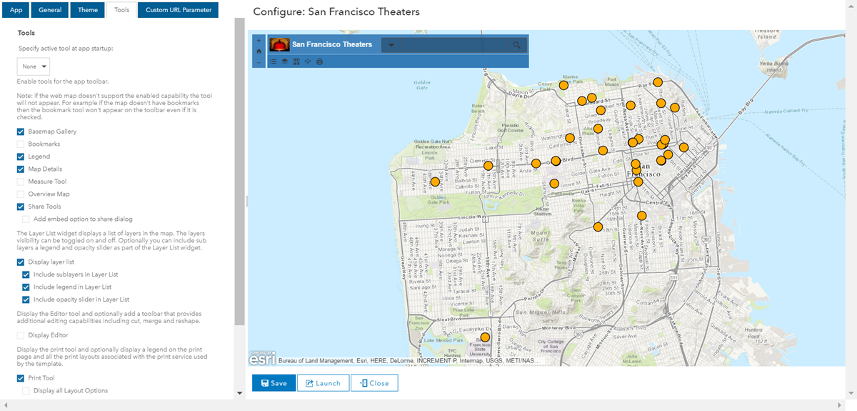
To further utilize space, certain settings inside the configuration page are now conditional and will only appear if another, higher level setting is enabled. For example, in the Basic Viewer there is an option for displaying a layer list. If this option is checked on, three additional subsettings will appear that are dependant on this main setting. If the layer list option is checked off, those three subsettings are hidden to better utilize space and not clutter the panel. Another example is search. If the main “Enable search tool” setting is disabled, then all settings related to search are hidden in the UI.
New App Themes
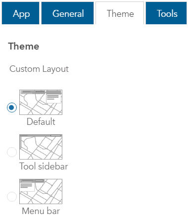
The Basic Viewer, Map Tools, and Elevation Profile now offer addional layout themes to choose from. Within the configuration page on the Theme tab there will be three themes for Basic Viewer, two for Map Tools, and two for Elevation Profile. Basic Viewer features “Default”, “Tool sidebar”, or “Menu bar”. “Default” is the same layout that has previously been available. “Tool sidebar” places all tools in a vertical row under the app title and zoom control buttons on the left, all of which are under an extended title bar header that stretches the full width of the app. Clicking a tool still opens that tool’s widget on the upper right corner of the app UI. “Menu bar” initially looks like “Default” except the tool widgets open right under the menu bar instead of on the opposite side of the app UI. Within Map Tools, the new additional theme is called “Full Map View”. This theme removes the upper header and offers more space for viewing the map. Within Elevation Profile, the new additional theme is called “Full Width Profile”. This theme extends the size of the elevation profile widget across the entire map frame.
Mature Support
The Finder app and the Find, Edit, and Filter app are both moved to the mature support level of the product lifecycle. Development work will no longer take place on these apps, however, your current apps using these templates will continue to exist. Though they will be removed from the featured gallery of app templates, they will still exist within ArcGIS Online. Note that we will not address any newly found bugs or enhancements with apps that are in mature support. Please refer to this blog for additional details.
Crowdsource Apps
There is an array of updates to the crowdsourcing apps. The Crowdsource Reporter now supports adding documents within comments as long as attachments exist on the related comment table. Several new configuration options are now available as well:
- restrict new reports to within a designated area
- control over labels, including the message displayed when no maps are available, and the text on the Submit a Report button
- options for the colors on the splash page to increase the contrast between these elements and a wider variety of background images
- allow users to edit and delete reports and comments they have submitted
- hide the splash page when all sign in options are disabled

Article Discussion: