 In war zones, rockets are just one tool insurgents use to combat friendly forces (roadside bombs, snipers, and ambushes are also common). GIS aids in the predictive analysis needed to defeat these threats.
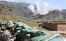
Actionable Intelligence is a new Learn ArcGIS lesson that shows you how military intelligence analysts, during their first field training exercise in California, use ArcGIS Pro to identify and locate the insurgents firing rockets at their base. In this tutorial, you will map data from a spreadsheet with information about enemy attacks and symbolize the data to better understand the battlefield. Then, using spatial and temporal analysis, you’ll discover the patterns behind these rocket launches—information your commander needs to prevent future rocket attacks.
The geoprocessing tools presented in this tutorial are based on standard Esri Commercial off-the-Shelf (COTS) technologies and commercial data. Information about the ranges of insurgent rockets were obtained from the US Army’s Worldwide Equipment Guide, December 2010, and are approved for public release under Distribution Statement A.
About the author


Article Discussion: