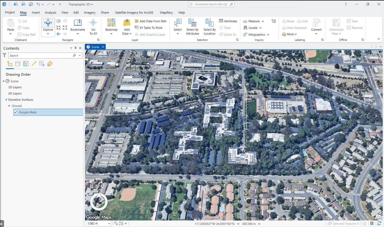
Google’s Photorealistic 3D basemap is now available in beta for ArcGIS Pro 3.6 users. Basemaps serve as the foundation of any GIS project, providing insightful context to the viewer and setting the stage efficiently. In the current GIS landscape, users are increasingly drawn to immersive and relatable map experiences that mirror the real world’s complexity. Maps that prompt users to think of the real environment with all its challenges and opportunities place users in a new mindset where they can think of the project in its entirety. Transitioning to a 3D-first approach is a powerful way to meet these desires, as it enhances the accuracy, realism, and relatability of GIS projects. Instead of seeing an image that is flat on a screen the user can view buildings from different angles and see how the built environment relates with the given space.
From 2D to Immersive: Add Photorealistic 3D to ArcGIS in Seconds
Google Photorealistic 3D Basemap will help fill this growing need as users desire to evolve from 2D to 3D photorealistic. Esri’s approach to solving these challenges centers on seamless integration and workflow enhancement. From Defense and Intelligence agencies to AEC firms, these incredibly realistic representations of the world’s environment will enable decision makers to elevate their projects and analyses by providing not just accurate geospatial data but improved situational awareness.
Basemaps can significantly influence the success of GIS projects as they provide immediate and meaningful context to viewers without extensive explanations and can elevate the impact of datasets. The Google Photorealistic 3D Basemap advances the basemap’s benefits further by transporting viewers to a more realistic representation of the world enabling 3D thinking and a view of all the available opportunities.
How to access the basemap in beta when available:
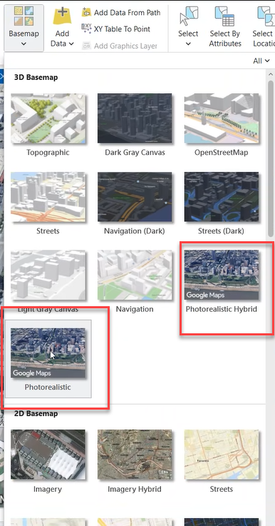
- Google Photorealistic 3D basemap is accessible in beta in ArcGIS Pro 3.6 for named users connected to ArcGIS Online.
- ArcGIS Online admins will need to enable access to the Google Photorealistic 3D basemap for named users.

3. Usage is tracked by sessions. Sessions start when a user adds the basemap to a 3D-capable app and ends after three hours or when they close that app. Organization admins can keep track of session usage and have 20,000 sessions* available during the beta period.
4. Start enhancing your GIS projects and be one of the first users to experience this revolutionary service!
If you would like to provide feedback during the beta period, please join the Early Adopter Program.
We will add support for the Google Photorealistic 3D basemap in other ArcGIS clients, such as Scene Viewer and other web applications, in upcoming releases. Stay tuned for updates!
*Please note: sessions are not provided to students, Esri Nonprofits, or Esri Business Partner organizations. There will be options to buy sessions in future releases.

Commenting is no longer enabled for this article