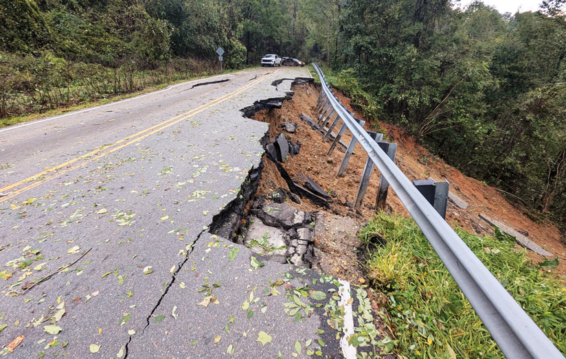
In September 2024, Hurricane Helene brought strong winds and heavy rainfall accompanied by flooding, which knocked out power for millions, washed away roads and bridges to entire communities, and caused widespread cellular service outages.
Natural disasters can have unexpected impacts, and the ability to take maps offline is essential for organizations that need to work with their service data even when internet access is limited or unavailable. Whether it’s the utility company needing to assess damage and restore services, or emergency response teams working to save lives, being able to access information is imperative to tackle these events safely and quickly.
The capability of taking maps offline is not a new workflow in the world of GIS. This has been supported by apps such as ArcGIS Field Maps, ArcGIS Survey123, and apps built with ArcGIS Maps SDKs for Native Apps. Additionally, ArcGIS Pro has had offline capabilities in an on-demand manner, which requires each user to determine a map area and perform individual queries and downloads of the data from the server.
But now with ArcGIS Pro 3.5, users can download offline map areas that are prepared ahead of time, in addition to taking maps offline on demand. This allows the use of prepackaged, predetermined map areas that can be downloaded, edited, and synced by multiple users in a faster, more system-friendly process.
There are several benefits of using offline map areas prepared ahead of time:
1. Uninterrupted Access and Reliability: ‘No Internet, No Problem’ – Map areas are downloaded and stored locally so that users can still access and rely on maps and data in areas without internet connectivity.
2. Prepackaged Data: Prepackaged data allows quicker downloads, minimizes repetitive data extracts, and leads to a more system-friendly environment by reducing server load and improving scalability.
3. Consistent Geographical Area: Each user sees a uniform geographical area along with consistent map content. This consistency improves user experience and ensures accurate data representation
4. Regular Updates: Web map owners can set a regular update schedule for these packages, guaranteeing users access to current offline maps. Whether updates are needed hourly, daily, or weekly, this feature maintains data accuracy and relevance.
Take advantage of the benefits of preparing offline map areas ahead of time and witness as your field operations become more streamlined and reliable, especially in a remote environment or when connectivity is limited.
If you are interested in learning more about the workflow of using these map areas with ArcGIS Pro, from creation to downloading and syncing, continue on with the blog series and see the next installment — Offline map areas prepared ahead of time: Create the web map
Commenting is not enabled for this article.