ArcGIS LocateXT Extension gives you the ability to easily discover and extract geographic coordinates from unstructured text surfacing new connections in your data.
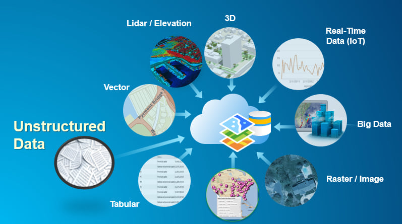
Many industries face the ongoing challenge of having large amounts of location-based information that is not in traditional structured spatial formats—instead, it’s trapped in unstructured and semi-structured, text-based formats where the data cannot be captured, visualized, or analyzed. This data can be found in documents, PowerPoint presentations, PDFs, simple Notepad text, emails, spreadsheets, website content, and even standard reporting forms.
Designed for users of all levels of expertise—ranging from detail-oriented GIS analysts to desktop users and all-source analysts needing quick visualizations—ArcGIS LocateXT technology allows users to rapidly scan through documents, placing the results instantly into geospatial features.
The alternative is a tedious process that requires hours of reading, copying, pasting, and running spreadsheet formulas—workflows that are highly subject to human error. Important spatial patterns are missed or ignored due to the monotonous nature and amount of work involved with finding, identifying, and mapping geospatial references in textual data. The cumulative effect of this problem translates into thousands of hours lost, low productivity, user frustration, and fewer data captured and entered into the enterprise.
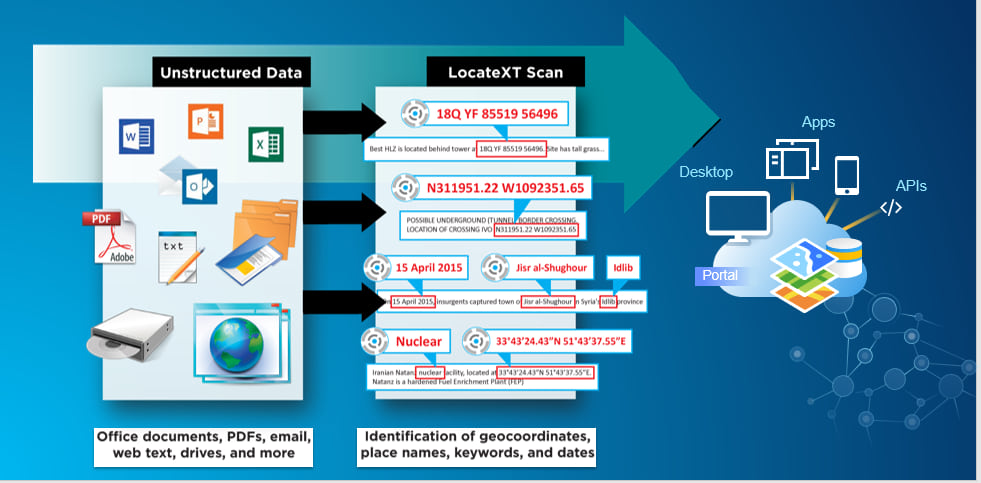
The objective of the ArcGIS LocateXT extension is to provide our customers with the ability to easily discover and extract geographic coordinates from their unstructured data holdings such as emails, briefs, and reports, allowing users to instantly generate intelligent map-based information and share it across the enterprise.
Here is a hypothetical example of how it works:
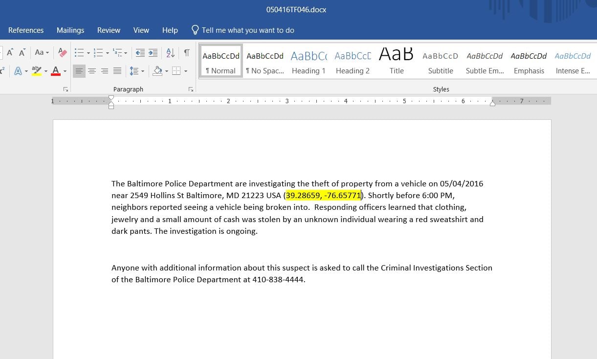
A police department has been recording all criminal-activity incidents in Microsoft Word documents. Over time, the department has accumulated hundreds of reports containing dates; times; locations; and incident types such as robbery, vandalism, and illegal drug sales. To better serve their community and keep it safe, officers would like to use these reports to identify hot spots and trends so that they can target these illegal activities and allocate their limited resources accordingly.
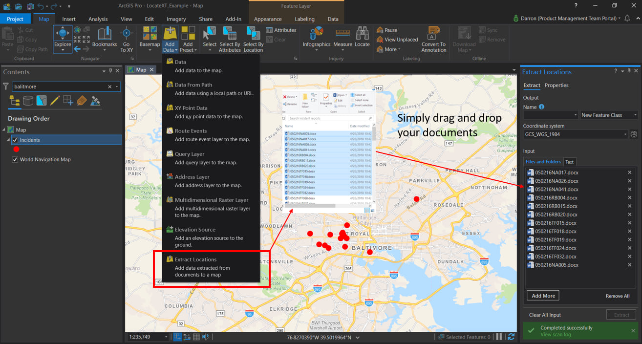
In the past, this would have meant countless hours of reading through each report; highlighting the incident; and adding a point on a map for each type of incident. Now, with the new Extract Locations tool, you can simply drag these documents or drag the folder into ArcGIS Pro.
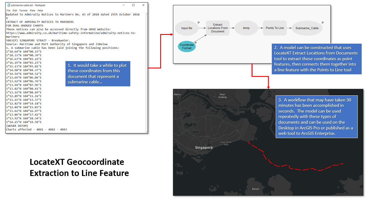
LocateXT technology uses a regular expression (REGEX) pattern search and can be combined with other ArcGIS geoprocessing capabilities to accomplish advanced workflows.
The integration of LocateXT provides unique opportunities to enhance this capability across ArcGIS. This extension, which is now available for both ArcGIS Pro and for ArcMap, makes it seamless to transform textual data with hidden geographies into geospatial features on a map for analysis and intelligence finding.
For more information on LocateXT and how it can further enhance your ArcGIS workflow, visit esri.com/en-us/arcgis/products/locatext/overview.

Commenting is not enabled for this article.