Starting with ArcGIS Pro 3.8 and ArcGIS Enterprise 12.2, ArcGIS Roads and Highways and ArcGIS Pipeline Referencing come together in a single extension: ArcGIS Linear Referencing. Whether you manage roads, pipelines, or other linear-referenced features, the linear referencing tools are now available in one product.
This release of ArcGIS Linear Referencing focuses on three areas: consolidating tools in one product, loading large amounts of calibration points in bulk, and displaying more information in the straight line diagram (SLD).
Quick links
- One extension for linear referencing
- Single Linear Referencing ribbon tab
- Single Linear Referencing toolbox
- Bulk load calibration points with the Append Calibration Points tool
- LRS dataset support for the Prune Branch History tool
- ArcGIS Pro assistant (beta) covers all route editing tools
- New beta capability: Feature Extraction from video
ArcGIS Enterprise capabilities
- Dynamic Segmentation widget enhancements
- Referent fields filled in automatically
- Copy coordinates using the LRS Identify widget
- Append Calibration Points REST operation
ArcGIS Pro capabilities
The following capabilities have been added to ArcGIS Pro.
One extension for linear referencing
ArcGIS Roads and Highways and ArcGIS Pipeline Referencing are now consolidated into a new extension named ArcGIS Linear Referencing. The extension provides the advanced enterprise linear referencing capabilities that were previously offered through ArcGIS Location Referencing.
The map-based linear referencing tools that primarily work with file geodatabase data are now referred to as basic linear referencing.
Learn more about the product consolidation
Single Linear Referencing ribbon tab
Previously, linear referencing tools were available on two ribbon tabs. In ArcGIS Pro 3.8, all tools from the Location Referencing tab are now on the Linear Referencing tab.
Additionally, the Identify Routes and Locate Route and Measures tools now work with basic linear referencing datasets.

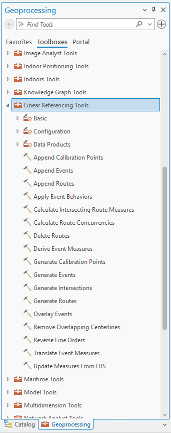
Single Linear Referencing toolbox
Previously, geoprocessing tools for linear referencing workflows were available in two toolboxes. The tools and toolsets from the Location Referencing toolbox are now in the Linear Referencing toolbox, so you can find all tools in one place.
Existing Python scripts and ModelBuilder models that run tools from the Location Referencing toolbox should continue to run without modification until the ArcGIS Pro 4.0 release.
Bulk load calibration points with the Append Calibration Points tool
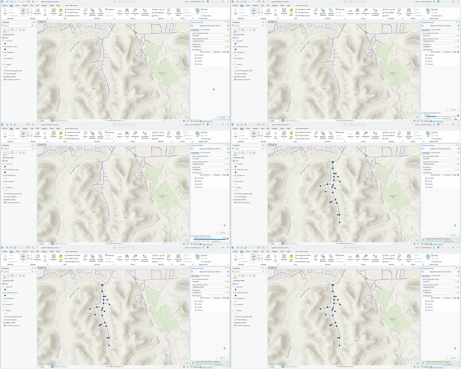
The new Append Calibration Points tool performs the following tasks in a single run:
- Appends calibration points in bulk from an input point layer to a calibration point feature class
- Runs quality checks on the incoming data
- Recalibrates only the routes affected by the new points
- Recalibrates a route with multiple appended calibration points once at the end of the process, rather than after each point is appended
Pipeline organizations often bring in legacy or newly acquired calibration points from outside sources. With this tool, you can migrate the data in a single batch, flag invalid measures, and recalibrate only the routes that the new points affect. Compared to the Append tool, this tool loads data faster and runs data quality checks during loading to identify any issues with the new calibration points.
LRS dataset support for the Prune Branch History tool
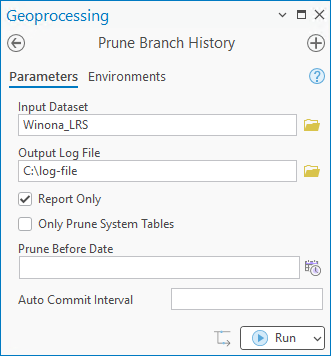
The Prune Branch History tool now accepts linear referencing system (LRS) datasets as input. Use this tool to delete archived records from branch-versioned datasets, which may help reduce their size.
Learn more about prune branch history
ArcGIS Pro assistant (beta) covers all route editing tools
In the previous release, the ArcGIS Pro assistant (beta) supported route creation, reversal, and realignment. With added support for route extension, retirement, and reassignment, the assistant now supports all LRS route editing tools. Conflict prevention is also supported, letting you see whether routes are locked or available before you edit them.
You can use natural language prompts to make route edits and get step-by-step guidance through the workflow. The ArcGIS Pro assistant (beta) documentation includes instructions on how to access the assistant, sample prompts, and synonyms you can use when performing route editing.
New beta capability: Feature Extraction from video
Feature Extraction is a beta capability that turns roadway videos into usable GIS features by automatically detecting and locating common assets, such as signs, captured along a route. This capability reduces the time and manual effort required to review large volumes of street-level imagery and build or update an asset inventory.
The workflow uses Segment Anything Model 3 (SAM 3) and text-based prompts to identify features within a video. Video location information and multi-frame observations help determine where detected assets are located in the real world. Repeated observations of the same asset are consolidated to ensure there are no duplicate features.
You can review detections, remove false positives, and correct classifications before accepting the results. This capability turns roadway video into GIS-ready assets and LRS event data that support mapping, asset inventory, and roadway management workflows.
Learn how to sign up for the beta program
ArcGIS Enterprise capabilities
The following capabilities are available in ArcGIS Enterprise.
Dynamic Segmentation widget enhancements
The Dynamic Segmentation widget in ArcGIS Experience Builder includes several updates that display more information than before and simplify working with long routes.
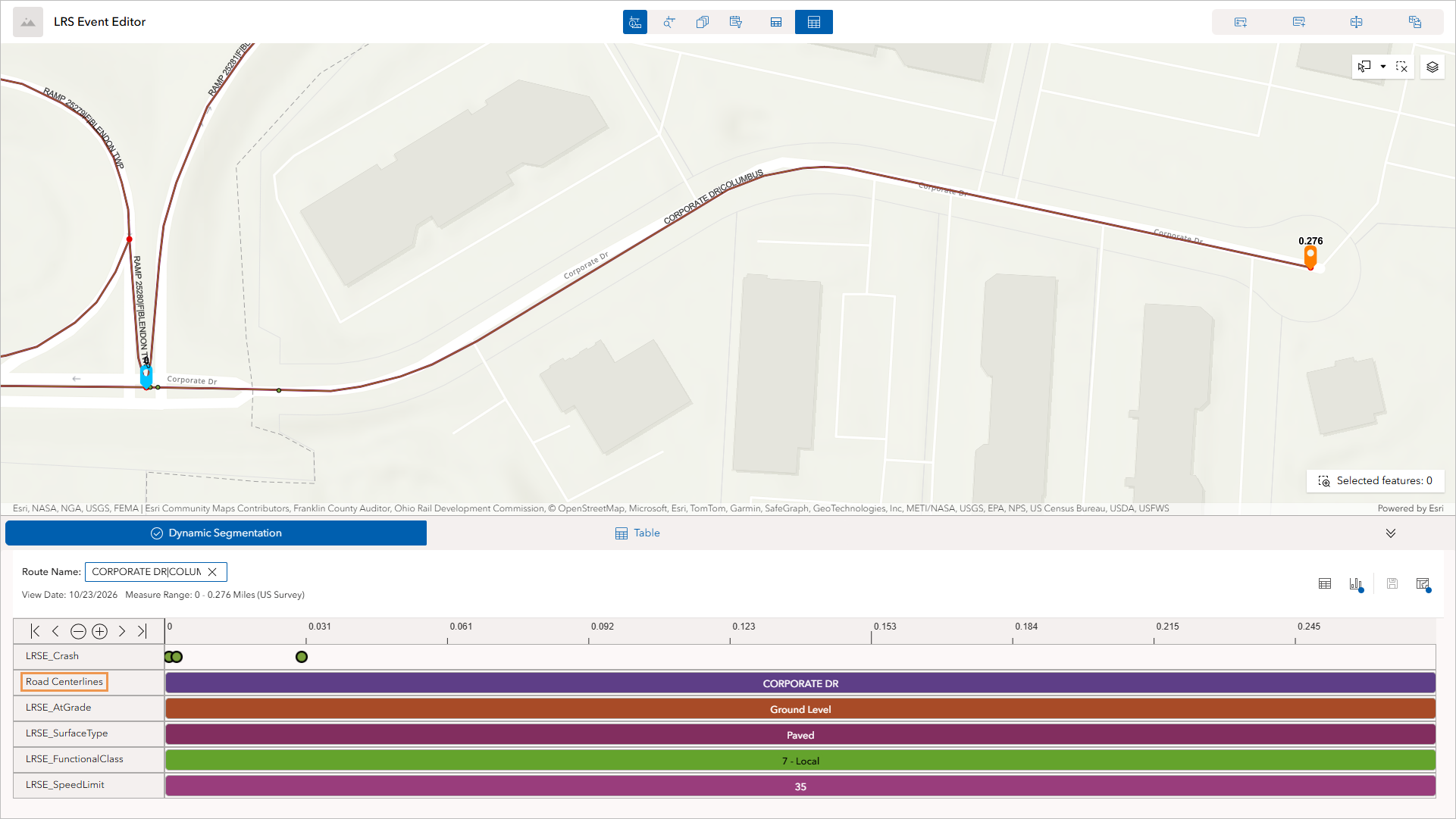
Utility network and address data in the SLD
If your LRS is integrated with ArcGIS Utility Network or the Address Data Management solution, the SLD now displays centerlines. The following screenshot shows the centerline layer from the Address Data Management solution:
The SLD displays pipeline devices and junctions when the LRS is integrated with ArcGIS Utility Network:
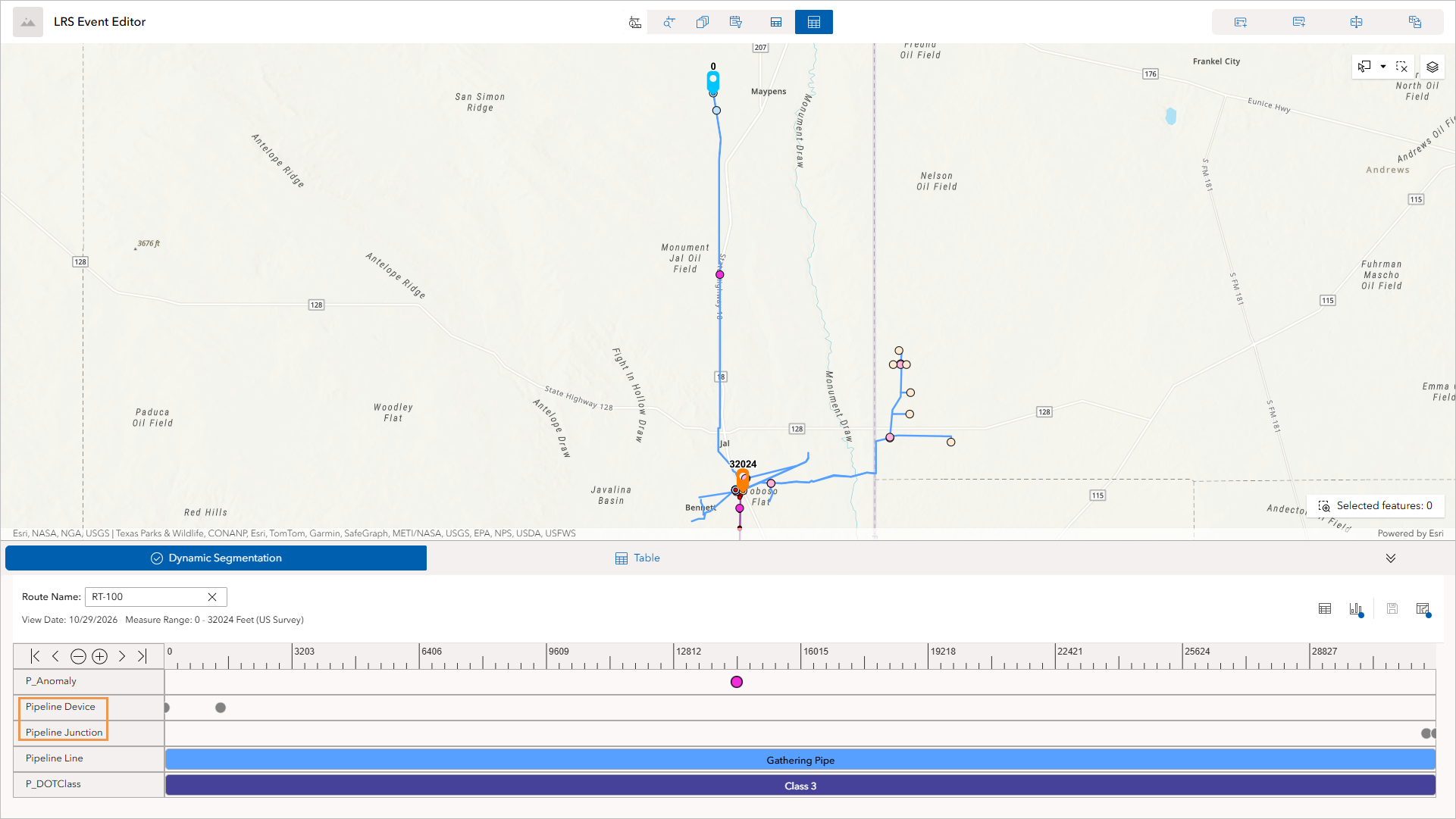
Previously, the SLD did not display this information, so LRS editors had to perform cross-checks outside the LRS or in separate systems. Now the SLD displays assets, attributes, and address information along a route with event data.
Custom display fields
You can now configure a custom display field for the following layers:
- Event layers
- Utility network layers (Pipeline Line, Pipeline Device, or Pipeline Junction)
- A centerline layer configured as the Address Range layer in the Address Data Management solution
To use a custom display field, use ArcGIS Pro to create an Arcade display expression in the feature layer before you publish the feature service, and then select the display field in the widget settings in ArcGIS Experience Builder.
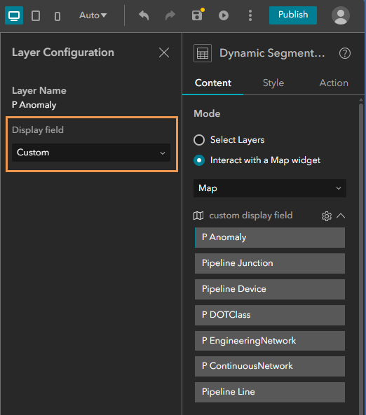
GIS administrators can set a custom Arcade display expression to provide LRS editors with a clear tooltip and label in the SLD. For example, a tooltip that combines the anomaly type and year helps LRS editors identify important information at a glance.
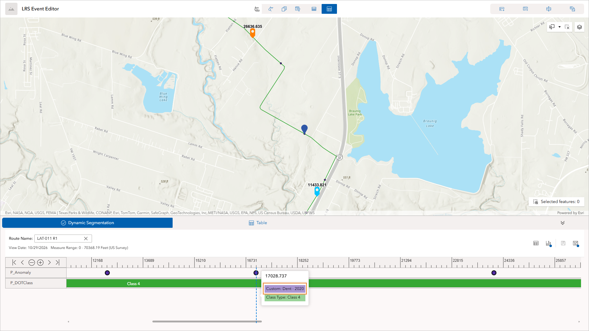
Attribute tooltips
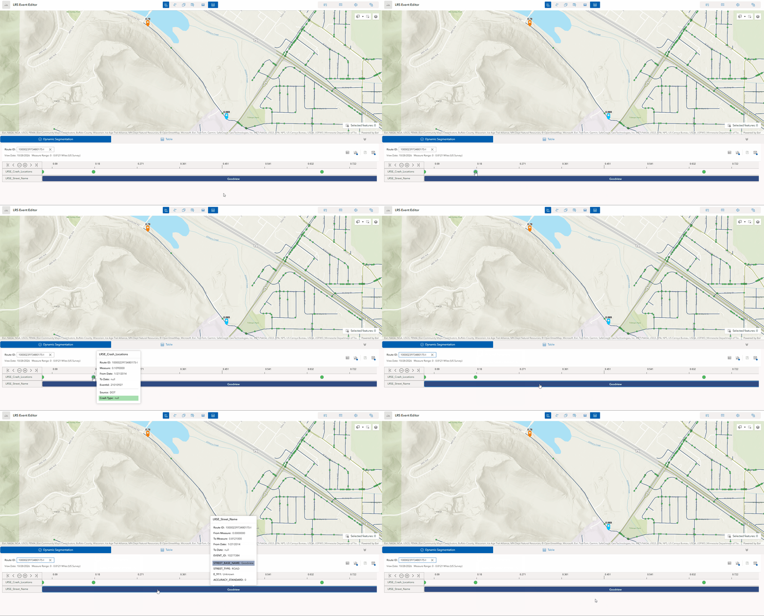
Previously, to see the full context of an event, you had to open extra dialog boxes or add more widgets. Now you can hover over an event, intersection, centerline, device, or junction in the SLD to see a tooltip with its attributes, such as route ID, measure, start and end dates, event ID, and user-managed fields.
For example, a GIS analyst can hover over an event and confirm its effective dates and measures with fewer clicks.
Focus on a measure range
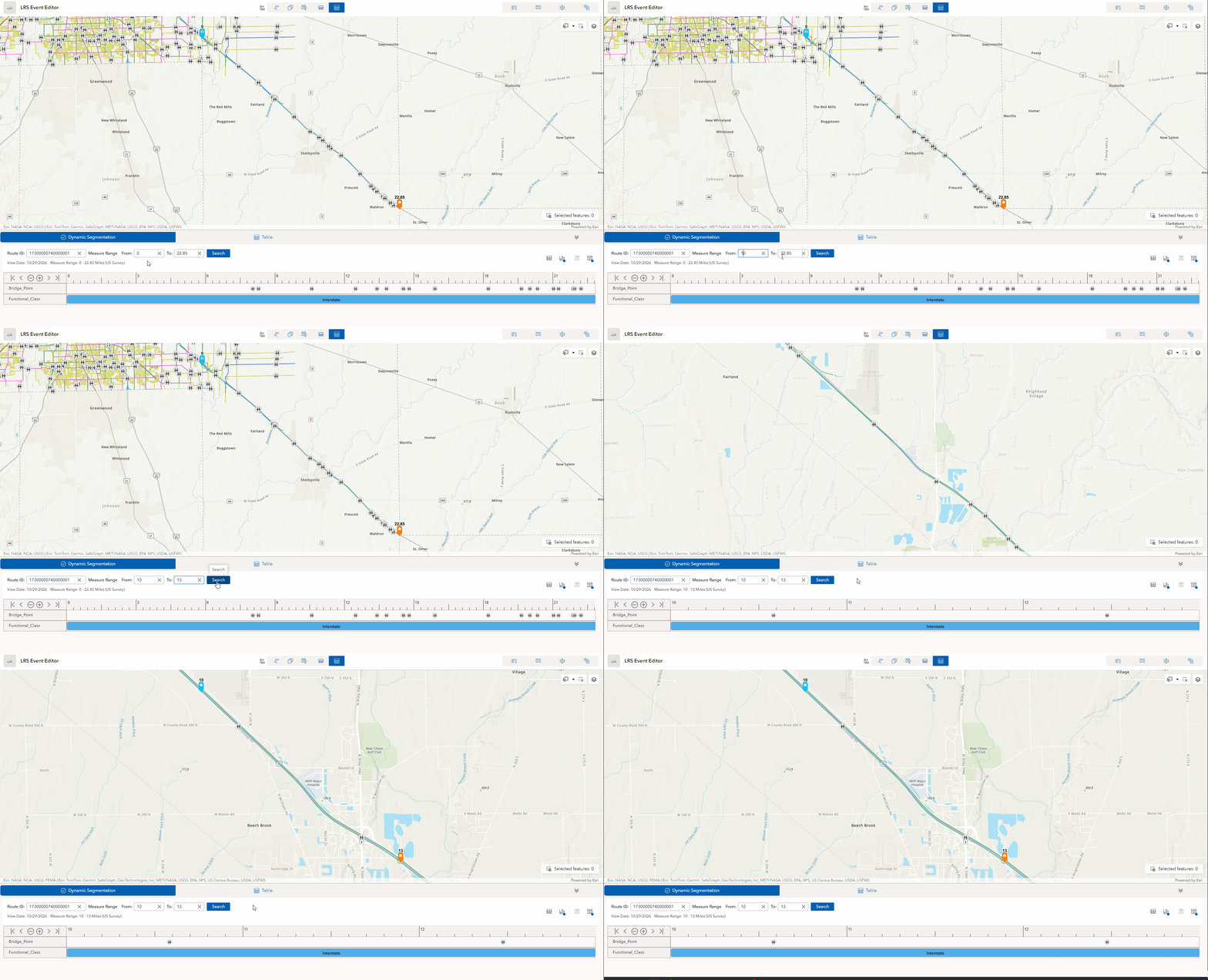
With the new Show measure range setting, you can run dynamic segmentation for a specific measure range.
Narrowing the view helps you find problems such as overlaps and gaps in one section, and the SLD responds faster. For example, an LRS editor can review bridge points between measures 10 and 13 on a 23-mile stretch of a highway without loading the whole route.
Referent fields filled in automatically
The following widgets now populate referent fields on new events automatically:
- Add Point Event
- Add Line Event
- Split Event
- Merge Events
- Dynamic Segmentation
This enhancement matches the behavior of the equivalent LRS editing tools in ArcGIS Pro and maintains consistent referent information without manual entry. For example, when an LRS editor adds a crash location, the referent fields are filled in automatically.
Copy coordinates using the LRS Identify widget
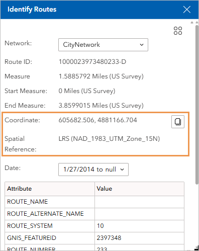
Previously, getting the coordinates of a clicked location required another widget or method. The LRS Identify widget now shows the coordinates of the location you click, and you can copy them in x,y format.
To display coordinates, turn on the Include coordinates in results setting when configuring the LRS Identify widget. Coordinates can be displayed in the spatial reference of the web map or the LRS. You can also set the number of decimal digits for the displayed coordinates.
This enhancement allows you to reuse coordinate information in other systems. For example, a GIS analyst can identify a point and paste its coordinates into a work order for a field crew.
Append Calibration Points REST operation
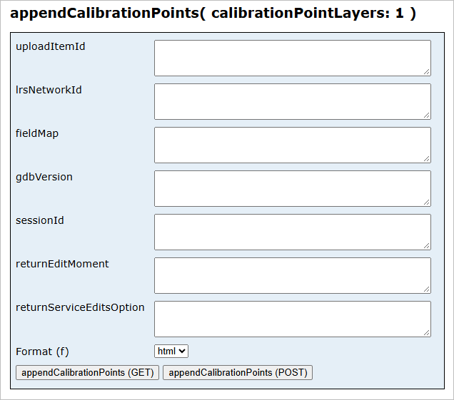
The Append Calibration Points REST operation provides the capabilities of the Append Calibration Points geoprocessing tool to workflows outside ArcGIS Pro.
_______________________________________________________________________
Try these new capabilities and share your feedback in Esri Community!

Commenting is not enabled for this article.