Sometimes that map just isn’t ready for prime time, but you still need to show progress to a customer or something. Or maybe you want to let folks test-drive it…but you want to make sure they give the keys back. How do you ensure some or all of your map doesn’t get snagged by some unscrupulous fiend and sold as pirated prints?
Watermarks!
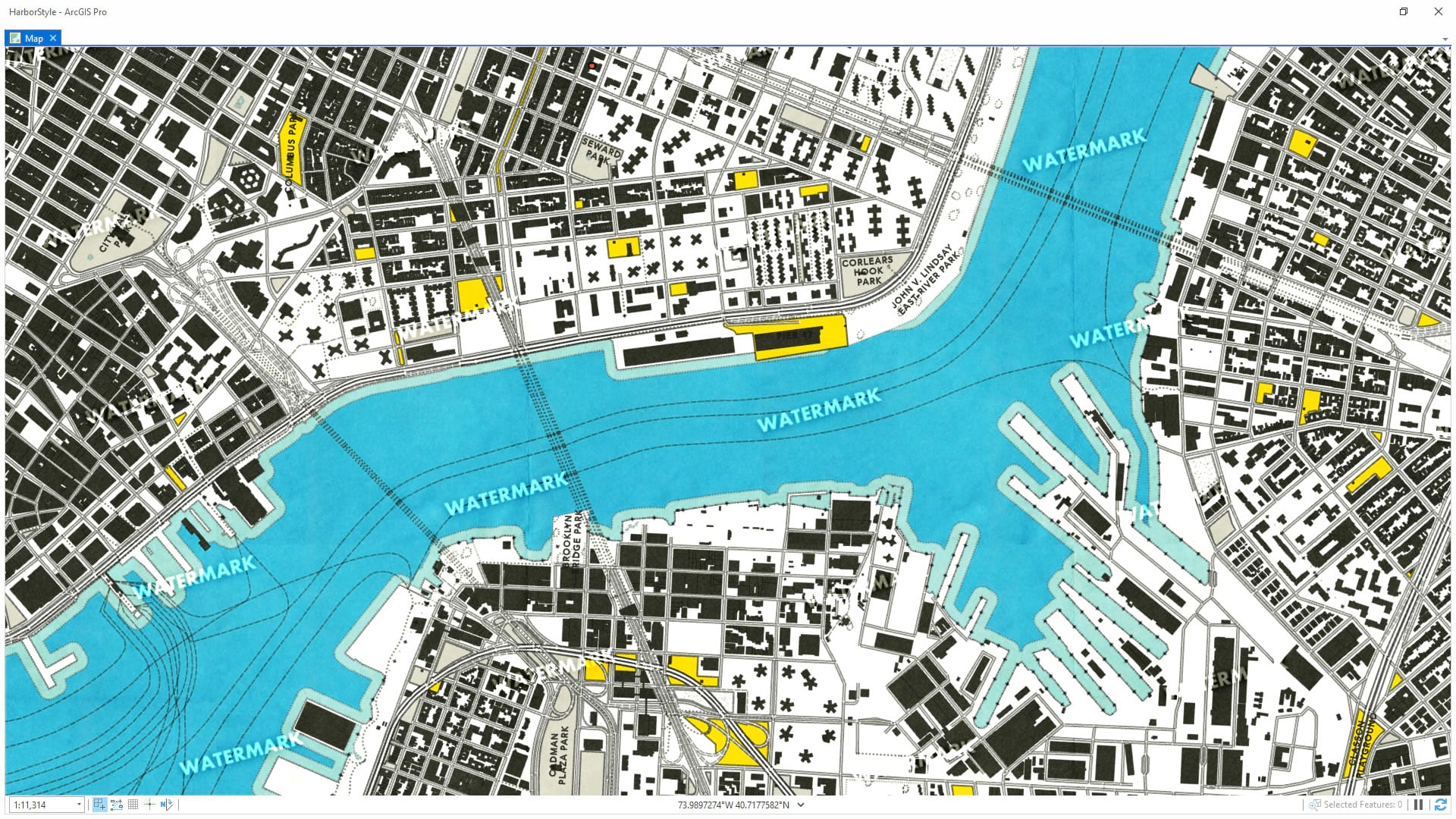
Those pesky little repeating graphics are subtle enough to still let you share your work without overt distraction/destruction, but visible enough to foil any thief’s mustache-twisting ambitions. Shoot, you don’t need me to tell you about the utility of watermarks. But maybe you’d like to see how to make them really easily even if you aren’t a designer or you don’t have access to PhotoShop or Illustrator? Then this video is for you.
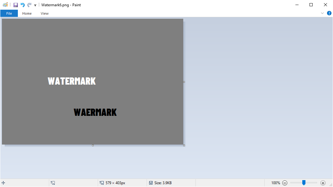
I’ll show you how to make a simple watermark graphic in Paint!
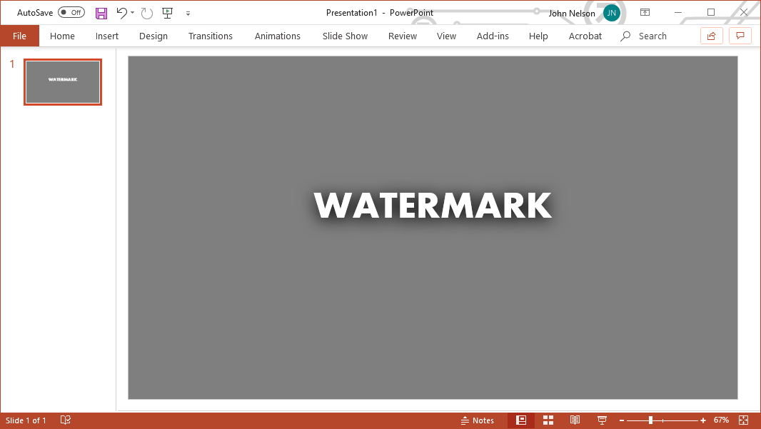
Or, if you are feeling ambitious, PowerPoint!
No need to call up a graphic designer or feel intimidated by making a graphic with transparency and stuff (though that is a noble pursuit). No problem! Blend modes in ArcGIS Pro can handle all that. Here’s how to make a simple graphic and add it as a repeating watermark graphic to Pro, my somewhat-protective map-making friends!
0:00 A setup for watermarks
0:44 How to make a watermark graphic in Paint.
2:20 Adding in the trusty Global Background layer from Living Atlas to Pro
3:00 Applying a repeating picture fill to the global background
3:36 Using the “overlay” blend mode to blend the watermark into our map
4:18 Giving the watermark pattern an angle, like the pros do!
4:41 Tweaking the watermark density with less background area
5:03 How to get light AND dark watermarks
6:12 What about making a graphic in PowerPoint? Awwww yeahhhhh.
Say, if you like that map style, I DO want you to steal that. It’s the “New Amsterdam” style for ArcGIS Pro designed to make your maps look like charming modernist Dutch port maps of the 1970s! Here’s where to find it.


Article Discussion: