Every November since 2019, cartographers and map hobbyists around the world have participated in the 30-Day Map Challenge. The Challenge asks participants to create maps based on themes Topi Tjukanov (mastermind behind the Challenge) shares for each day of November. The objective is to create and post maps on social media for as many of the Challenge days/themes as you wish.
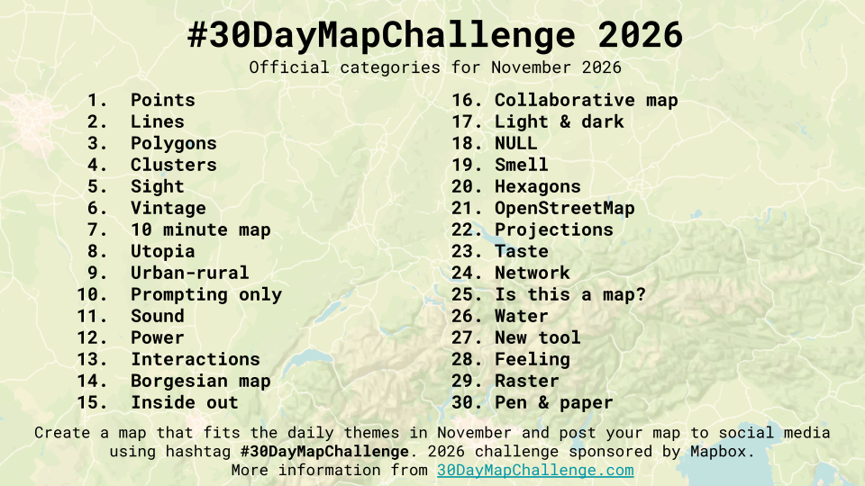
Once again, the ArcGIS Pro Team decided to join in on the fun. Members from all across the Team volunteered to make a map for every day of the Challenge. Find weekly recaps right here in this blog. Get daily updates via the Gallery on the November StoryScape, and the ArcGIS Pro Facebook & LinkedIn pages.

Week 1 Maps
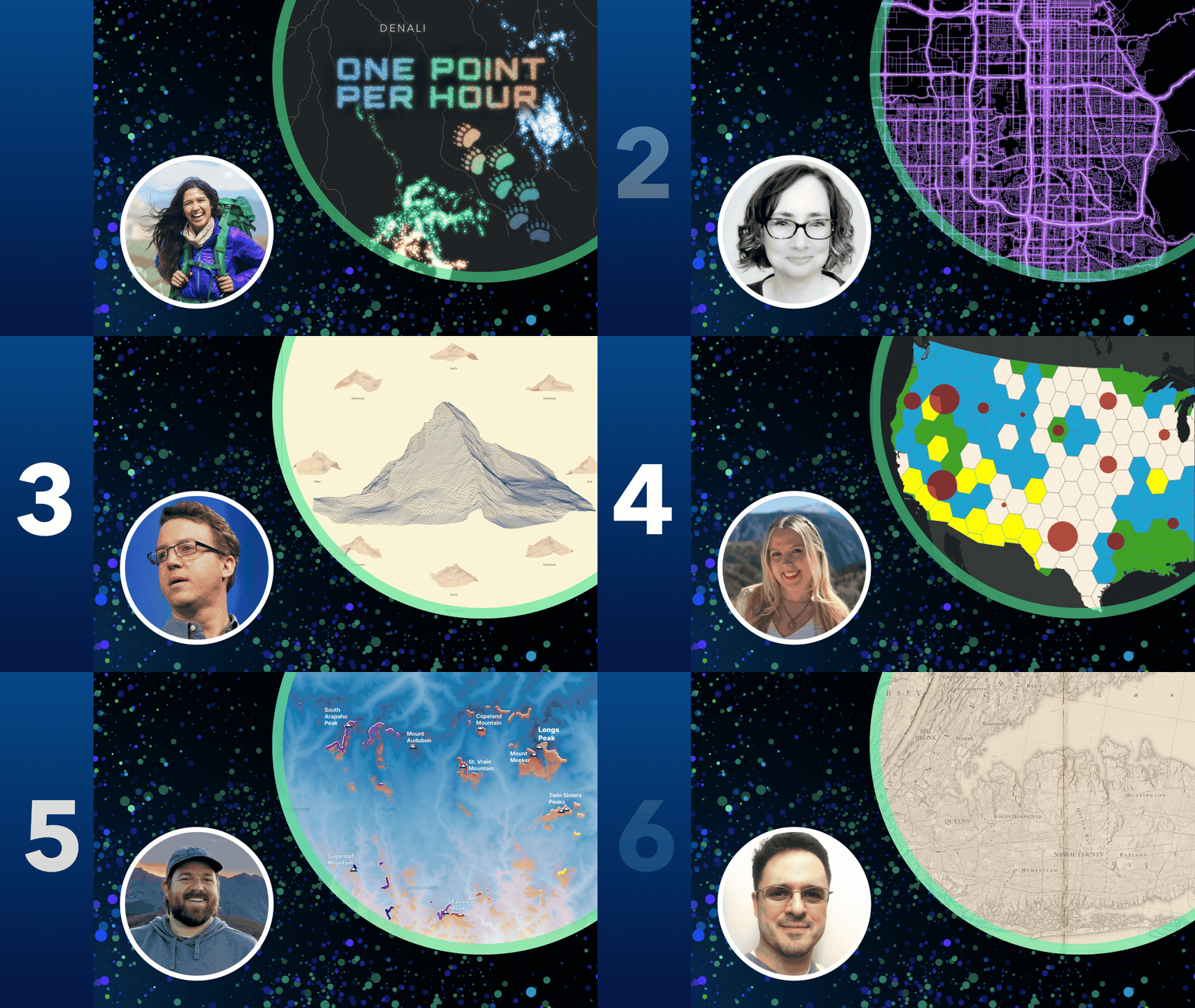
Day 1: Points “One Point Per Hour”
Follow three grizzly bears through a summer in Denali National Park! Elizabeth Menezes mapped their hourly GPS locations in ArcGIS Pro, using time-enabled visualization and glowing symbology to bring each bear’s movements to life.
Day 2: Lines “Greater Salt Lake City Area Road Network”
Inspired by Salt Lake City’s roads glowing at night, Shannon Gonzales recreated the electric view in ArcGIS Pro using symbol layering, gradients, and unique value symbology to highlight traffic-dense roads.
Day 3: Polygons “2027 Matterhorn Wall Calendar”
216,568 triangles make one impressive mountain! Craig McCabe used Terrain3D elevation data in ArcGIS Pro to create nine views of the Matterhorn and transform them into a 2027 wall calendar.
Day 4: Clusters “Spatial Clusters of Renewable Energy Capacity”
Grace Anderson mapped two sides of renewable energy across the U.S.: the leading energy source and total capacity. She used hexagonal bins and clustering tools in ArcGIS Pro to reveal patterns across the country.
Day 5: Sight “What can I see when I watch the sunset?”
Jared Kohler mapped how the sunset moves along Colorado’s Front Range throughout the year. Using Geodesic Viewshed and an ArcGIS notebook in ArcGIS Pro, he traced the horizon and daily sunset locations.
Day 6: Vintage “A Map of Long Island”
Tommy Fauvell gave Long Island a vintage makeover! Inspired by antique maps, he combined modern geographic data with old-school cartographic style in ArcGIS Pro to bring nostalgia to a landscape he knows well.
View the FULL MAPS here

Week 2 Maps
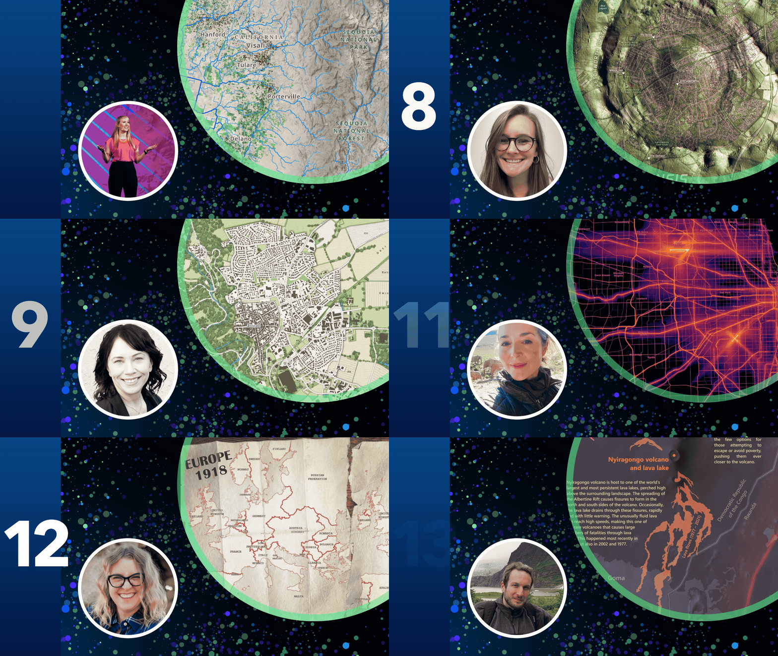
Day 7: 10-Minute Map “The Heart of Central California”
In just 10 minutes, Lisa Berry mapped nut crops within the Tulare subregion, overlaid with a key water source: streams from the Sierra Nevada Mountains. The map was built in ArcGIS Pro with ready-to-use ArcGIS Living Atlas content.
Day 8: Utopia “Utopia Hortensis”
For the “Utopia” theme, Kait Irving drew inspiration from Ebenezer Howard’s Garden Cities of To-morrow. Her map overlays Letchworth, England, on Utopia Planitia, Mars, to see whether its many craters could host a Martian Garden City of its own.
Day 9: Urban-rural “Stadt und Land”
Towns and farmland checker the Bavarian landscape, mixing urban and rural life. For the “Urban-rural” theme, Cindy Prostak created a map using OSM data in ArcGIS Pro.
Day 10: Prompting Only “Four Literary Lenses of Walden”
Kait Irving explored vibe coding to spatialize Thoreau’s Walden through four literary lenses using ArcGIS Maps SDKs.
Day 11: Sound “USA Transportation Noise”
Emily Meriam was drawn to civilian aviation noise patterns and how unique geography differentiates the visual sound signature for every city. For the “Sound” theme, she created small-multiple maps that reveal the signatures of airports across the U.S.
Day 12: Power “Europe 1918, Europe 1930”
For the “Power” theme, Aubri Otis used ArcGIS Pro to map the power shift that occurred after World War I. She kept the labels and symbology simple so the data could speak for itself, while layout tricks give the final product a historic feel.
Day 13: Interactions “A Nexus of Hazards”
Charles Preppernau created mapped how geologic hazards and political violence interact in North Kivu. He used terrain shading techniques and a color palette inspired by the lava lake within Nyiragongo volcano.

Commenting is not enabled for this article.