One of the key capabilities of the ArcGIS Maritime server extension is the ability to publish Maritime Chart Service (MCS) layers using S-57 and S-63 encrypted datasets that can be integrated into applications such as desktop, mobile, and cloud capabilities across the enterprise.
With the recent release of version 3.0, Maritime Chart Service is now integrated into ArcGIS Pro with its own contextual tab. The Maritime Chart Service tab appears whenever an MCS layer is selected in the Contents pane and allows you to view and modify display parameters directly from the Pro interface. With this update, you can explore dynamic data changes instantly within Pro—there’s no need to open your Maritime Chart Service, update parameters there, and then reload a chart in Pro, thereby saving time and streamlining workflows and analysis.
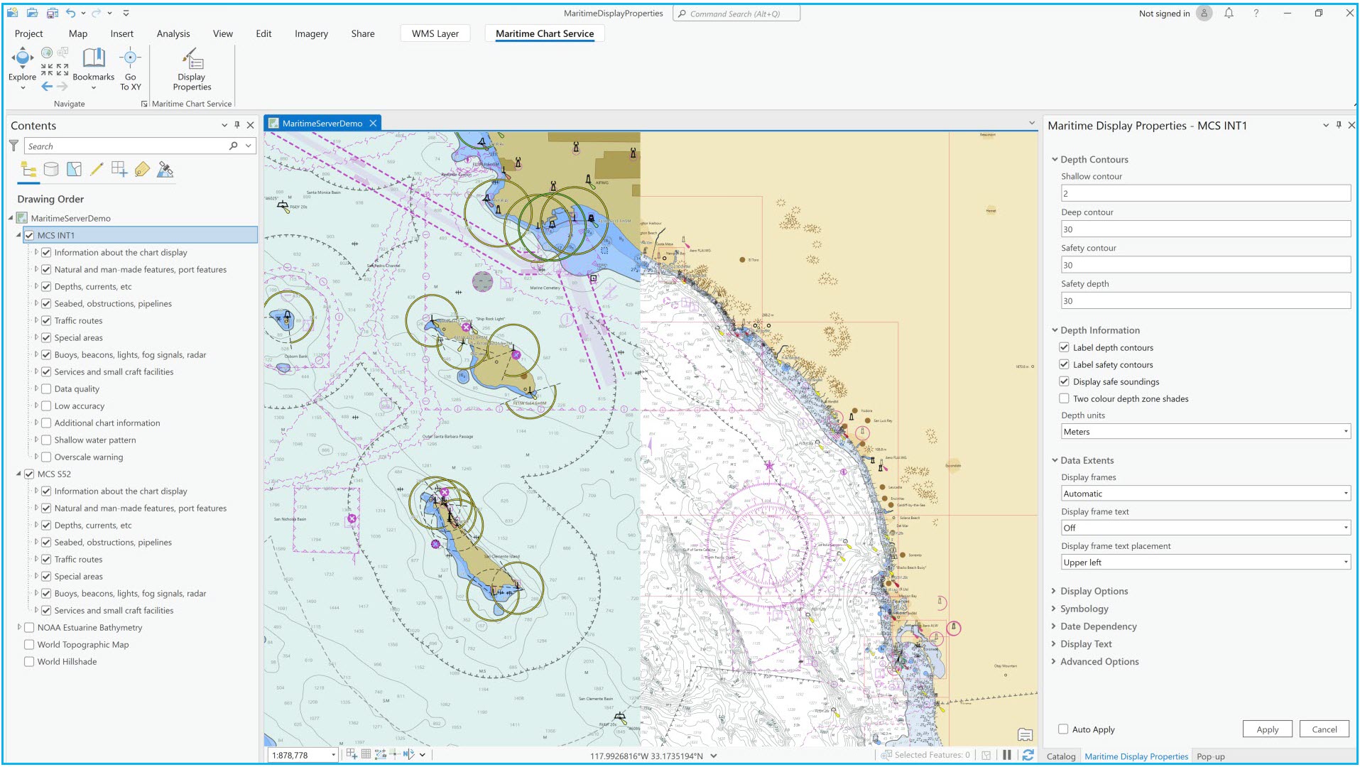
From the Maritime Chart Service tab, you can open the Display Properties pane to modify more than 35 unique S-52-based parameters, such as depth contours, data extents, symbology, and date dependencies. To see changes on your charts as parameters are modified, you can set the display properties to auto-apply using the check box at the bottom of the Display Properties pane.
The MCS viewer can support multiple MCS layers in Pro, meaning you can bring in multiple MCS layers, such as Additional Military Layers (AML), Electronic Navigational Charts (ENC), and Inland ENC. You can then use the Swipe tool to visualize and compare changes on your charts quickly and easily. For example, viewing changes in charts based on projected date dependencies.
To enable the Maritime Chart Service tab, simply load an MCS layer into a new or existing map you are working with and select the layer in the Contents pane. ArcGIS Pro sends a request to the server to append the MCS layer in real time as display properties are modified. If you’d like to explore how the tool works, go to Portal in the Catalog pane and search for a NOAA published MCS layer by using the keywords “noaa enc online”, or any other MCS layer you’d like to view.
To learn more about the latest updates to Maritime Chart Service, check out What’s new for ArcGIS Maritime.

Article Discussion: