Content contributed by Nathan Easley, Product Owner and Lead Product Engineer.
ArcGIS Pipeline Referencing includes a variety of new and enhanced features at the ArcGIS Pro 3.2 and ArcGIS Enterprise 11.2 releases. This includes enhanced reassign route capabilities in ArcGIS Pro along with a more streamlined user experience making it easier to merge, split, and transfer routes. Additionally, enhancements were made in the Dynamic Segmentation and Event Replacement tools as well as in route editing tools that create new routes. Within ArcGIS Enterprise, new REST endpoints have been developed to support translating between referent offsets along a pipe and measures, stations, and coordinates.
Enhanced Reassign Route
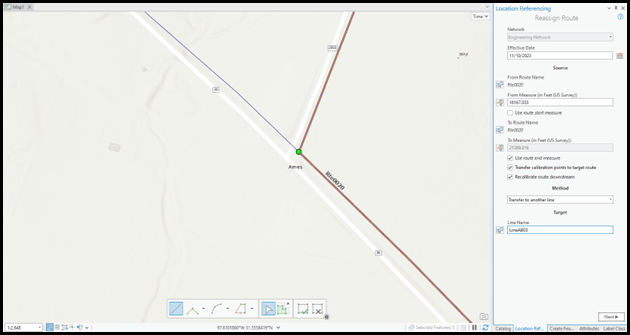
Reassignment to a New Line
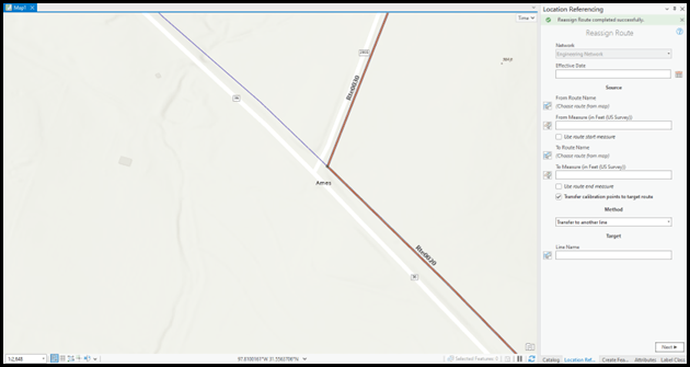
The Reassign Route tool has been enhanced to support reassigning to a new line when making edits in a line network. Part of a single route, an entire route, or multiple routes can now be transferred from one line to another with this enhancement. This enhancement also supports the workflow when part of or an entire route in a derived network needs to be transferred from one route to another.
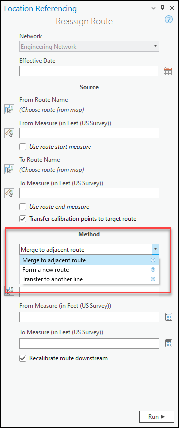
Redesigned User Interface
The UI for the Reassign Route tool has been redesigned to only display fields that need to be populated. The user will now choose what type of reassignment they’re going to complete (merge to adjacent route, form a new route, or transfer to another line) and only the fields needed for that type of reassignment will appear. This streamlining of the UI will make the tool easier to utilize and ensure the desired type of reassignment is completed.
Additional ArcGIS Pro tools
Other new tools improve the event editing experience within ArcGIS Pro, enhance the user experience when creating new routes in LRS route editing tools, and simplify the bulk route and event loading process.
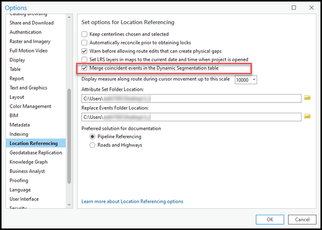
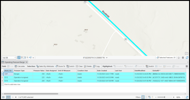
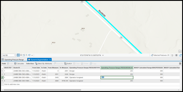
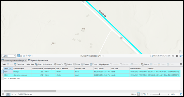
Merge option in Dynamic Segmentation tool
The Dynamic Segmentation tool supports the option to merge coincident events when making edits in the tool. When an attribute in an event is changed and matches the attribute of an adjacent event, this option will automatically merge the events into a single event.
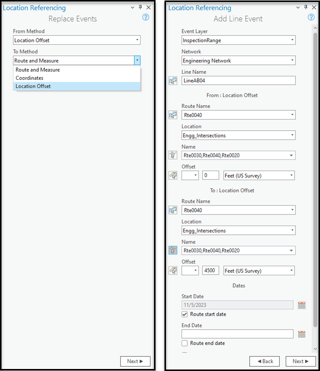
Intersection input method in Event Replacement tool
Users can now utilize intersections as an offset method in addition to route and measure within the Event Replacement tool. If referent offset fields are configured for any event layer with new records being added, this intersection offset information will be stored for the new events along with route and measure information.
Eyedropper tool when creating new routes in Create, Realign, and Reassign Route tools
A Copy attribute values from route from map button, also known as an eyedropper, in the Create Route, Realign Route, and Reassign Route panes was added at this release. This button allows attributes from an existing route to be copied to when creating new routes.
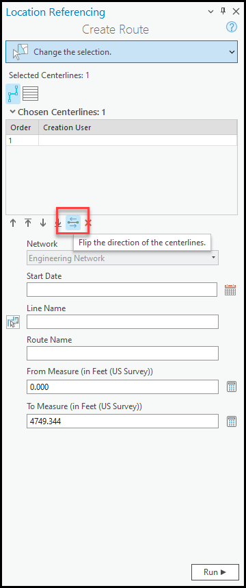
Flip centerline direction enhancement
The flip centerline button used in Create Route, Extend Route, and Realign Route has been enhanced to support flipping the centerline in memory as part of the route editing operation instead of permanently flipping the geometry of the centerline feature in LRS route editing tools. For users that utilize Pipeline Referencing with the Utility Network, this will ensure there is no break in connectivity within a Utility Network when the centerline/pipe feature is flipped as part of an LRS route edit.
Attribute sets attach to published service
Attribute sets have been redesigned to be able to be published with a service in ArcGIS Pro. When a service with an attribute set attached is utilized in ArcGIS Pro and Event Editor, the attribute set will automatically be read and will be available to utilize for event editing without the user have to reconfigure it in each application or export/import a RHAS file.
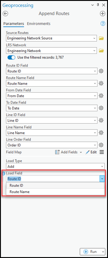
Support loading via route name in Append Routes/Append Events geoprocessing tools
The Append Routes and Append Events geoprocessing tools have been enhanced to support loading via the route name or route ID fields when the route name field is configured for the network/event. This additional flexibility allows users that have a route name, but not a route ID on a route/event record they want to load, to append the record without having to populate a route ID as it will be automatically added by the tools.
ArcGIS Enterprise
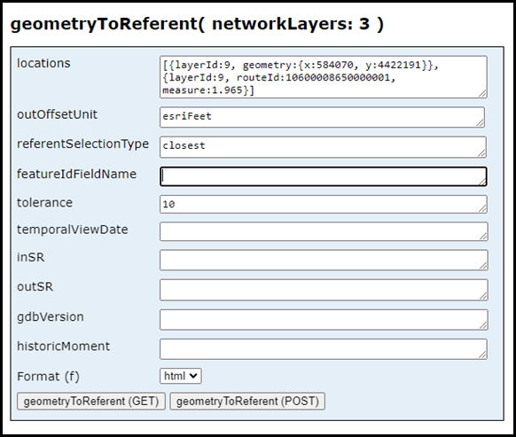
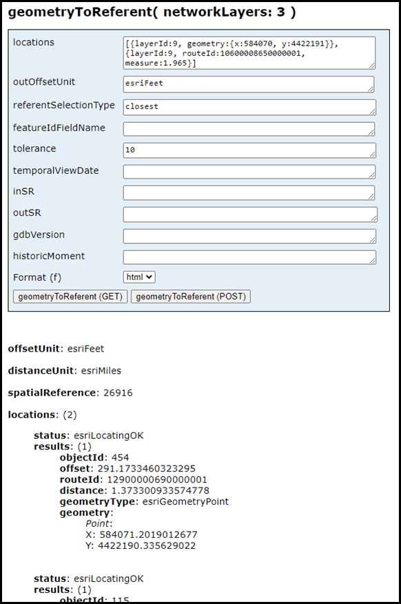
Geometry to Referent REST endpoint
The new geometryToReferent REST operation allows a user to provide one or more coordinates or route and measure locations along a route and have those locations converted into a referent and offset value. The user can choose the referent layer that will be used to convert the inputs. This operation will be useful to organizations looking to convert the location of linear referenced features into a location that is more easily identifiable to team members working outside the office.
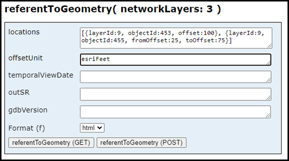
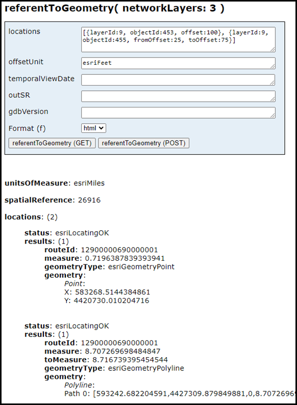
Referent to Geometry REST endpoint
The new referentToGeometry REST operation allows a user to provide one more point referent locations along a set of routes that are converted into coordinates and route and measures. This operation is useful for users who want to convert linear referenced information that was collected via a referent and offset, such as 50 feet from a valve location, into route and measure and coordinates to be easily managed within Pipeline Referencing.


Article Discussion: