In order for communities to fight blight, it is essential to know the condition of properties. Historically performing property condition surveys required inspectors to physically visit properties, fill out forms and take pictures. For many communities, this was a slow and expensive process.
The Property Condition Survey configuration available with ArcGIS significantly reduces the time and cost associated with performing property surveys by applying artificial intelligence (AI) and machine learning (ML) to street-level property photos and automatically calculate a blight probability for every property. Once blight probabilities are calculated communities can take action against individual properties to fix blight or make policy changes to reverse neighborhoods that are blighted or trending toward blighted. After performing an initial survey and establishing a baseline, communities can rapidly resurvey in the future to track blight trends over time.
The Property Condition Survey configuration is free and fully supported for ArcGIS users. It leverages the artificial intelligence and machine learning capabilities of Microsoft’s Custom Vision Service to perform the image analysis.
This video from the 2018 Esri User Conference to shows Property Condition Survey in action.
The rest of this post explores the 2 primary workflows of Property Condition Survey – collection and management of street-level property photos and blight probability calculation.
Collect and Load Your Street-Level Property Photo Collection
After deploying the Property Condition Survey configuration, you can collect new street-level photos or load your existing photos. Property Condition Survey uses images captured with standard EXIF data, which means you can use inexpensive commercially available cameras. Follow this guide to select cameras best suited to your individual needs.
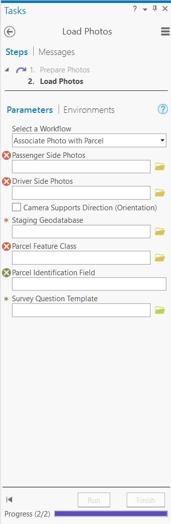
Use the Load Photos task to associate photos with properties.
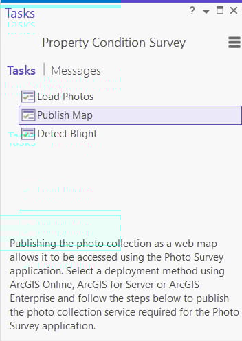
Publish Your Photo Collection
Next use the Publish Map task to publish your photo collection as a web map.
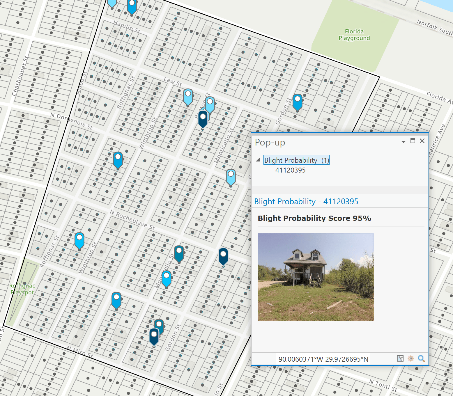
Blight Probability Calculation
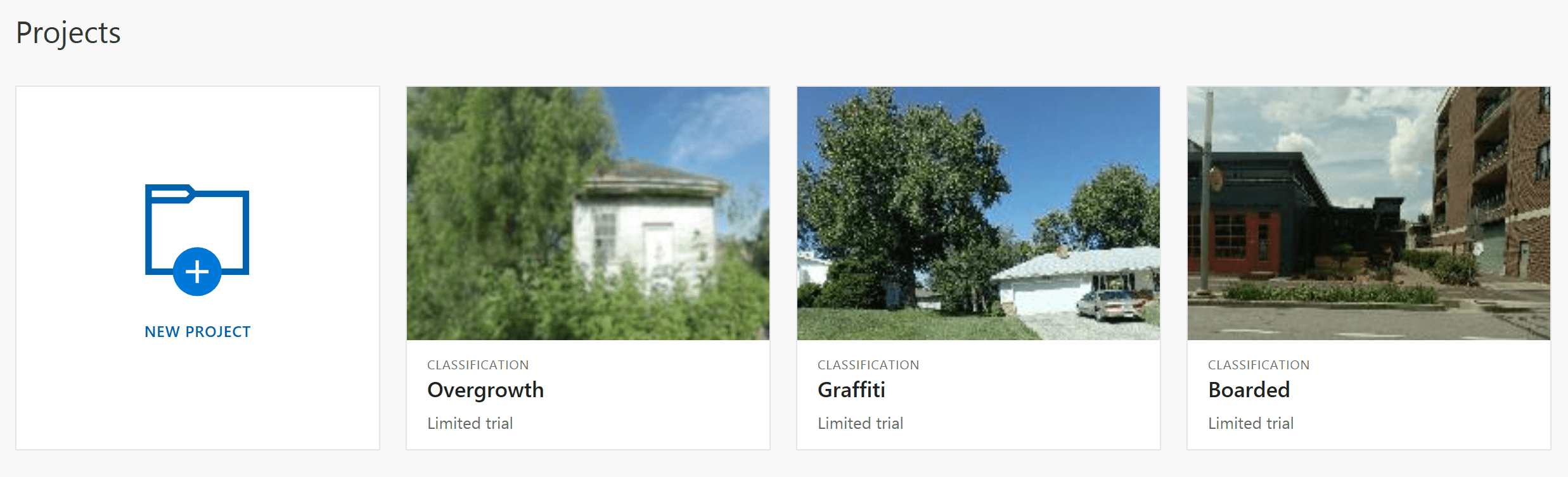
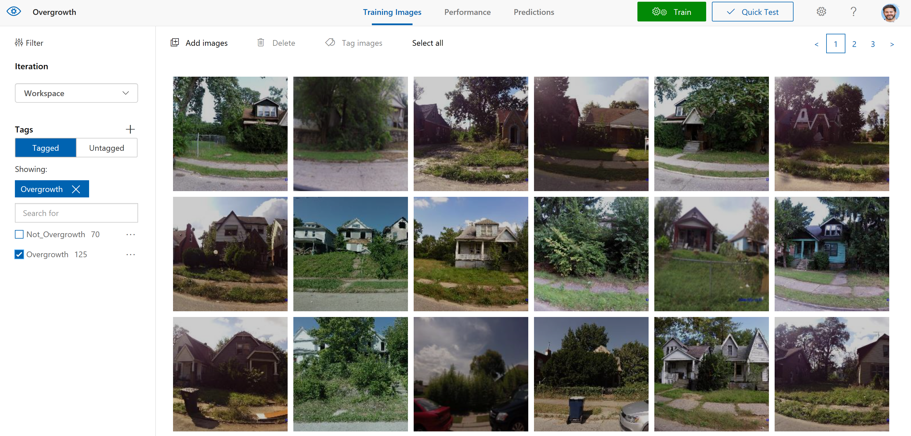
Once you have published your street-level photo collection, you can employ Microsoft’s Custom Vision service to calculate probability scores for graffiti, boarded windows, and overgrown yards. Custom Vision lets you build custom image classifiers, which works well for blight identification.
The process is so simple that you do not need to be a data scientist, but if you are – you’ll find the tools easy to use, and the models easy to update and customize. Gathering photos to train the AI is a time-consuming task, so we took care of that for you by providing a set of training photos. The included training photos represent typical blight categories (graffiti, boarded windows, overgrowth), and the tools will automatically create and train the models required by Custom Vision. You can further train the AI with your own photos or add more blight categories.
The predictions are calculated on the individual points created when you published your street-level photo collection.
Microsoft Custom Vision has two types of accounts, a free account that includes up to 10,000 predictions or if you need to analyze more properties, you can use a standard account at a $1.00 per 1000 prediction fee. Compared to the cost of manual classification, using Microsoft Custom Vision is a dramatic cost saving. For more information, see the Custom Vision pricing guide.
Contribute Your Training Photos
If you’ve gotten value from Property Condition Survey, we hope you’ll pay it forward by contributing some of the photos you used to train the artificial intelligence to detect blight for your locale. Doing this helps build out a smarter and more global blight detection capability. To contribute your training photos for consideration follow these steps.

Commenting is not enabled for this article.